North-South Route in Switzerland. Crossing the Alps by bicycle
Nord-Süd-Route (literally the North-South Route) is one of the most well-known cycling routes in Switzerland. Marked as Route 3, it is part of Veloland, a network of nine national cycling routes designed for touring. The Nord-Süd-Route starts in Basel, in northern Switzerland, and ends in Chiasso, at the southern border, crossing the main chain of the Alps via the legendary Gotthard Pass. This route offers over 360 kilometers of an incredible cycling adventure, though some sections are more challenging compared to other routes from Switzerland’s "top 9".
Route on the map
GPX file (GPS track): cyclingthread.com-switzerland-2024.gpx
North-South Route - table of contents
- Cycling through Switzerland’s scenic routes
- From south to north across Switzerland
- Getting to Switzerland by car or train
- On the train, like in a living room
- First kilometers with lakes in the background
- Good morning, Lugano
- A campaign for mutual respect
- A rough start to the ride
- First red cycling lanes
- Our unlucky Swiss holidays
- Three castles on the UNESCO heritage list
- A demanding ride through the Ticino Valley
- Romanesque churches in picturesque Giornico
- Welcome to the land of the Gotthard Pass
- The Gotthard Museum tells the story of the tunnels
- A dozen kilometers forward, a kilometer up
- Over 30 turns on historic cobblestones
- Crowds of drivers at the summit
- You can take the bus up, too
- Better to climb the cobbles than descend them
- Two reasons to reverse the direction
- A bottleneck in the gorge beyond Andermatt
- First glimpses of Lake Lucerne
- One of the most beautiful cycling roads
- Free substitute transport for cyclists
- Paddle steamers and Switzerland’s sacred site
- The route includes a ferry crossing
- Two minus one and a bike path on stilts
- The Lion of Lucerne and the Glacier Garden
- The route softens through forests and vineyards
- Beautifully painted houses in Aarau
- Basel and the largest open-air cinema
- Veloland will guide you through Swiss cycling routes
- Part of the EuroVelo network
- The most demanding Swiss cycling route
Cycling through Switzerland’s scenic routes
The Nord-Süd-Route was another step in our journey of discovering excellent Swiss cycling routes. Our first adventure took us along the stunningly diverse Rhine Route (Rhein-Route), from Andermatt to Basel. Next came the Lakes Route (Seen-Route), which we followed from the Zurich area all the way to Geneva. The third Swiss route we explored was the Jura Route, stretching from Lake Geneva to Basel. Bit by bit, we keep pedaling through Switzerland’s most beautiful corners, soaking in the breathtaking landscapes and experiencing the country’s impressive cycling infrastructure. This infrastructure, present even on tourist routes, enhances both comfort and safety. Though… this time, on the North-South Route, we did come across some stretches where we wished for better cycling facilities.
From south to north across Switzerland
Although the name suggests riding from north to south, we deliberately chose the opposite direction. Cycling south means riding straight into the sun - squinting, wrinkles forming, even with the best sunglasses. More importantly, it also means worse views of the mountains while cycling. By heading north, with the sun shining from behind, we had a constant ally illuminating the spectacular alpine scenery ahead of us rather than blinding us. Riding with the sun at our backs also helped protect our faces from excessive tanning - sunscreen is essential, but keeping your face in the shade by turning away from the sun is even better.
Getting to Switzerland by car or train
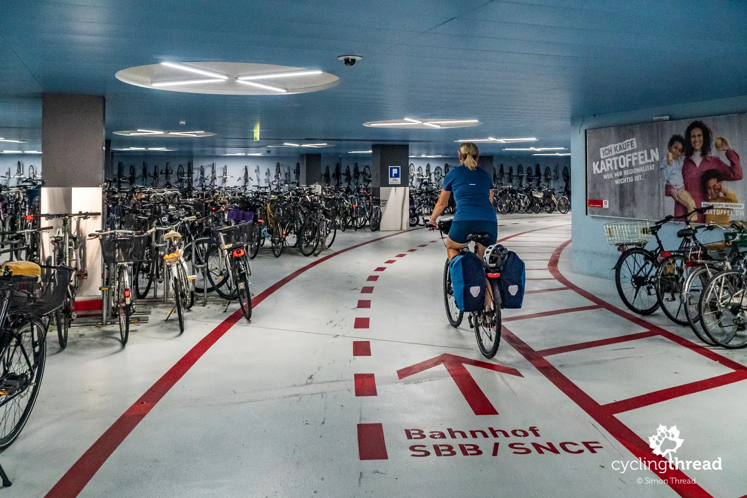
How do you get to Switzerland with a bike? Basel is well-connected by rail, making it easy to reach from all over Europe. From Berlin, for example, you can take a fast ICE train to Basel in about nine hours for as little as 40 euros if booked in advance. If trains aren’t an option, Switzerland is also accessible by car - that’s what we did, as we had additional plans afterward. We left our car in Lörrach, Germany, near Basel, at an affordable long-term parking lot. Then, we took the train to the starting point of our journey. The train wasn’t just a convenient and reasonably priced mode of transport - it was also a perfect complement to our cycling adventure. By the way, if you’re in Basel, don’t miss the large and visually impressive bike parking facility under the train station!
On the train, like in a living room
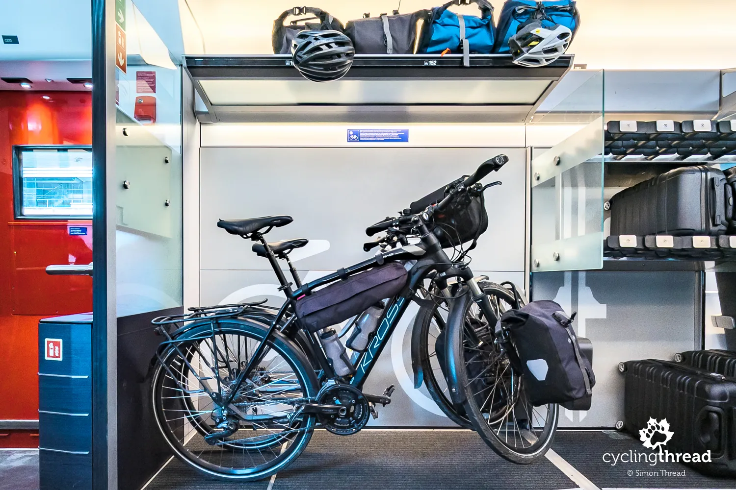
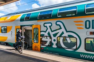
To start our journey from south to north, we first boarded a Swiss InterCity train from Basel to Lugano. This ride turned out to be the perfect introduction to our trip, offering a preview of the landscapes and emotions we would fully immerse ourselves in over the coming days. We were also impressed by the bike transport facilities - elegant racks, illuminated sections and carpeted floors made the space feel more like a cozy home interior than a standard baggage area on a long-distance train. Now this is one of the best bike-friendly trains we’ve seen on our travels.
First kilometers with lakes in the background
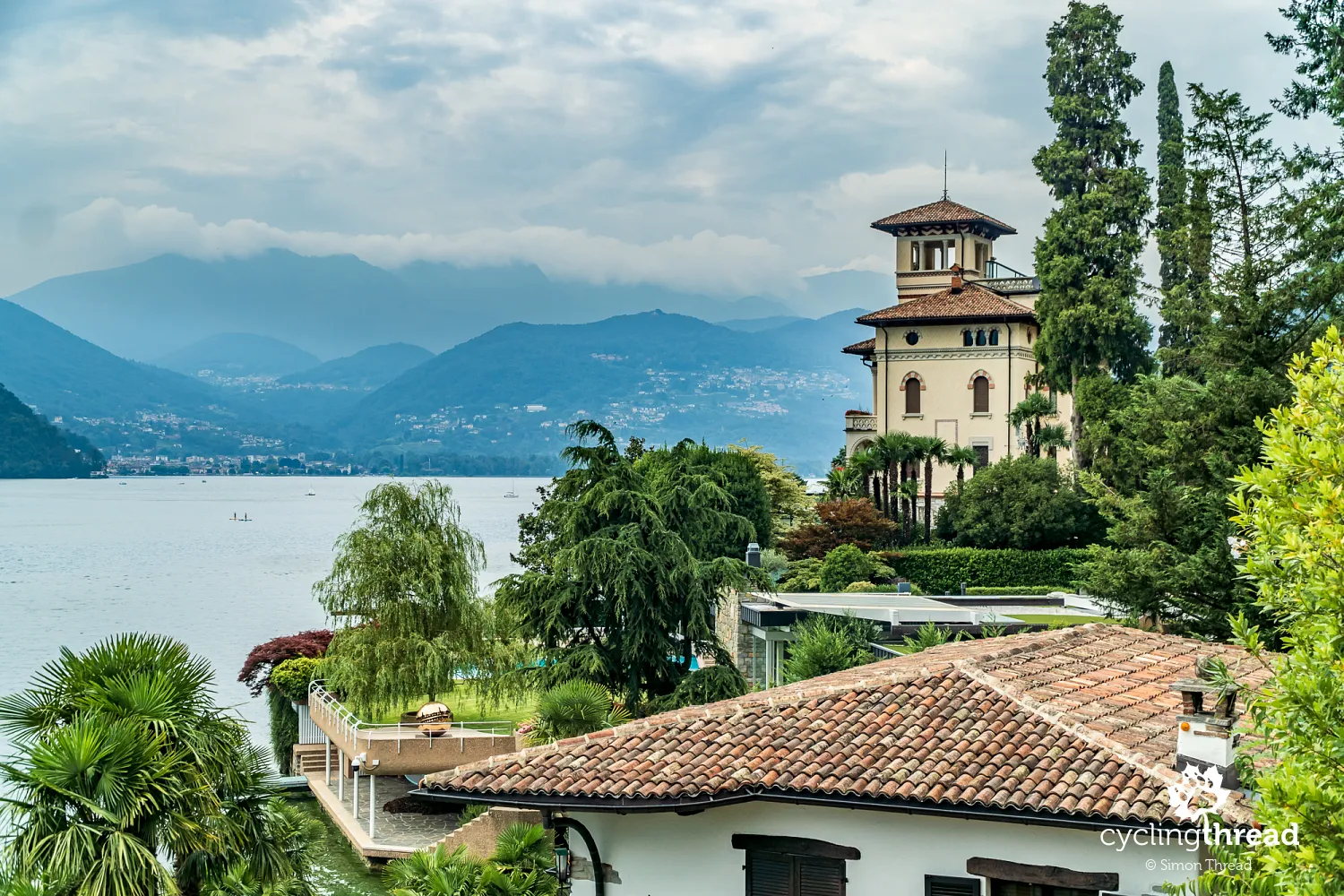
For a relatively short route - just 360 kilometers, perfect for a five-day or at most a week-long trip - the Nord-Süd-Route is incredibly diverse in terms of landscapes. The journey begins in the "Swiss lake region", though the Italians also have their share in it. The route starts in Chiasso, just a few kilometers from the famous Italian Lake Como. It quickly descends for over 20 kilometers along the shores of the picturesque Lago di Lugano. This landscape is a perfect blend of alpine peaks and Mediterranean charm. Along the shoreline, elegant villas, gardens filled with cypresses, palms and flowering shrubs create a scenery reminiscent of southern Europe. The road winds close to the water’s edge, offering stunning views of the deep blue lake framed by steep mountain slopes. And just as we leave the Lago di Lugano area, Lago Maggiore comes into sight.
Good morning, Lugano
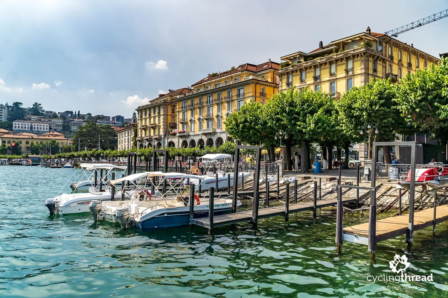
Our journey along the North-South Route began in Lugano, one of Switzerland’s most beautifully located cities, situated in Ticino, the country’s only fully Italian-speaking canton. The heat, the stunning view from the train station perched high above the lake and the sound of Italian everywhere - these were our first impressions at kilometer zero of our route. Lugano, surrounded by mountains such as Monte Brè and Monte San Salvatore, offers breathtaking views of the lake and the surrounding peaks. Monte Brè is said to be the sunniest mountain in Switzerland, but it’s Monte San Salvatore that attracts more visitors with its incredible 360-degree panorama of the Alps. We take a moment to visit Lugano’s most important landmark, the Cathedral of Saint Lawrence, then do a short loop through the city, admiring Art Nouveau facades and stopping by the often-mentioned Parco Civico-Ciani, where police officers patrol on bicycles. After that, we set off along the lake’s promenades toward our route.
A campaign for mutual respect
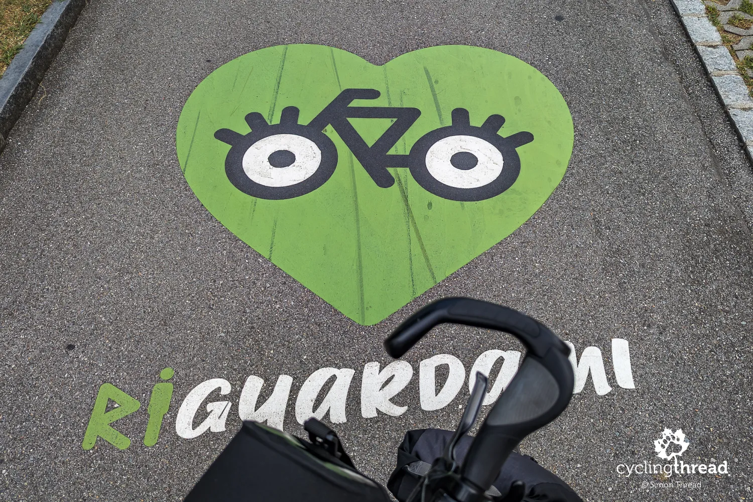
As we cycle through Lugano, we occasionally spot green-and-black logos with the words "Riguardami" under our wheels. A quick online search reveals that this is a campaign promoting mutual respect between pedestrians and cyclists, launched in 2022 by the city of Lugano in collaboration with local mobility organizations. It was a joint response from officials and activists to the rising number of conflicts between pedestrians and cyclists sharing urban spaces. The campaign emphasized the need for clear communication, special attention to children and pedestrians, and avoiding excessive cycling speeds.
A rough start to the ride
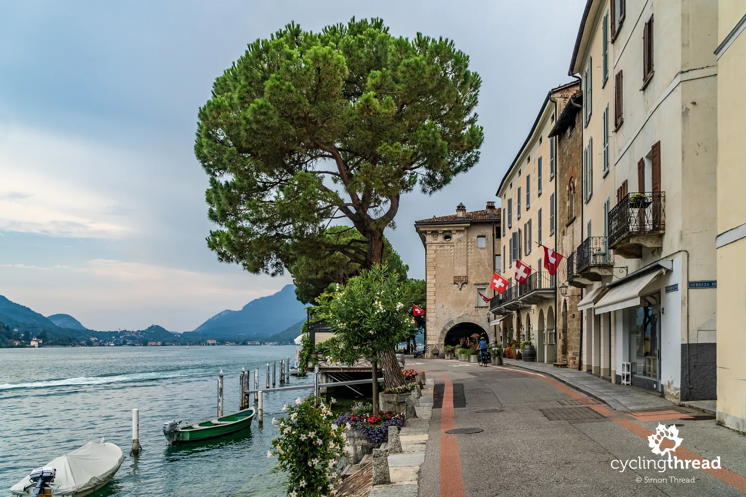
Leaving Lugano is not exactly pleasant - the narrow road winding along the lake is busy with cars, motorcycles and buses passing us by. Unfortunately, this is the only way to reach our route, but thankfully, it’s just 6 kilometers from Lugano to Melide. Once in Melide, we spot the North-South Route signs, the traffic eases and we can finally start enjoying the beauty of Switzerland. Before long, we ride through Morcote, once a fishing village and now one of the most picturesque towns on our journey - the southernmost point of our trip. High on the hillside, the silhouette of Santa Maria del Sasso church catches our eye, while along the lakeside road, grand historic mansions line our path. The architecture blends beautifully with the lush Mediterranean greenery - palms, bamboo, cypresses, cedars, pines, camphor trees, eucalyptus and blooming azaleas.
First red cycling lanes
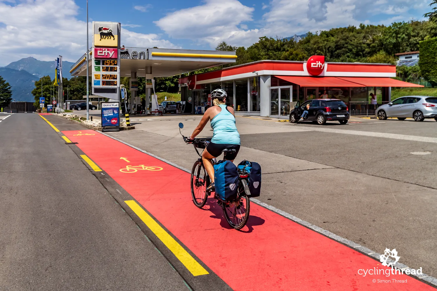
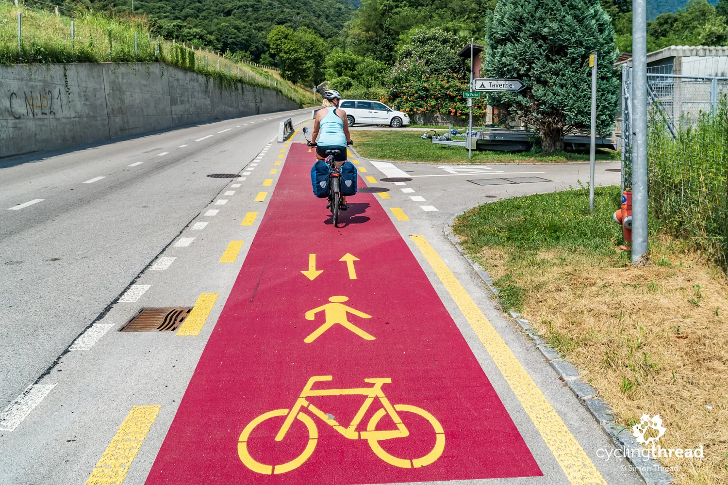
The next section of the route takes us further north toward Bellinzona. It’s about 30 kilometers of gentle uphill riding along the small Vedeggio River. Here, we get a firsthand look at how Switzerland protects pedestrians and cyclists from traffic hazards. Yellow-painted areas mark zones designated exclusively for vulnerable road users, including bike lanes on roads with higher traffic volumes. In some places, these lanes are covered in red paint, guiding cyclists safely through particularly dangerous sections. We first encounter this system when crossing an entrance to a quarry, and soon after, a similar red strip leads us past a gas station. Before long, the red "carpet" disappears and a yellow-marked bike lane takes us on a swift descent toward Bellinzona.
Our unlucky Swiss holidays
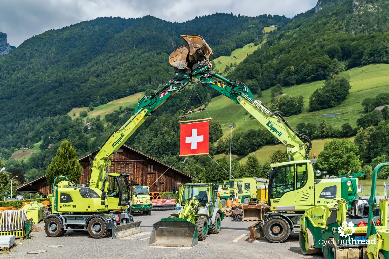
Our stop in Bellinzona was meant to be special - we planned the entire trip so that we would be here on Swiss National Day. Celebrated on August 1st, the holiday marks the signing of the Swiss Confederation’s founding charter in 1291. The daytime weather was perfect - pleasant temperatures, light clouds and no rain - but in the evening, strong winds picked up. The gusts were so intense that, for safety reasons, the fireworks display over Castelgrande was canceled. Thousands of people waiting for the spectacle left disappointed, having only watched a rather underwhelming concert of American (!) cover songs. This was our second attempt at experiencing Swiss National Day and our second stroke of bad luck - when we cycled along the Rhine in 2020, the fireworks in Schaffhausen were canceled due to the COVID-19 pandemic.
Three castles on the UNESCO heritage list
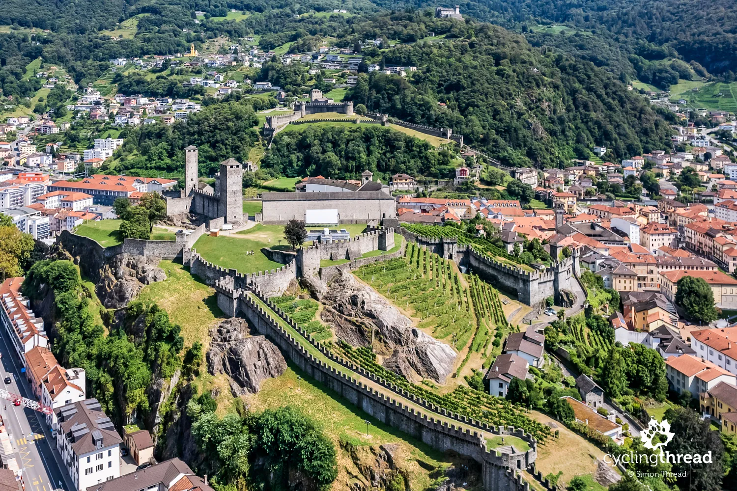
Surprisingly, the North-South Route doesn’t pass through the center of Bellinzona, meaning that many cyclists may unknowingly bypass one of Switzerland’s 13 UNESCO World Heritage Sites. In Bellinzona, the site consists of three castles - Castelgrande, Montebello and Sasso Corbaro - which form a single fortified complex. These castles are prime examples of medieval military architecture in the Alps, strategically positioned to guard the Ticino Valley and control access through the alpine passes leading to northern Italy, including Milan. The castles and their towers remain in excellent conditio, and their architecture blends harmoniously with the region’s natural topography - a real highlight for any traveler exploring Switzerland.
A demanding ride through the Ticino Valley
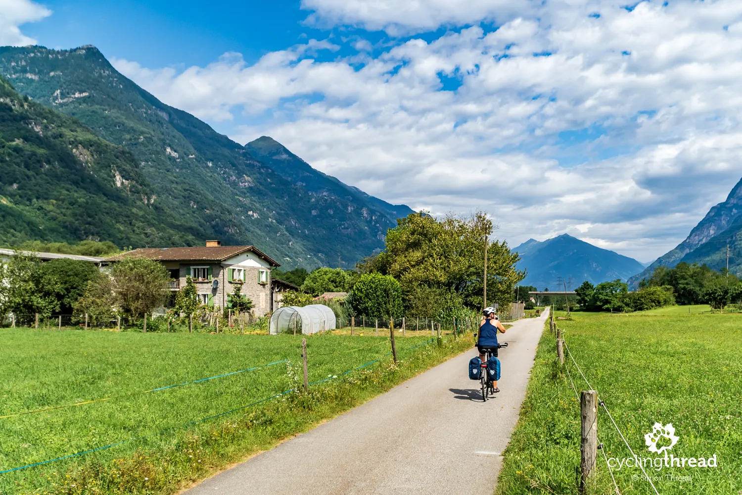
Beyond Bellinzona, the North-South Route follows the long, narrow alpine valley of the Ticino River, leading all the way to Airolo, a village at the foot of the Gotthard Pass. The valley’s landscape gradually shifts from the gentle green surroundings of Bellinzona to the steeper, wilder slopes of the Alps near Airolo. This stretch of the Ticino Valley is also a major transportation corridor, connecting northern and southern Switzerland. At first, the cycling route follows quiet side roads, farm paths, and even some forest tracks. But as the valley narrows and the terrain becomes steeper, the route occasionally merges with the main road, where heavy transit traffic makes cycling less enjoyable. The section from Lavorgo to Airolo is particularly challenging - so much so that Ola decides to take the train, skipping the steep, narrow and busy mountain road, which offers little cycling pleasure.
Romanesque churches in picturesque Giornico
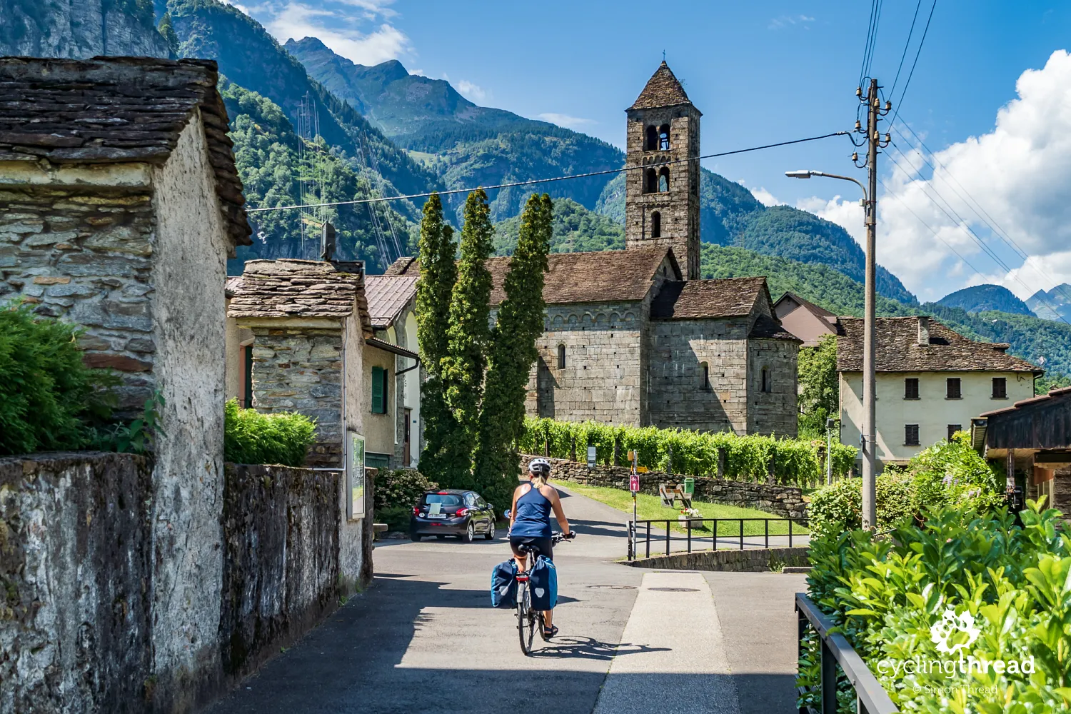
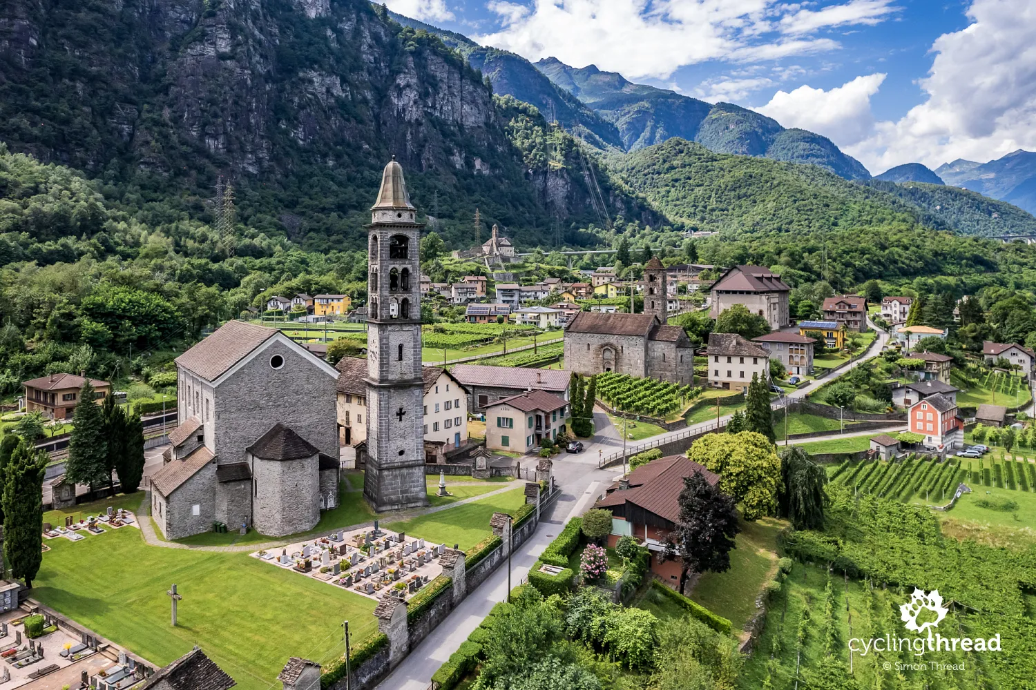
Luckily, before Ola boarded the local train, we had time to visit the beautiful, small village of Giornico, nestled in the Leventina Valley. The most famous landmarks here are two neighboring medieval churches - San Nicola and San Michele. San Nicola stands out with its impressive Romanesque architecture, well-preserved frescoes and a solemn, almost mysterious interior. Meanwhile, the lower-lying San Michele captivates with its simplicity, harmoniously blending into the mountain landscape. Giornico is also known for its vineyards, which surround the village and are deeply woven into the local economy and traditions. Another historical site is the old power plant, which, even in the early 20th century, played a key role in supporting railway transport in the valley. From the bridge above the village, you can admire a stunning panorama of Giornico, with its picturesque stone bridge arching over the Ticino River.
Welcome to the land of the Gotthard Pass
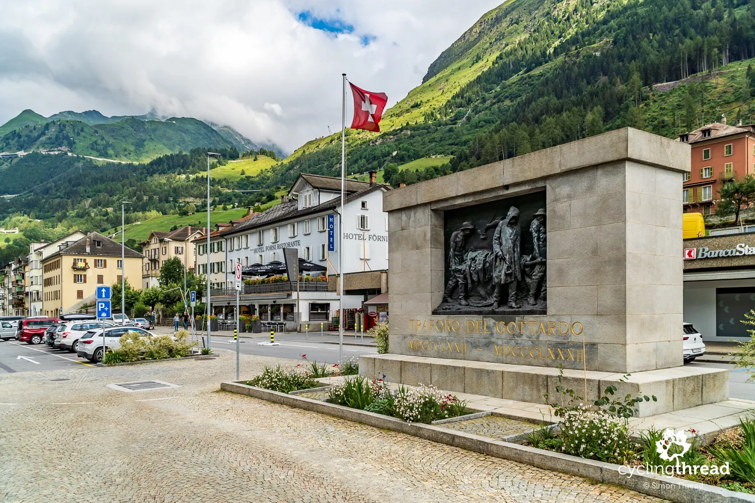
Our main memory of Airolo? First and foremost… the small, family-run Italian hotel where we stayed. Basic conditions, almost no interior decor, and shared bathrooms in the hallway. But what made the place special was the Italian restaurant downstairs, where we ended the day with a delicious pizza. Aside from that, Airolo is a gateway to the mountains, home to a well-known cheese factory and, most importantly… tunnels. Or rather, two tunnels - one for cars and one for trains - that are crucial not only for Swiss but for European transport infrastructure. The Gotthard Road Tunnel, opened in 1980, remains one of the longest in the world at 16.9 km. It connects northern Switzerland with Ticino in the south, significantly shortening travel time through the Alps. The tunnel experiences heavy traffic, especially in summer, and if you're cycling the North-South Route during peak season, you’ll almost certainly spot traffic jams at the tunnel entrance.
The Gotthard Museum tells the story of the tunnels
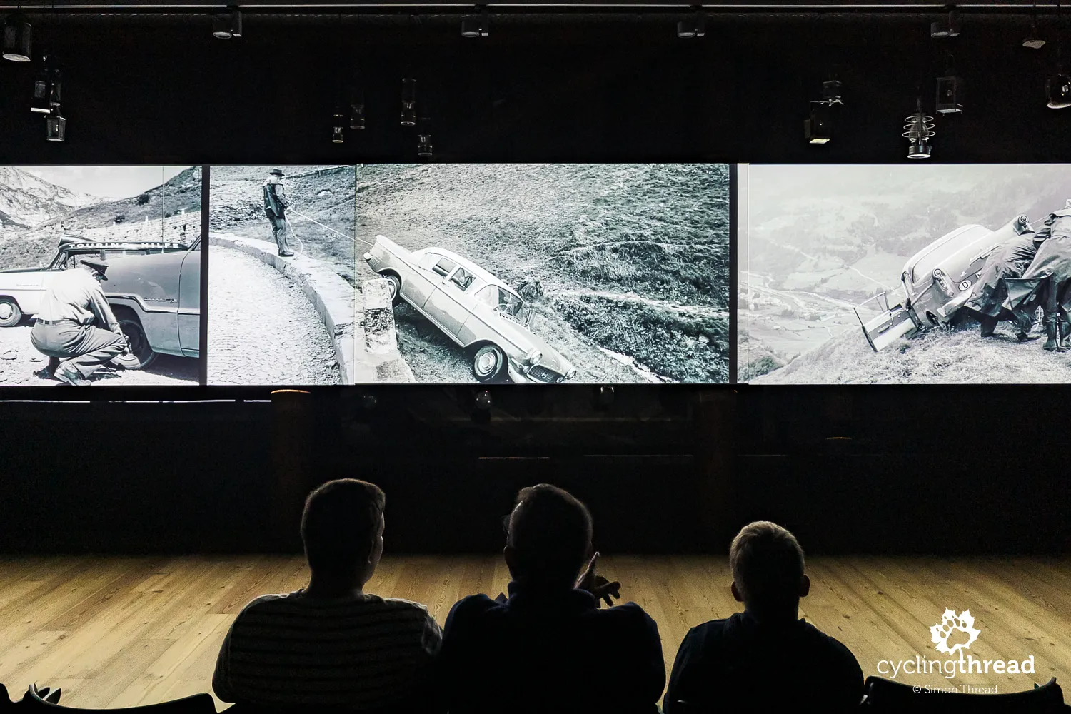
In addition to the road tunnel, two railway tunnels run beneath the Gotthard Pass. The first opened in 1882 and played a key role in the development of rail transport across Europe. The second, much newer one, was inaugurated in 2016 and is the longest railway tunnel in the world. The Gotthard Base Tunnel stretches 57.1 km and took 17 years to build. It has significantly improved freight and passenger transport, reducing travel times across the Alps - we experienced this firsthand on our train journey from Basel to Lugano. To learn more about the Gotthard Pass as a major transport hub, a visit to the Gotthard National Museum on the pass is highly recommended. One of the highlights is a fascinating film presentation about the history of the region’s roads and tunnels, displayed on three screens simultaneously. For me, the most interesting part was the archival photos and footage showing the construction of these engineering marvels. But before you can sit in the multimedia room at the museum, you first have to get there.
A dozen kilometers forward, a kilometer up
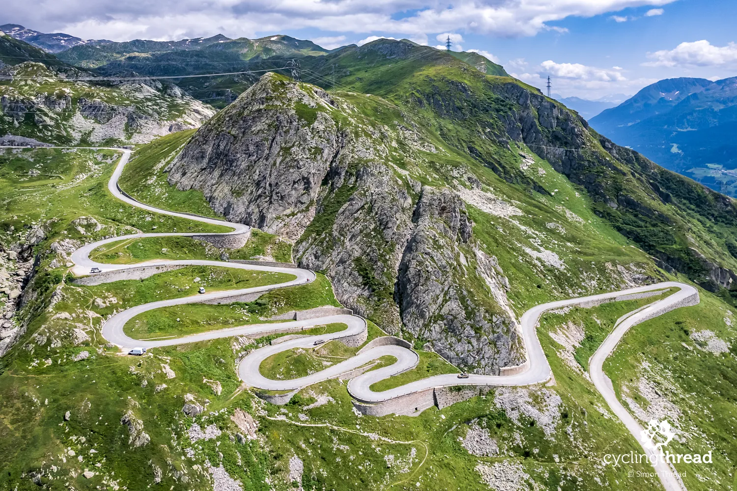
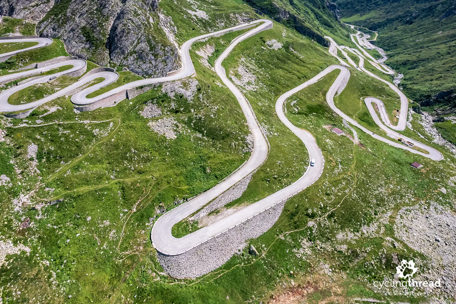
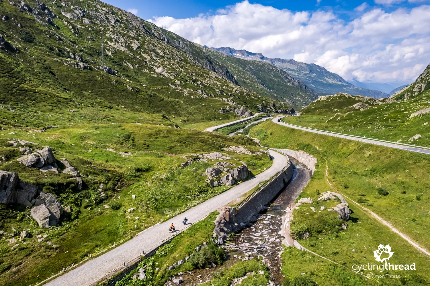
The climb to the Gotthard Pass is the defining challenge of the Nord-Süd-Route - its true essence. Two roads lead to the summit: National Road 2, packed with tourist transit traffic that opts out of taking the Gotthard Tunnel and the historic Tremola Road, built around 1830. Naturally, cyclists choose Tremola - a narrow, winding and cobbled road that is Switzerland’s longest historical monument. Today, this symbol of Alpine engineering is a classic mountain cycling challenge and one of the must-ride roads in the mountains of Europe. Unfortunately, there aren’t many sweeping views here, as Tremola zigzags up the steep mountainside in tight hairpins. For cyclists, the main attraction is simply conquering the next switchback.
Over 30 turns on historic cobblestones
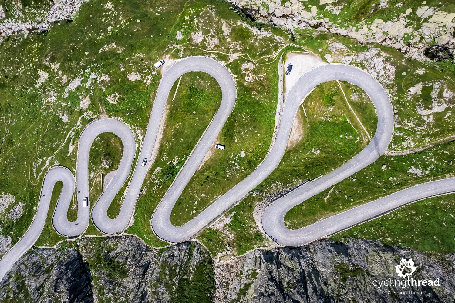
Climbing the cobbled Tremola with panniers is no quick feat - starting near the train station in Airolo, it’s about 13 km with 970 meters of elevation gain. A total of 39 turns, most of them classic alpine switchbacks, await. This gives plenty of time for observations - what stood out to me the most were the bikes being ridden up the Gotthard Pass. To my surprise, among the dozens, maybe even a hundred cyclists I saw during the climb, only a handful - perhaps 10 at most - were on e-bikes. The vast majority tackled the challenge purely with their own muscle power, which I found truly impressive. Most cyclists rode road bikes, while those of us with panniers were in the minority.
Crowds of drivers at the summit
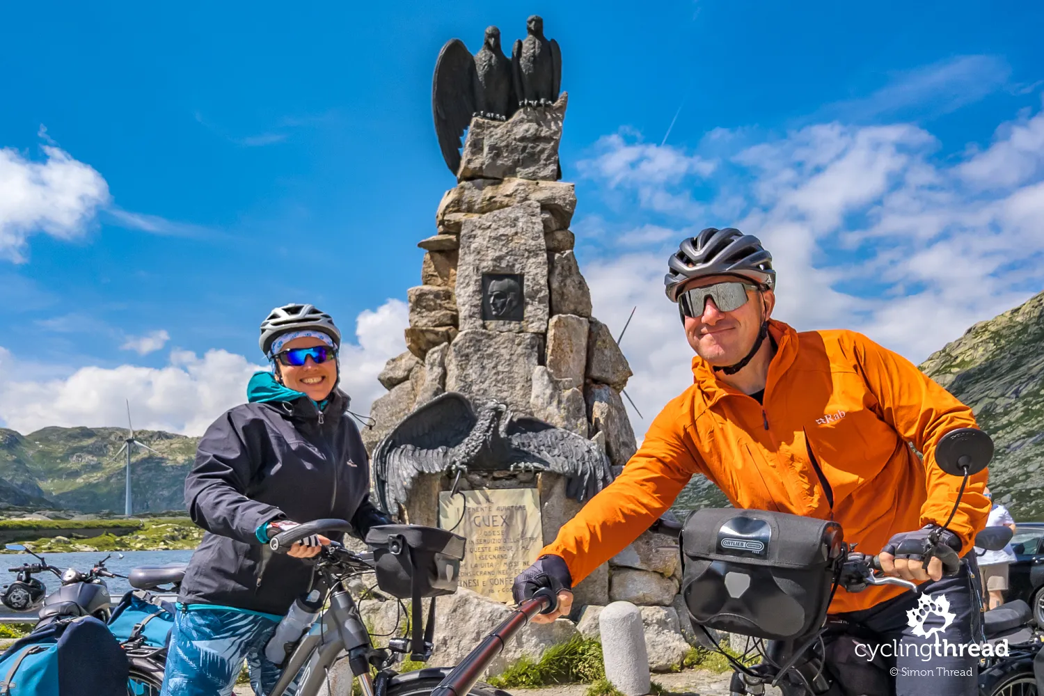
The Gotthard Pass itself is not the most charming stop along the route - a few buildings, the aforementioned museum with an interesting film, two monuments, a handful of snack trucks and… crowds. Most of the visitors arrive by car, using the pass as a brief stop on their longer journey. It’s such a contrast to the Tremola Road, where cyclists dominate, and cars are a rare sight - only the few drivers who deliberately choose a tough mountain road instead of the much faster and easier National Road 2 take this route. The most photographed spot at the summit - including by us - is the monument to a Swiss pilot who lost his life in a crash near the pass.
You can take the bus up, too
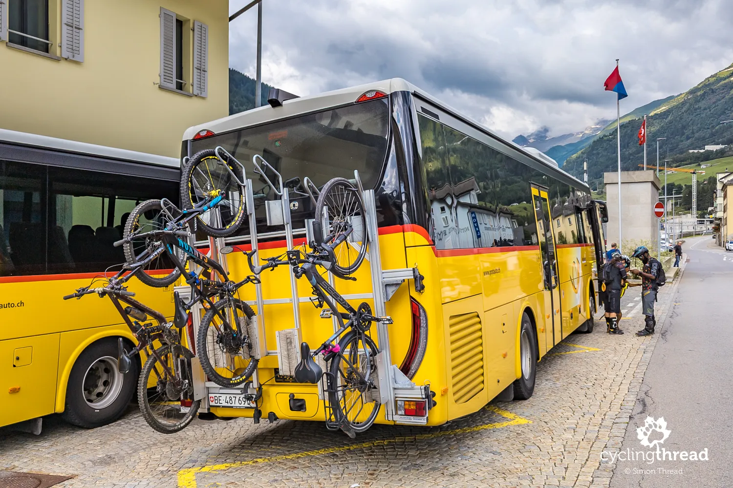
I call the climb to the Gotthard Pass the highlight of the North-South Route, its main attraction - but it’s not mandatory. If you don’t feel up for the challenge, you can hop on a yellow alpine bus, with your bike secured on rear-mounted racks. That’s exactly what Ola did - she cheered me on first from the bus, then from the pass itself. The bus schedule can be found in the SBB app, the same one used for booking train tickets across Switzerland. Important tip - if there’s an available bike spot, you can board without a reservation, but it’s recommended to book a free bike slot in advance by calling the number listed in the app. This rule applies to all Swiss "Postbuses", not just the one running over the Gotthard Pass.
Better to climb the cobbles than descend them
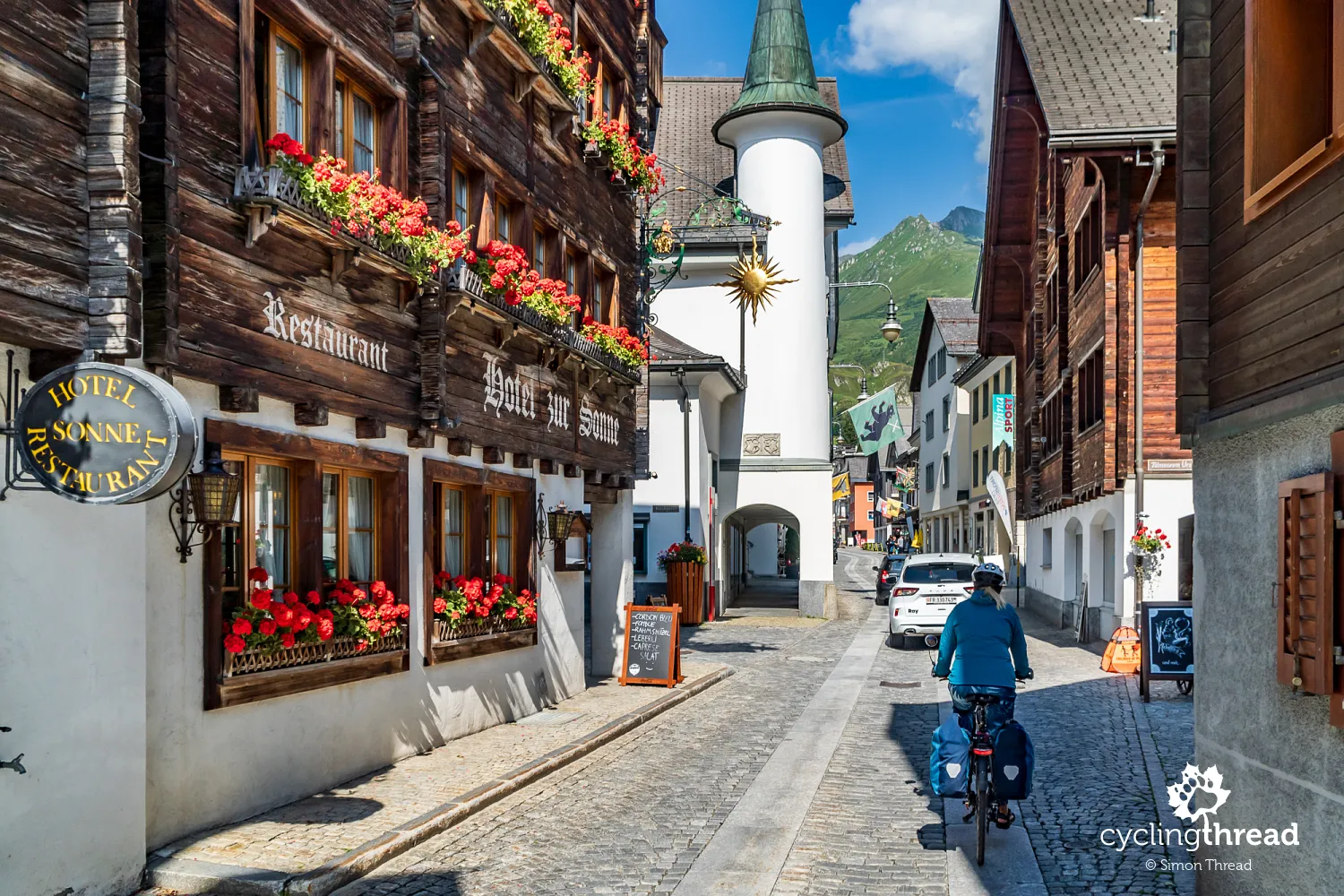
Descending the cobbled Tremola Road with panniers was far less comfortable than climbing it. On the slow uphill sections, there was no need to worry about uneven surfaces or slippery stones - but going down, with a fully loaded bike eager to pick up speed, was a completely different story. Fortunately, the northern side of Tremola toward Andermatt is short, and soon we merged onto the smooth asphalt of the national road, only to find ourselves in a long traffic jam. Luckily, uphill traffic was light at this time of day, so by hopping onto the left lane for a few hundred meters at a time, we quickly made our way down to the picturesque village of Hospental and then - through yet another traffic jam - into Andermatt. This town holds a special place in our hearts ever since our ride along the Rhine Route. We pass by the campsite where we stayed in 2020, admire the charming wooden houses in the town center, stop briefly at a familiar fountain on the bridge, and then continue our journey.
Two reasons to reverse the direction
The different types of roads leading to the Gotthard Pass offer yet another reason to ride the North-South Route in the opposite direction. In our version, we tackled the classic Tremola climb, which is nearly car-free but, due to its rough historic surface, much more challenging as a descent. And speaking of descents - toward Andermatt, the cobbled Tremola is short, followed by a smooth asphalt road with sweeping hairpins and excellent pavement. Climbing this way, however, would mean sharing a narrow road without a shoulder alongside heavy car traffic - not exactly an appealing alternative to the peaceful, traffic-free Tremola ascent. The same applies to the comparison between climbing the Ticino Valley (from Bellinzona to Airolo) and the Reuss Valley (from Flüelen to Andermatt) - despite some tough sections, the Ticino Valley offers much better cycling conditions for a steady climb.
A bottleneck in the gorge beyond Andermatt
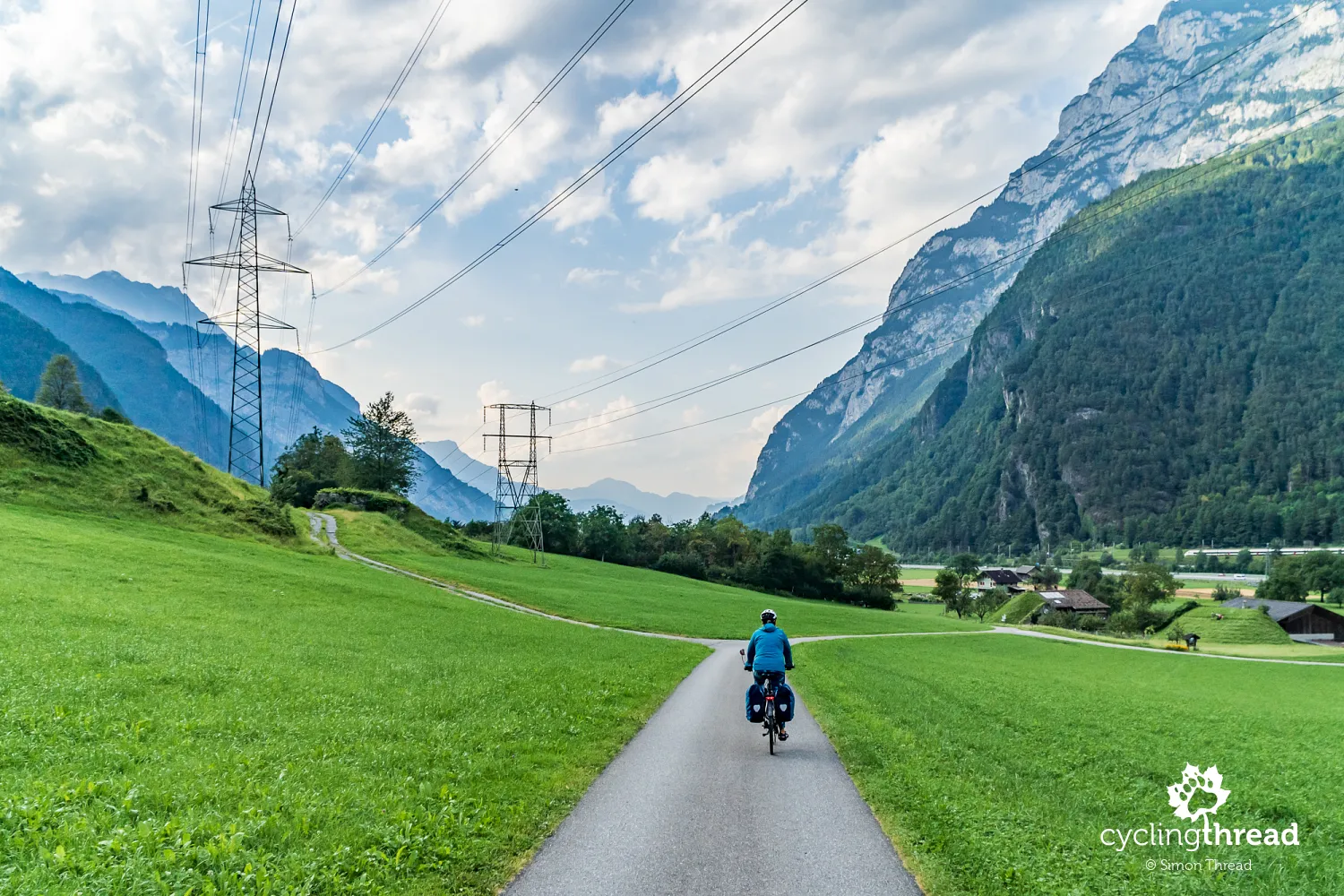
A long descent through a narrow, deep and shadowy alpine valley separates Andermatt from Lake Lucerne. Unfortunately, only a very short initial stretch runs along a comfortable cycling path. Near the Devil’s Bridge over the Schöllenen Gorge - likely for safety reasons - the route separates cyclists traveling in opposite directions. Those riding toward Lake Lucerne are directed onto the main road, while the narrow cycling path through the gorge is reserved for those climbing toward Andermatt. And so, for the third time that day, we find ourselves stuck in car traffic. But this time, with congestion in both directions, we avoid risky overtaking and instead roll down slowly alongside the cars. This is another cycling "bottleneck" on the North-South Route and a frustrating loss in terms of scenic value - being forced onto the main road with cars takes away the stunning views of the Devil’s Bridge and the Schöllenen Gorge.
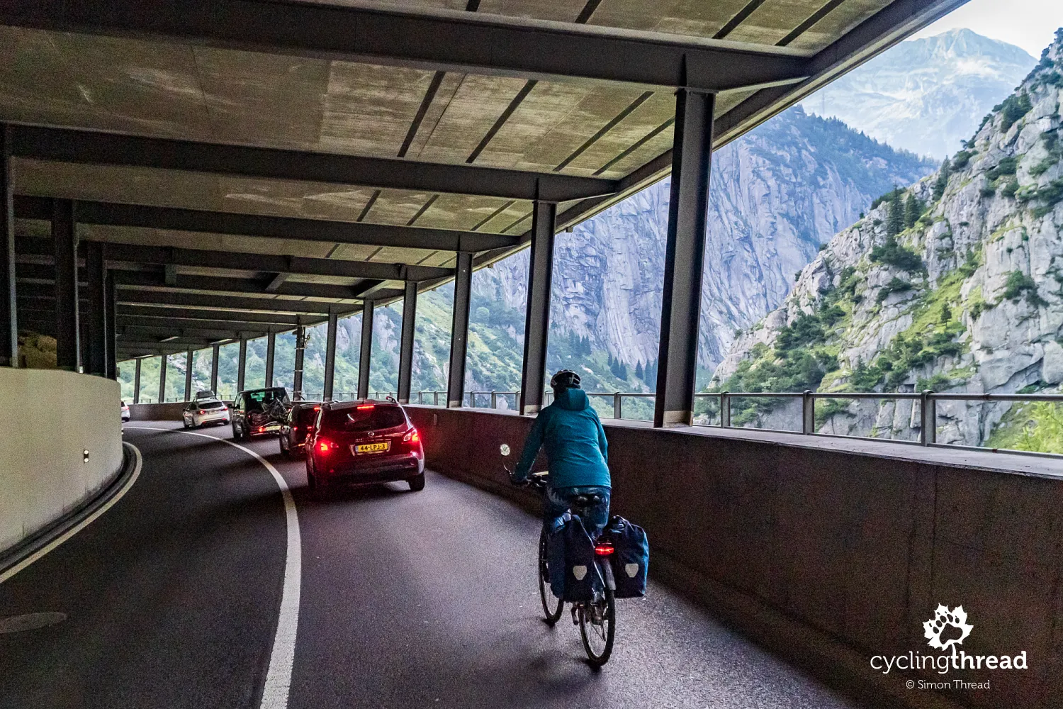
Fortunately, after a few kilometers, most cars divert onto the highway, leaving us on a nearly empty road near Göschenen, with only the occasional vehicle passing us. The ride becomes smooth and pleasant, with beautiful landscapes and charming villages along the way - but we’re pressed for time and don’t linger. The climb to the Gotthard Pass, with all its photo stops, had taken longer than expected, then there was the museum visit, which we didn’t want to skip, and now we still had about 40 kilometers to cover. In the second half of the descent, we switch from the main road to flood protection embankments, quickly passing through Wassen, Amsteg, Erstfeld and Altdorf.
First glimpses of Lake Lucerne
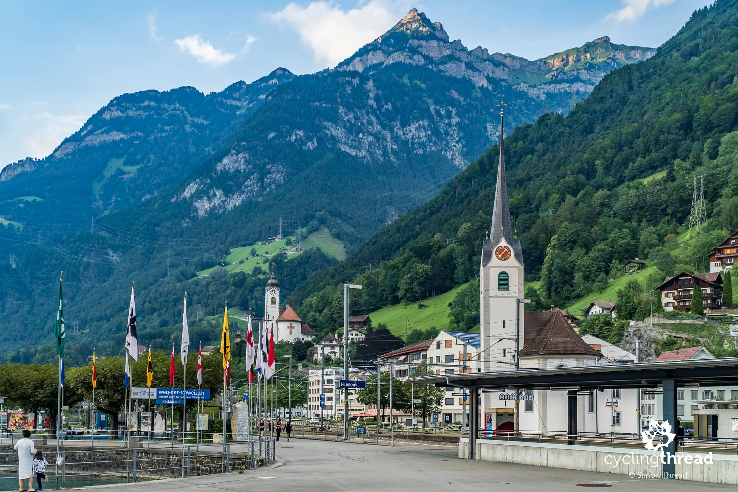
We finally take a break in Flüelen, captivated by our first views of Lake Lucerne. The town’s location is as stunning as it is problematic - Flüelen sits where the Reuss River, which had accompanied us from Andermatt, flows into the lake and it has suffered frequent flooding in the past. Today, Flüelen is an important hub on Switzerland’s tourism and transport network, serving as a key local junction. Being located at the opposite end of Lake Lucerne from Lucerne itself, the town is a popular destination for lake cruises and excursions. It is also a central point of the so-called "Swiss Path", a scenic trail running from Brunnen through Sisikon and Flüelen to Rütli - the legendary "cradle of Switzerland".
One of the most beautiful cycling roads
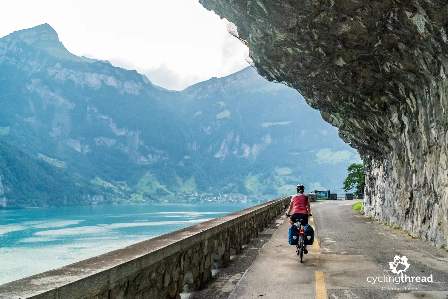
After a short break at the Wiesmann Roadster MF3 sculpture - an unusual piece of automotive art near the train station in Flüelen - we set off on what turns out to be one of the most spectacular stretches of our journey. This section follows an incredible cycling route along the Axen rock face, which is why the road here is called Axenstrasse. Parts of the route run through tunnels and galleries originally built for the first road along this lakeshore. At times, we ride beneath rocky overhangs, while in other sections, protective barriers shield us from falling stones. Occasionally, the old road, now dedicated to cyclists, merges briefly with the modern one, where cars pass through larger tunnels carved parallel to our path. This entire stretch is absolutely stunning - without a doubt, one of the most beautifully designed cycling roads in Europe. At one point, just below our route and right by the water, we pass Tellskapelle - a chapel marking the legendary escape of Swiss folk hero Wilhelm Tell from the clutches of a local governor.
Free substitute transport for cyclists
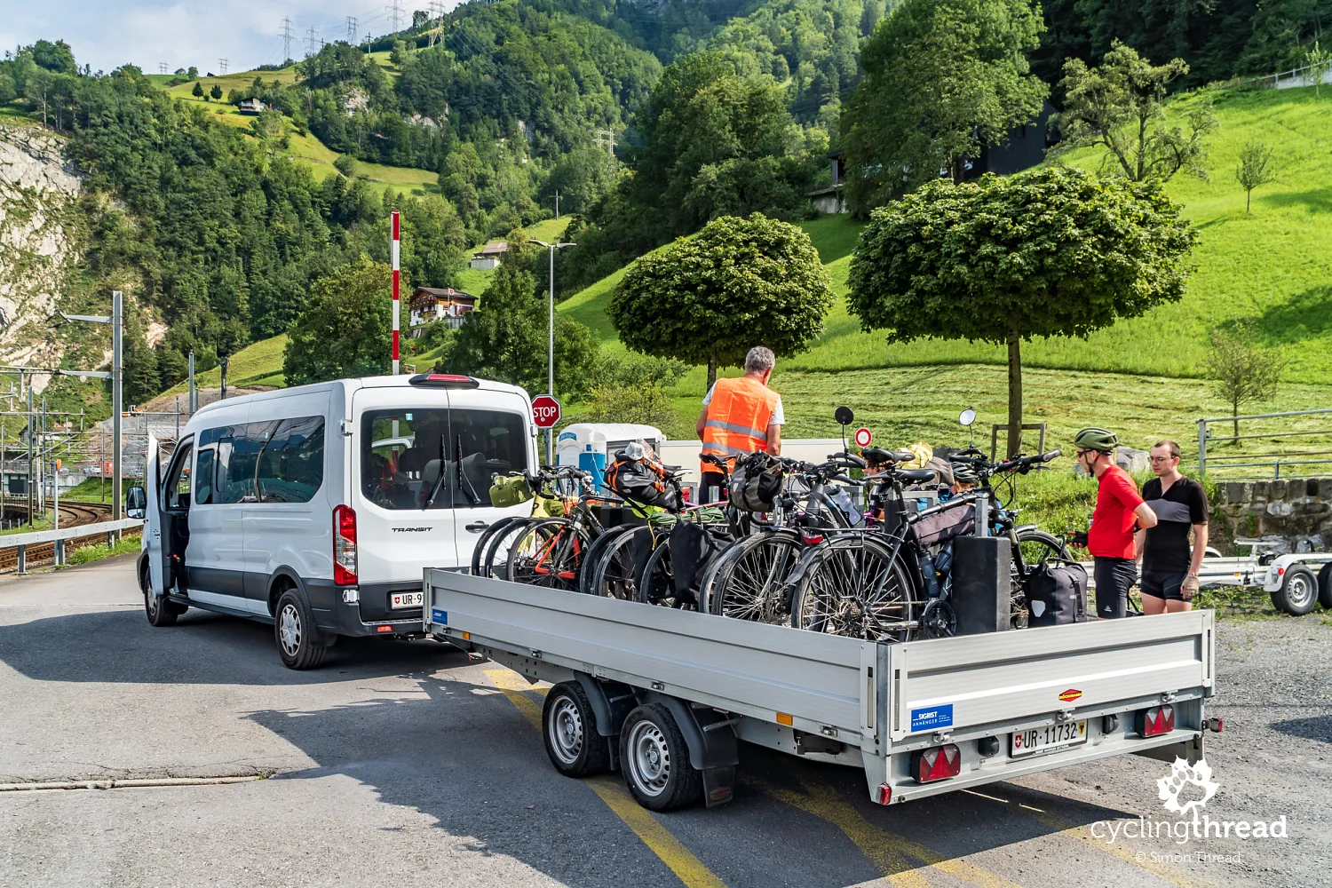
Unfortunately… we arrive just in time for roadworks on Axenstrasse, leading to traffic restrictions between Flüelen and Brunnen. We manage to cycle the first half of this stretch from Flüelen to Sisikon, where we’re staying for the night, marveling at the scenic bike route. But the next morning, the second half - from Sisikon to Brunnen - has to be covered using a specially arranged substitute transport service for cyclists. Yes, that’s right - in Switzerland, when a popular cycling route is temporarily closed for reasons beyond the cyclist’s control, the contractor provides a shuttle bus with a bike trailer to ferry riders across the affected section. And so, we cover part of the route around Lake Lucerne in a van, accompanied by a French couple and two German cyclists. The shuttle runs every hour and all costs are covered by the company managing the roadworks - cyclists don’t have to pay a thing.
Paddle steamers and Switzerland’s sacred site
In Brunnen, we stop at the lakeside pier, enjoying a breathtaking view of Lake Lucerne. From here, steep mountain slopes rise dramatically from the water, creating striking contrasts between the deep blue lake and the towering rocky peaks. The lake’s irregular shape, with its many bays and narrow passages, only adds to its charm. Surrounding it are majestic mountains like Pilatus, Rigi and Stanserhorn, which dominate the landscape. One of the most distinctive features of this region is the roads running along the lake’s edge, often squeezed between the mountains and the water. Many of these roads cut through rock tunnels and galleries, offering not only spectacular views but also a sense of adventure. One of them is the Axenstrasse, which we cycled just hours before.
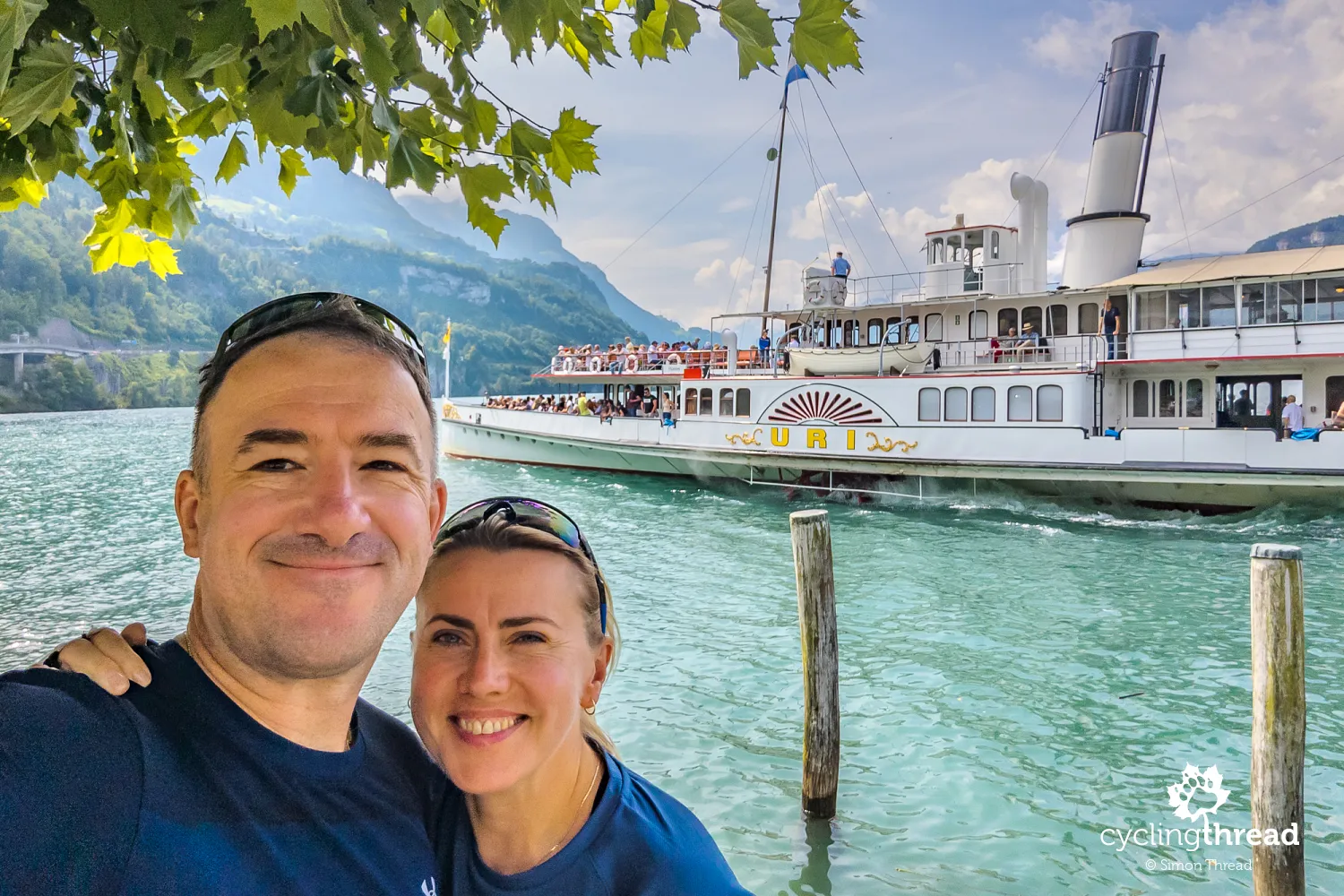
As we stand at the pier in Brunnen, the historic paddle steamer Uri sets off for a cruise around Lake Lucerne. Built in 1901, it is one of five steamships forming the fleet of historic vessels operating on this picturesque lake. The Uri is considered a masterpiece of its era, featuring beautifully preserved wooden elements, an elegantly decorated interior and a fully restored original steam engine. As we admire this floating gem, our eyes are drawn to a bright patch on the steep shore in the background, visible on the left side of our photo. That’s the Rütli Meadow, a place considered almost sacred by the Swiss. It was here, on August 1st, 1291, that an oath between three cantons laid the foundation for the Swiss Confederation. Today, August 1st is celebrated as Switzerland’s national holiday.
The route includes a ferry crossing
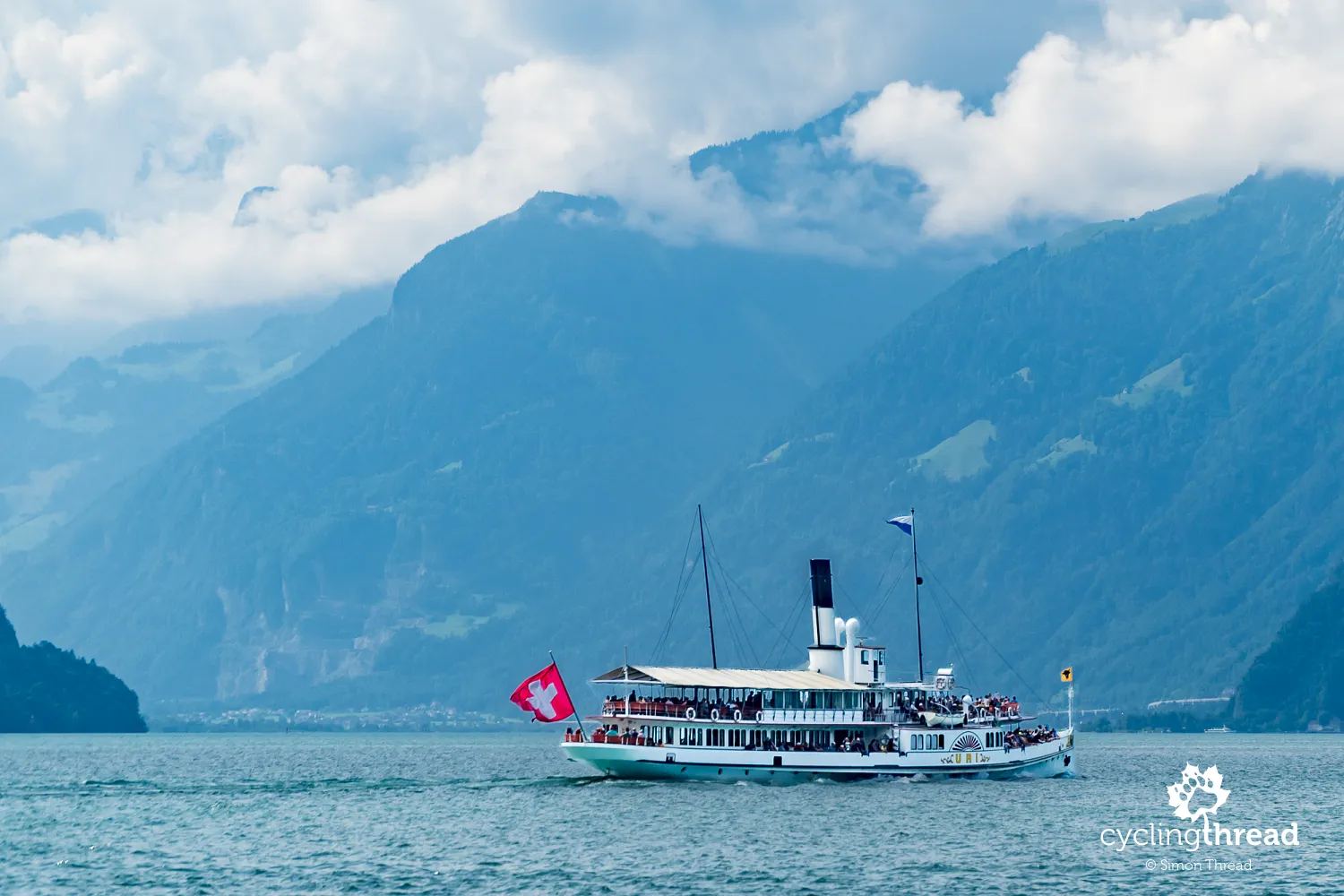
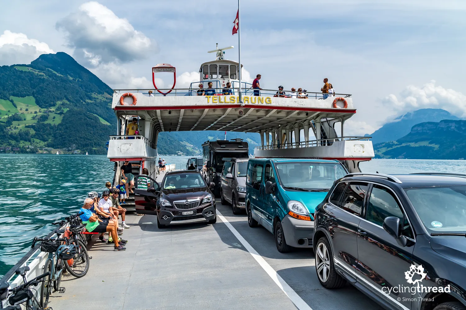
Before long, we find ourselves viewing Lake Lucerne from the middle of its waters - literally. The North-South Route includes a ferry crossing from Beckenried to Gersau, highlighting its significance as part of Switzerland’s Grand Tour, a curated selection of the country’s most scenic travel destinations. The red "frame" marking this spot bears the name of the ferry, Tellsprung, meaning "Tell’s Leap", a direct reference to the legendary escape of Wilhelm Tell, which I mentioned earlier while describing Axenstrasse. A small tip - don’t mix up the vehicle ferry between Gersau and Beckenried with the nearby pier for passenger tour boats in Gersau. We almost boarded the wrong one ourselves, but the fact that the boat was running seven minutes late gave it away - something that simply doesn’t happen in Switzerland.
Two minus one and a bike path on stilts
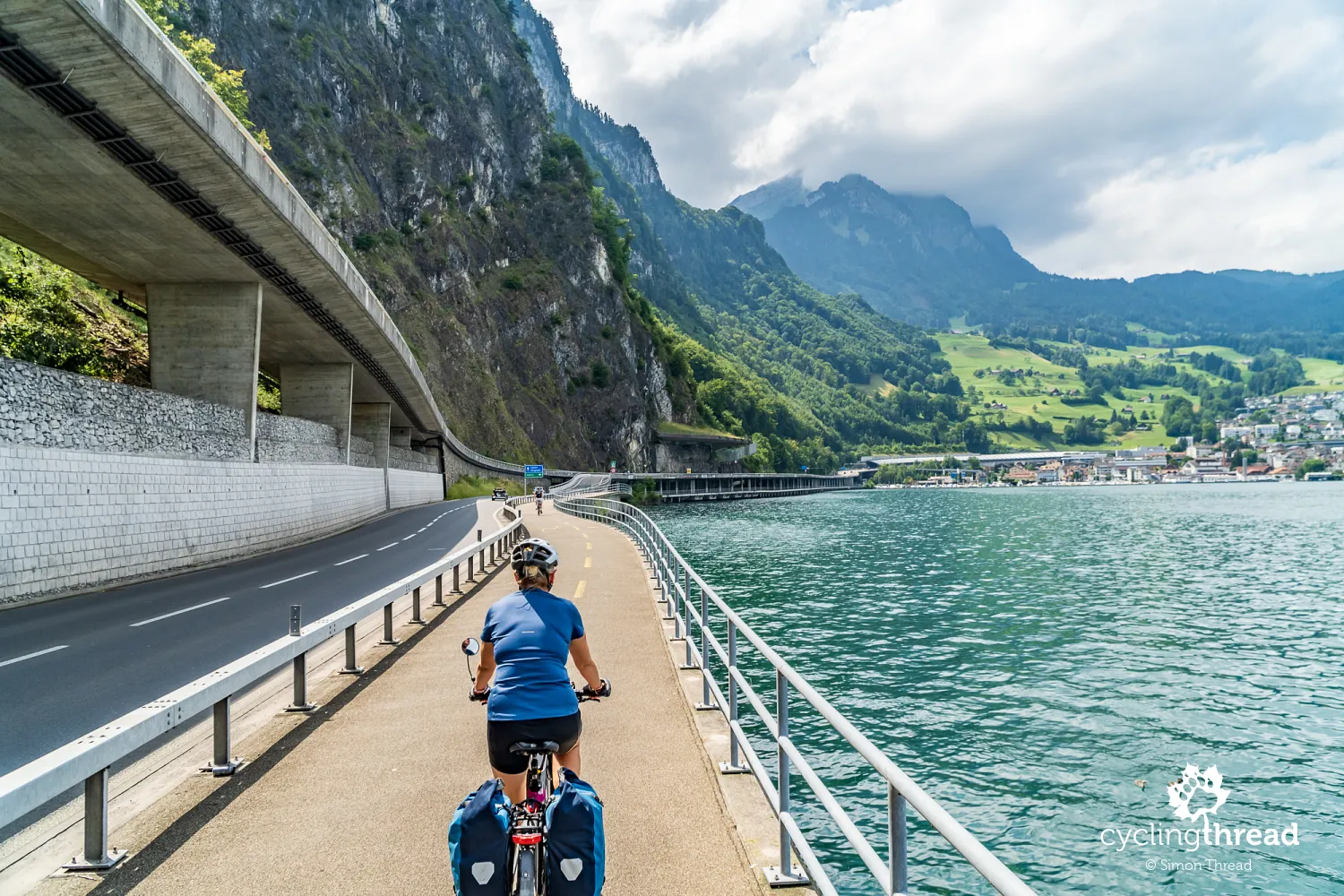
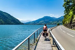
We continue toward Lucerne on a familiar section that we cycled two years ago on the Lakes Route. This is essentially a suburban stretch, meaning it’s busy with cyclists on weekends. Here, an impressive bike path is attached to the road running along the lakeshore - likely supported by stilts driven into the lakebed. A bit further, in the town of Hergiswil, we ride along what is perhaps the busiest example of a "2 minus 1" road design we’ve seen. We’ve encountered similar layouts in the Netherlands, occasionally in Denmark and even in Germany - but here, the Swiss have implemented it right in the center of a small town. And it works! Traffic moves smoothly and cars patiently wait their turn to pass cyclists riding in the designated lanes.
The Lion of Lucerne and the Glacier Garden
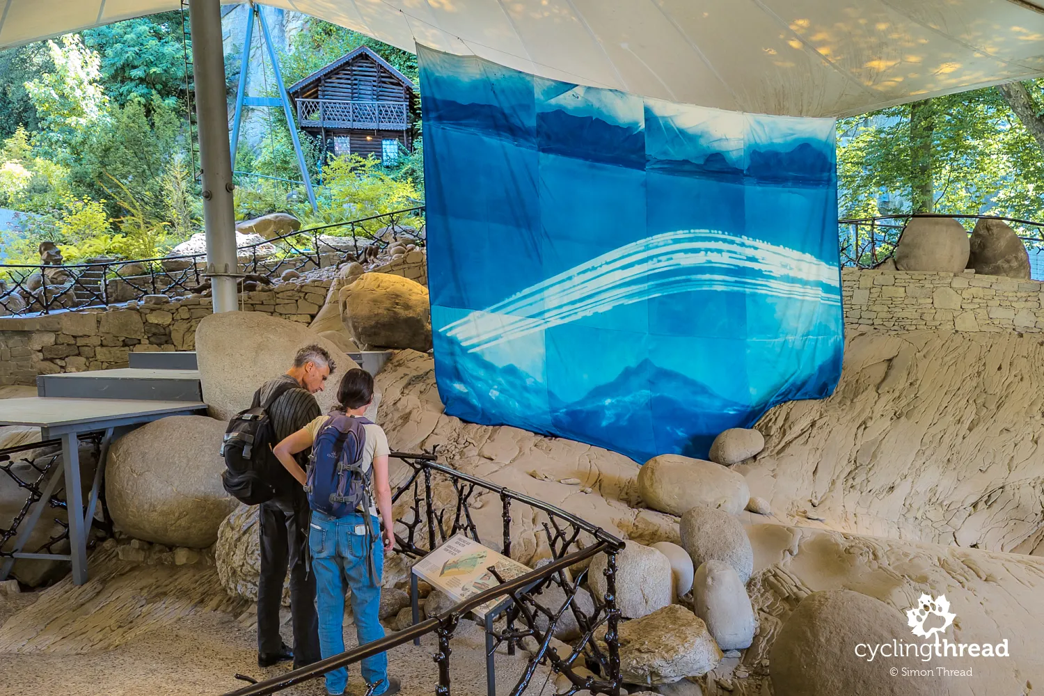
We set aside more time for Lucerne, staying for two nights to explore the city and get some well-earned rest. At last, we visit the Glacier Garden, a fascinating site showcasing 20 million years of the region’s geological history. Here, you can see several-meter-deep glacial potholes - perfectly preserved formations carved by ancient ice flows. The site also features fossils from a time when this region was covered in tropical vegetation, with palm trees instead of alpine peaks.During our visit, we also come across a Polish contribution to the exhibition - an artwork created by Daria Lelonek using solar photography. Her piece highlights the controversial practice of covering glaciers with reflective sheets to slow their melting. While this technique delays ice loss, it also contaminates pristine alpine environments with microplastic fibers.
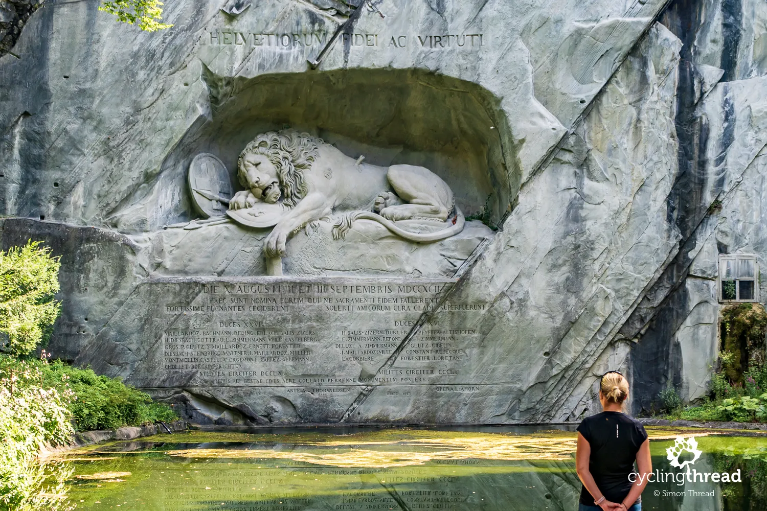
Just outside the entrance to the Glacier Garden stands the Lion of Lucerne, considered one of the most moving sculptures in the world. Seeing it in person is far more powerful than any photograph - the monument is carved into a high rock wall, nestled in a peaceful green setting that invites quiet reflection. The sculpture depicts a massive dying lion, pierced by a broken spear, commemorating the 750 Swiss Guards who lost their lives during the French Revolution. However, history suggests that the monument’s creator, an officer of the Swiss Guard who was on leave during the tragic events and thus did not take part, may have exaggerated the number of casualties. The monument itself remains a subject of local debate and controversy. Another curious detail - the grotto surrounding the lion is said to resemble the shape of a wild boar, supposedly a subtle act of rebellion by the underpaid sculptor responsible for the final carving.
The route softens through forests and vineyards
Beyond Lucerne, the terrain gradually transitions from highlands to lowlands. Rolling green hills and agricultural landscapes begin to dominate the scenery, many of them shaped by winding rivers and smaller lakes. The towering Alps remain visible on the horizon, but the terrain becomes easier to navigate, making it more accessible for both cycling and hiking. As we approach the border with Germany and France, the more continental climate becomes noticeable, favoring vineyards that stretch across the gentle hills. Another hallmark of this region is its vast forests, such as the Jura Forest, extending east of Basel. This area is characterized by undulating hills, small valleys and meandering rivers that carve through the landscape.
Beautifully painted houses in Aarau
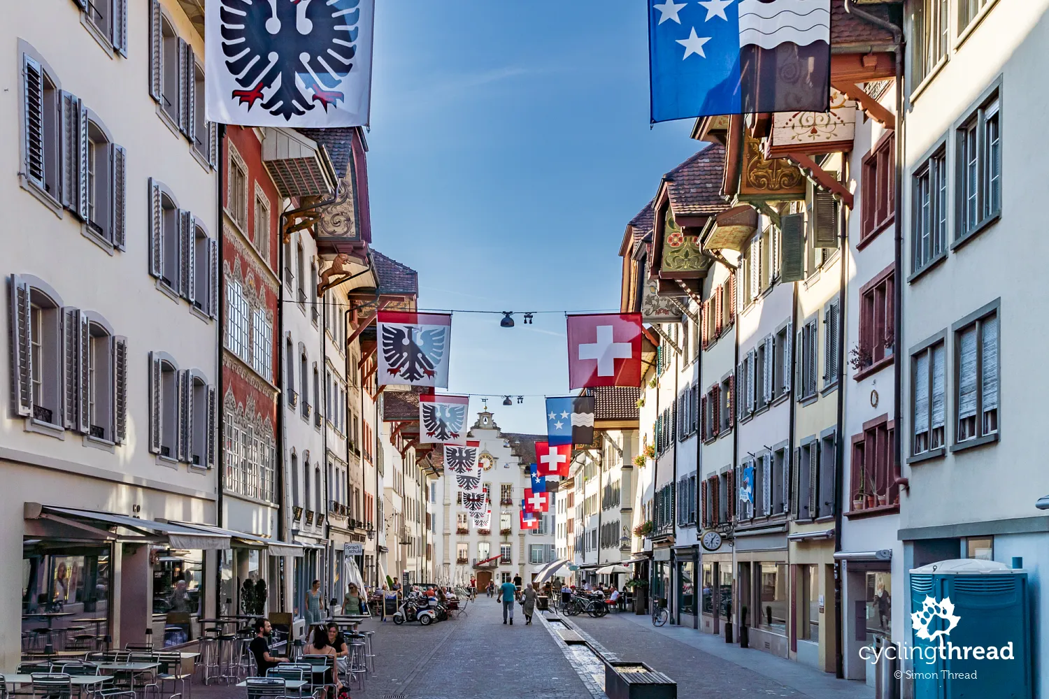
Near the end of our journey, Aarau makes a lasting impression on us. It’s one of those smaller Swiss cities that tend to be overshadowed by more famous ones like Zurich, Basel or Lucerne. Aarau’s medieval center is a maze of narrow streets and historic buildings, but what truly stands out are the uniquely painted eaves of its townhouses. We keep craning our necks to admire the intricate designs beneath the overhanging roofs - nowhere else have we seen such an artistic concentration of this type of decoration. While in Aarau, it’s also worth visiting Schlössli, the oldest part of the city’s fortifications. Located in the northeast corner of the Old Town, just beyond the former city walls, it features a 25-meter residential tower dating back to the first half of the 13th century, constructed from large, roughly hewn blocks of megalithic stone.
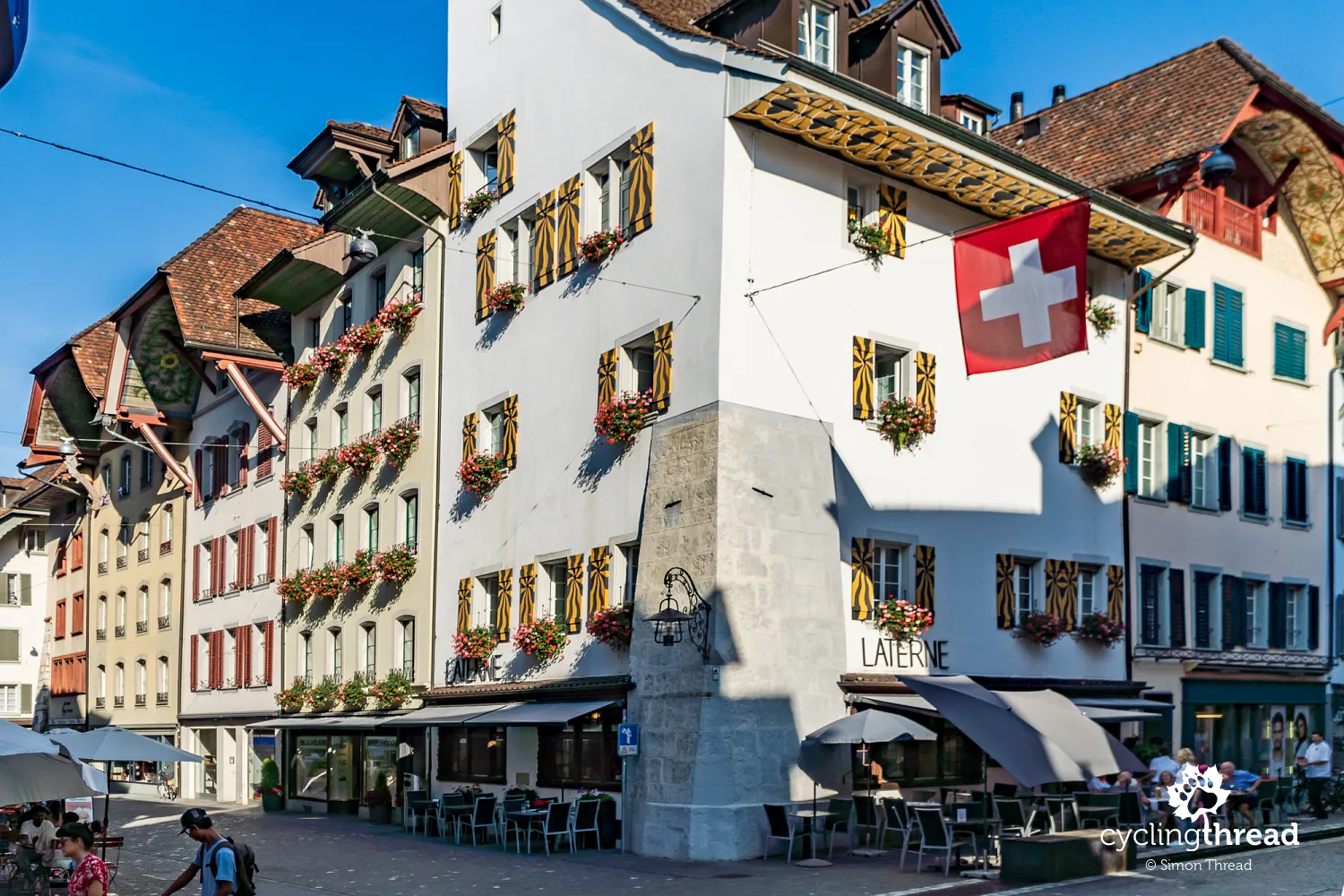
From Aarau, the North-South Route winds through picturesque landscapes, following the Aare River. Initially, the path meanders through a nature reserve before reaching the Erlinsbach weir, where three major Swiss cycling routes intersect (3, 5 and 8). The climb to Schafmatt Pass rewards us with stunning views, followed by a fast descent into the scenic village of Oltingen. These peaceful rural surroundings offer a quintessentially Swiss atmosphere, with numerous orchards and vineyards dotting the nearby hills. Through the rolling terrain - rich with fruit trees and local wineries - we pass through the villages of Rothenfluh, Ormalingen and Gelterkinden before reaching Liestal, the capital of the Basel-Landschaft canton. Liestal welcomes us with a charming Old Town and a picturesque town hall. From there, we cycle through more industrialized areas between Liestal and Münchenstein, where chemical and pharmaceutical industries dominate the landscape, before finally arriving in Basel.
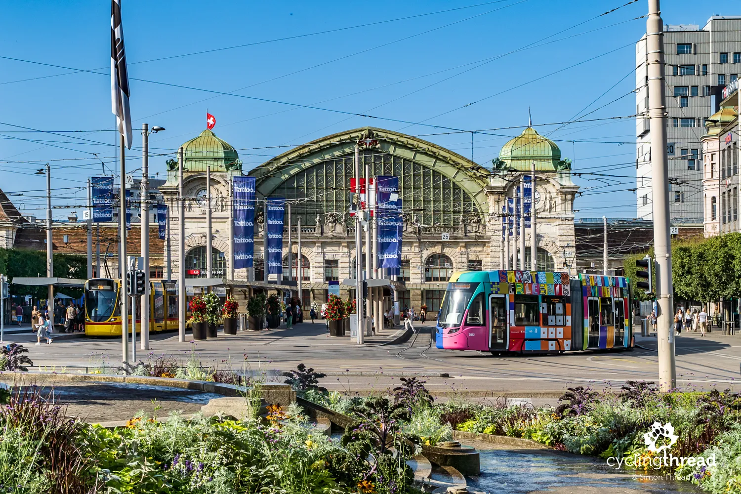
Basel and the largest open-air cinema
In Basel, the route follows the Birs River and passes St. Jakob-Park, Switzerland’s largest football stadium. Our cycling journey officially ends in the heart of the city, near Basel Cathedral, which offers stunning views of the Rhine. It’s the perfect spot for a well-earned break. As we stroll through the city, we reminisce about our previous visit to Basel after completing the Rhine Route - back then, we explored the Historical Museum in a former Franciscan church and visited the Natural History Museum. This time, in the square near the cathedral, we discover a massive screen and seating area, where the weekly Allianz Cinema - a large, open-air film screening - took place the night before. Maybe next time?
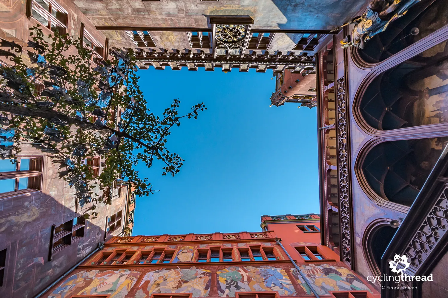
Veloland will guide you through Swiss cycling routes
If our journey has inspired you to explore Switzerland by bike, we highly recommend checking out Veloland, the official website showcasing Switzerland’s cycling routes. It features all nine national routes, including the ones we’ve ridden, as well as numerous regional and local trails. Each main route is broken down into stages, with descriptions highlighting key attractions. Of course, there are maps and elevation profiles available as well. One of the best features is the interactive map, where small photo icons reveal what kind of roads and surfaces to expect along different segments of the route. It’s an excellent tool for planning and making sure you know what kind of terrain lies ahead. The same content, including the full route map, is also available in the well-functioning Schweiz Mobil app, which is great for on-the-go navigation.
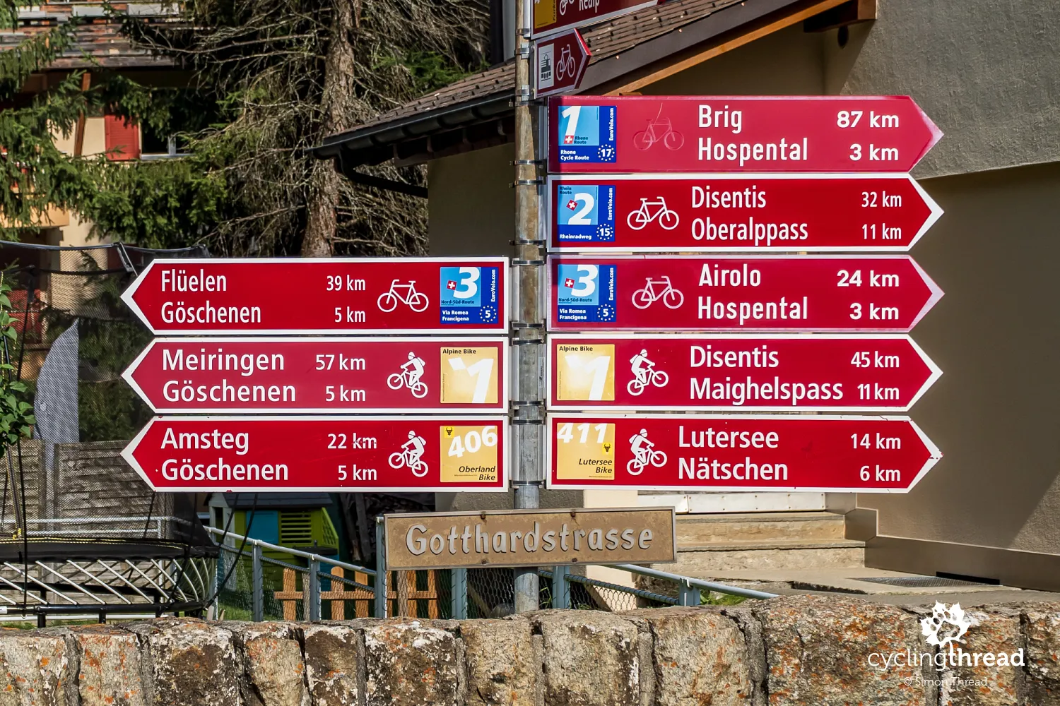
Part of the EuroVelo network
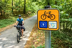
While cycling along the North-South Route in Switzerland, it's easy to spot the distinctive EuroVelo 5 sign - a bold number five on a blue background - integrated into the local route markers. This is a clear sign that the North-South Route is part of the EuroVelo network, a system of long-distance cycling routes that connect Europe by bike. Officially known as EuroVelo 5 - Via Romea (Francigena), the full route stretches from Canterbury in the United Kingdom to Brindisi in southern Italy. The Swiss section runs from Basel to Chiasso, following the entire length of our journey across Switzerland. As one of the 17 EuroVelo routes, EV5 traces historical pilgrimage paths and ancient trade routes, offering a unique blend of cultural depth and cycling adventure across the continent.
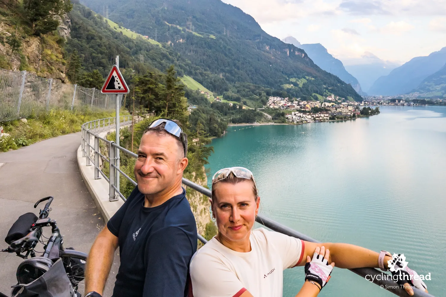
The most demanding Swiss cycling route
With three or four particularly challenging sections along the way, the North-South Route feels like the toughest Swiss cycling route we’ve ridden so far. However, climbing the Gotthard Pass and cycling along the Axenstrasse high above Lake Lucerne remain some of the most breathtaking moments of our cycling adventures. Once again, Switzerland has surprised, intrigued and - most importantly - fully satisfied our cycling and travel cravings. And that’s exactly what we wish for you too!
Back to top


Your Comments
Add new comment