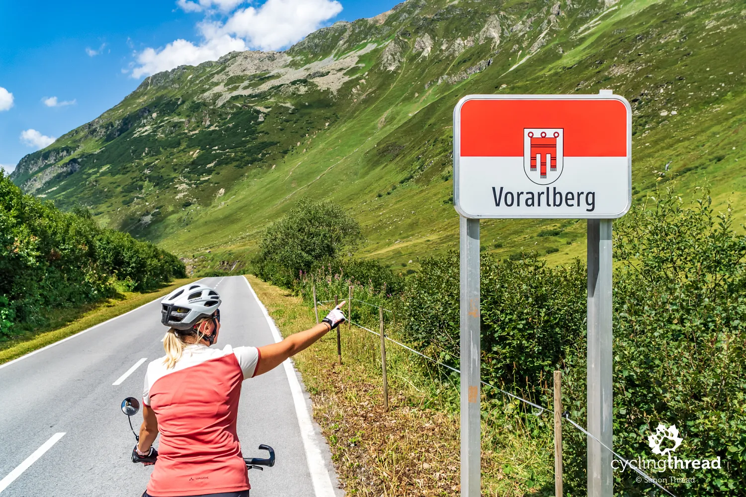
Vorarlberg. Cycling the mountains and valleys of western Austria
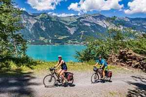
Vorarlberg, nestled between popular Tyrol and upscale Switzerland, remains a lesser-known but incredibly rewarding region for a few days of active cycling. I connected several short cycling routes running through the valleys of Vorarlberg into one longer journey - and the result was a five-day ride through a variety of stunning landscapes. From the high-altitude Silvretta range down to the Rhine and Lake Constance, we pedaled through peaceful towns like Bludenz, Lech am Arlberg, Mellau, Andelsbuch and Feldkirch, as well as vibrant Bregenz, home to the famous floating opera stage.
Cycling Partners
Route on the map
GPX file (GPS track): cyclingthread.com-vorarlberg-2024.gpx
Cycling Vorarlberg - table of contents
- Vorarlberg - quiet, relaxing and authentic
- The cycling route network of Vorarlberg
- A huge landslide to start the trip
- Skip the unfriendly section in Tyrol by bus
- Bielerhöhe Pass, Silvretta and Piz Buin
- Kopsee - a perfect alternative to Silvretta
- Silvretta road closed for two months
- Montafon - the first of Vorarlberg’s valleys
- The official cycling signs of Vorarlberg
- Bludenz reminds us of the Werdenbergs
- The next stage: a ride up Klostertal
- A bike taxi over the Arlberg Pass
- Very pleasant moments in Lech am Arlberg
- Where the most snow falls in Austria
- Mountain panoramas in the Bregenzerwald
- Home of good coffee and modern architecture
- The Vorarlberg Münster scheme was born in Au
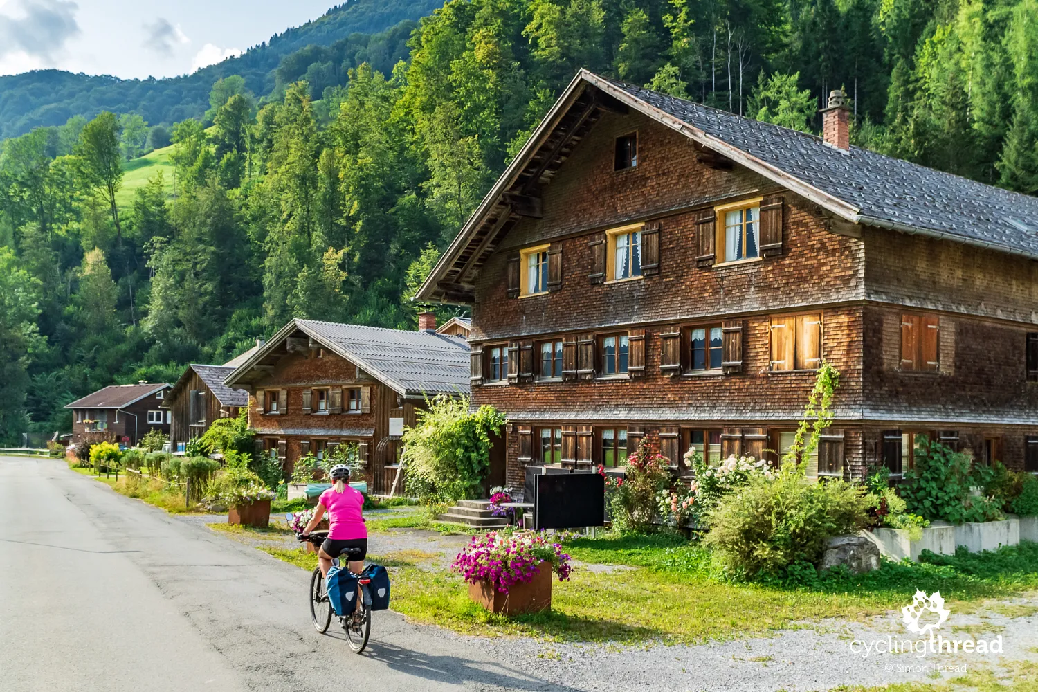
- Beautiful houses in the Bregenzerwald
- The flavors of Vorarlberg reflect the tradition
- Bicycle-friendly hotels in Vorarlberg
- Cycling route along a former railway line
- Andelsbuch - artistry, modern architecture...
- ... and the Bregenzerwald Cheese Route
- Cycling beautiful rail-to-trail in Vorarlberg
- An extra section of the route in Vorarlberg
- Austria’s first and only women's museum
- Bus stops combine design with craftsmanship
- Bregenz - the vibrant capital of Vorarlberg
- One of the most beautiful attractions in Europe
- One short ride along the Rhine
- An unexpected Jewish quarter in Hohenems
- The easiest ways to reach Vorarlberg
- Vorarlberg - mountains at every turn
Vorarlberg - quiet, relaxing and authentic
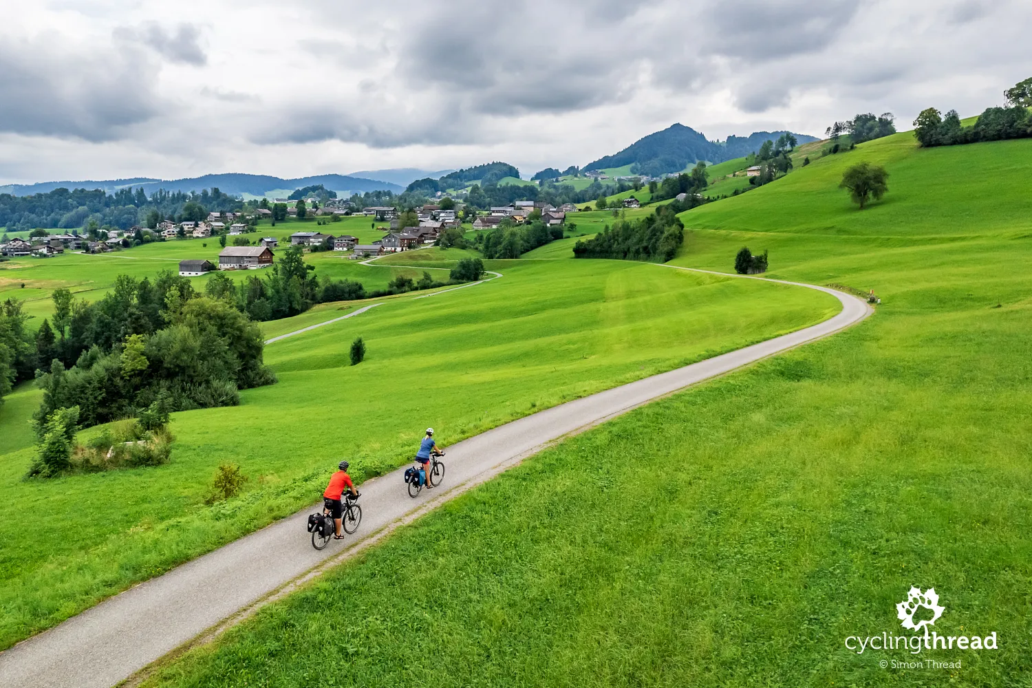
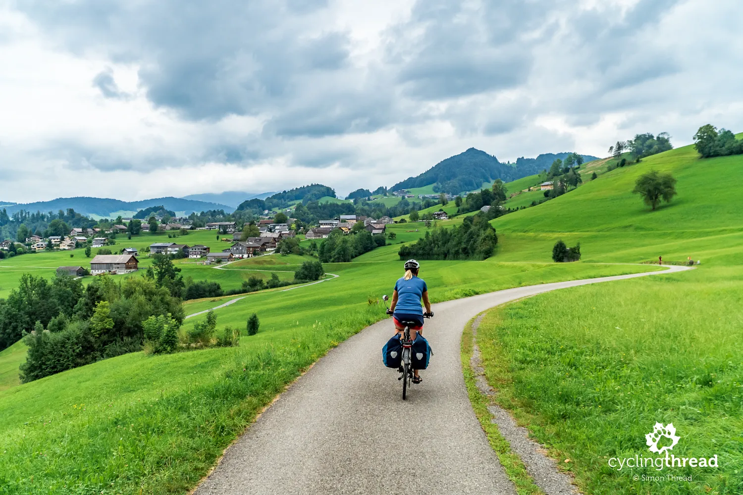
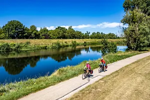
I wouldn’t be surprised if the owners of charming alpine guesthouses in Vorarlberg sometimes complain among themselves that being tucked between two tourism giants steals some of their visitors. But what might worry local hoteliers was, for us - cycling travelers - a real blessing. The cycle routes in Vorarlberg were far less crowded than their beauty and quality would suggest. And that calm, that sense of space, made riding through the region feel especially relaxing. While hundreds of cyclists pedal daily along the famous Rhine Cycle Route just a few dozen kilometers away, at the scenic Silvretta Lake, it was just us and our panniers. In a world overwhelmed by noise and constant rush, these quiet, authentic places are becoming some of the most valuable treasures - especially when traveling.
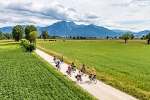
The cycling route network of Vorarlberg
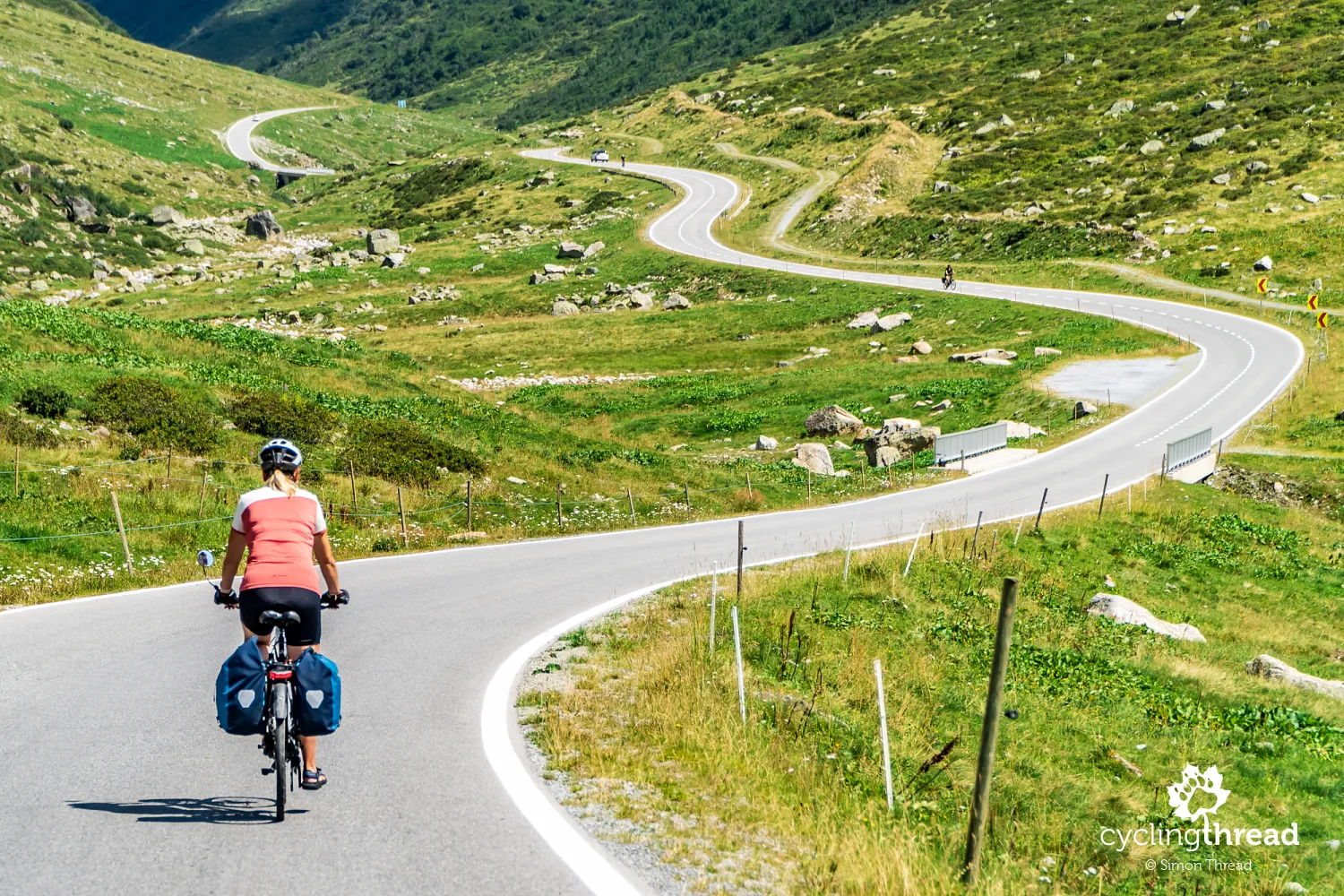
We mostly followed signposted mountain cycling routes across Vorarlberg. As always, we didn’t try to reinvent the wheel - we relied on the knowledge of local cycling tourism experts and trusted their experience. Shortly after descending from the Silvretta, we joined cycle route no. 1, the Ill-Rhein Route. In Bludenz, we switched to route no. 4 - the Klostertal Route. From there, we took on the longest stretch of our journey without a signposted route, heading toward Lech am Arlberg and Warth. Then in Schoppernau, we picked up the Bregenzerwald Route (Bregenzerwald-Radweg - route no. 3), which followed the Bregenzer Ach all the way to Bregenz. The final stretch took us back onto route no. 1, with a short section on route no. 2 - the Villages and Cities Route (Dörfer Städte Radweg). The total length of our route was around 270 kilometers.
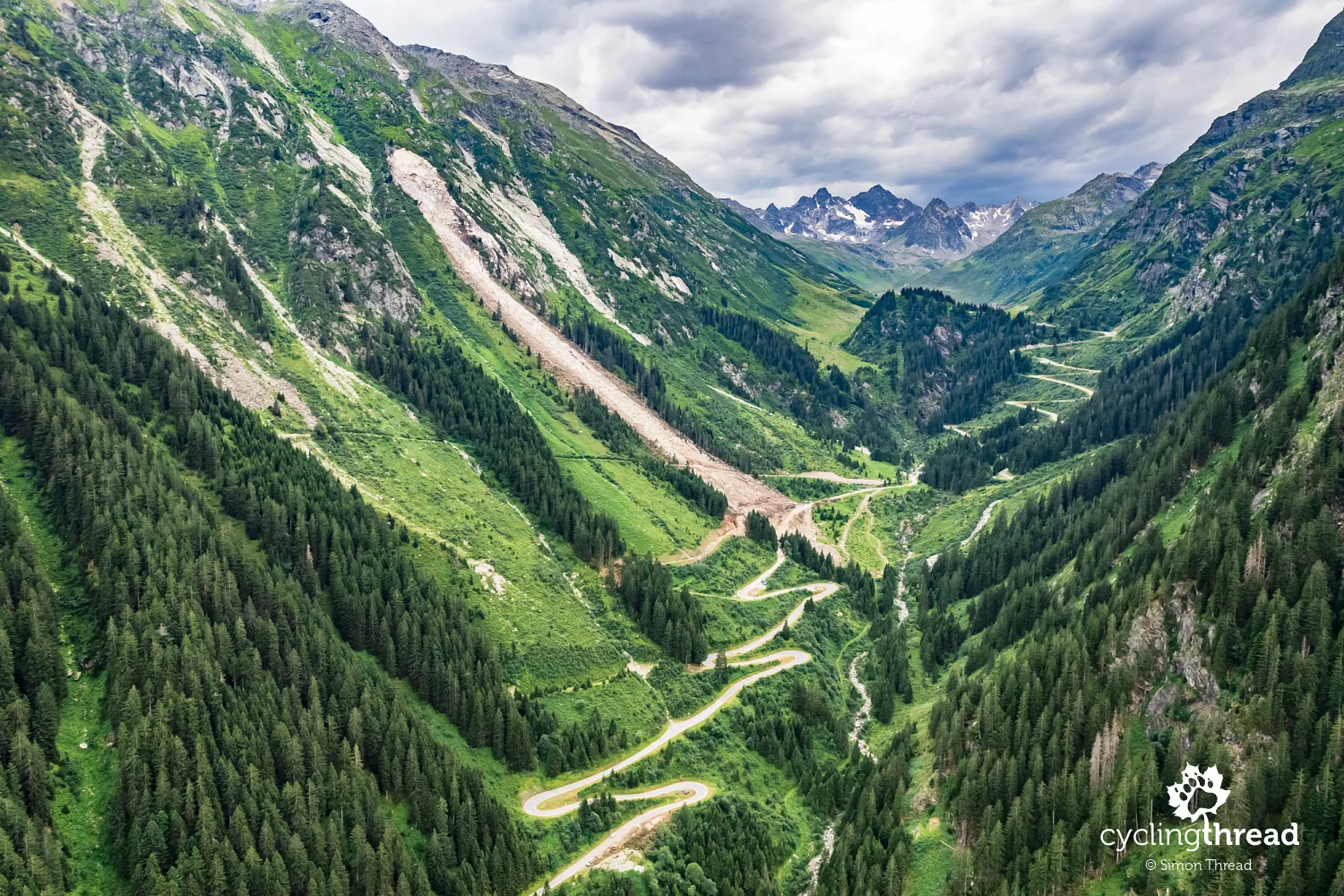
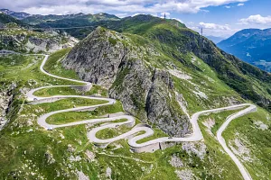
A huge landslide to start the trip
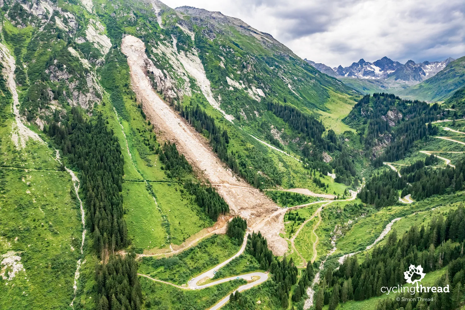
Our journey began with a dramatic interruption - or rather, a deep rumble, as around 60,000 cubic meters of earth, weighing up to 120,000 tons, slid down the steep alpine slopes and buried the famous Silvretta High Alpine Road. Just days before our arrival, a massive landslide shut down the route, cutting off car traffic in this part of the Alps. For a while, it looked like we might have to cancel the trip altogether - but soon, a detour route was announced. And as it turned out, this new path wasn’t just a workaround - it may have been even more interesting than the original plan. A quick reshuffle of our itinerary and we were back in the saddle.
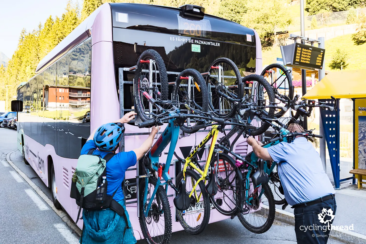
Skip the unfriendly section in Tyrol by bus
The name "Silvretta High Alpine Road" says it all - the reservoir that gives the route its name lies at 2,030 meters above sea level. To get there from the nearest train station in Landeck, Tyrol, you’d normally have to climb 50 kilometers and gain over 1,200 meters in elevation. The road from Landeck is narrow and winding, with plenty of car traffic, passing through popular mountain resorts including Ischgl. It’s definitely not the kind of route you’d call bike-friendly. Luckily, there's a better option: from Landeck station, bus no. 260 runs directly to Bielerhöhe Pass and has five bike racks mounted on the back. This seasonal service makes it easy to skip the toughest and least pleasant stretch of road. Instead of nervously checking our mirrors for overtaking cars, we could rely on safe, cyclist-friendly public transport.
So why didn’t we want to cycle up to Bielerhöhe from Landeck? Because we usually dedicate our bike trips to exploring one route or region in depth - and for us, Vorarlberg began on the other side of the pass. The long climb through Tyrol wasn’t part of the plan. Instead, we started our tour right from Bielerhöhe Pass and the Silvretta reservoir, launching into a long descent through the Montafon valley. This way, we could immediately focus on the part of Austria we came to see. Tyrol and other cycling routes of Austria? Not this time.
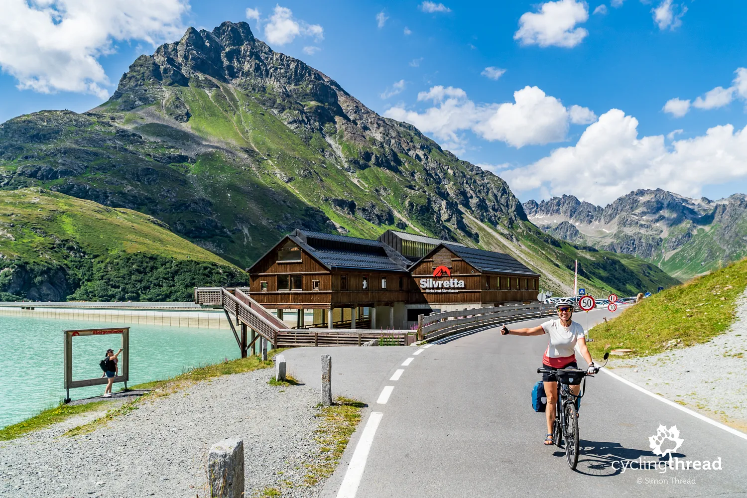
Bielerhöhe Pass, Silvretta and Piz Buin
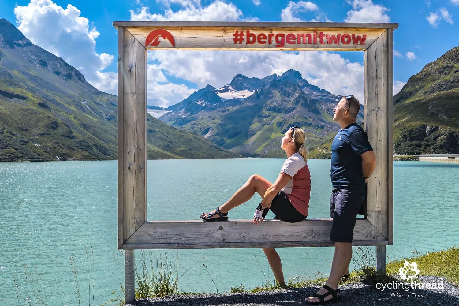
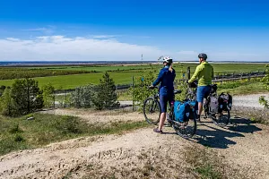
Bielerhöhe Pass is best known for the impressive Silvretta reservoir - an artificial lake surrounded by majestic peaks, including Piz Buin (3,312 m), the highest mountain in Vorarlberg. Construction of the reservoir began in 1938 and during World War II it was built in part by prisoners of war and forced laborers. The first filling occurred in 1943, with full completion in 1951. On the lake’s shore stands the Chapel of St. Barbara, commemorating those who died during its construction. Today, the reservoir powers hydroelectric stations and plays a key role in the region’s energy network. Water from the reservoir flows through a network of tunnels and pipelines to power plants lower in the valleys, efficiently harnessing the natural elevation differences.
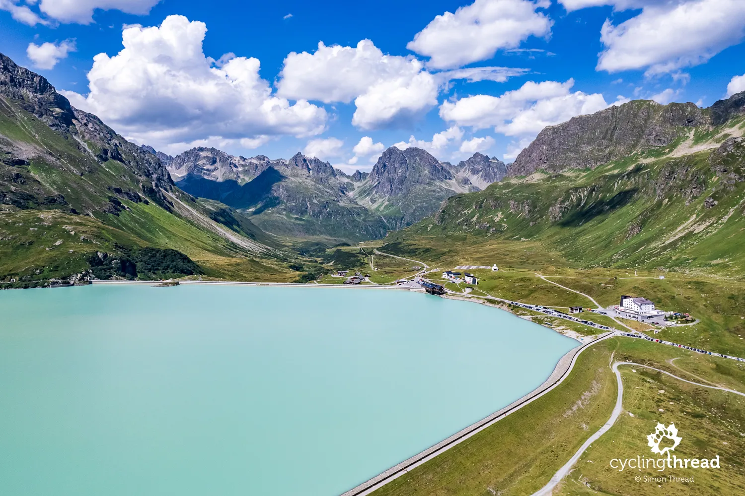
Near the reservoir, you’ll find the Silvrettahaus mountain hut, a hotel and a few restaurants that cater to travelers and cyclists drawn here by one of the most spectacular roads in the Alps. Bielerhöhe Pass is also a popular starting point for hiking and mountain biking, and in winter, a cross-country skiing loop is groomed around the lake. In summer, this area becomes an important hub for hiking and cycling routes that connect the surrounding valleys. We only stopped here briefly - rode a stretch of the lakeside path, took a selfie in the picture frame, snapped a few drone shots and then continued into the calm, welcoming world of Vorarlberg.
Kopsee - a perfect alternative to Silvretta
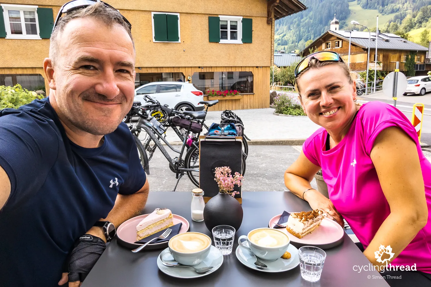
The detour caused by the Silvretta landslide quickly brought us to the area around Kopsee, a second artificial lake nearby. And although we had only just started cycling for the day, we couldn’t resist the inviting terrace of the Zeinisjoch guesthouse restaurant, perched beside the smaller Zeinisbach lake just before Kopsee. The place, the view, the weather, and the moment’s atmosphere were enough to stop us for a relaxed bite to eat. Vorarlberg’s cuisine, rooted in alpine tradition, surprises with its variety and bold flavors. Expect simple, hearty dishes made with cheese, potatoes and local herbs - perfect after a ride or a hike. I went for my favorite Käsespätzle with fried onions, Ola enjoyed a bowl of aromatic broth with cheese dumplings - Kaspressknödelsuppe. Delicious.
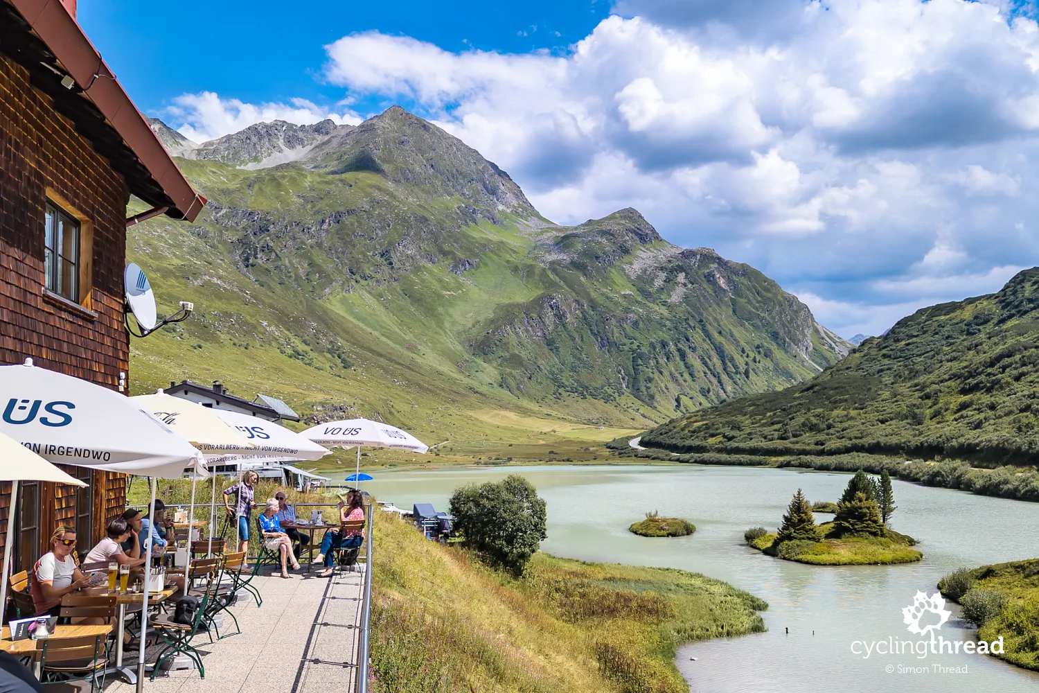
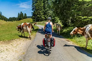
Our alpine food idyll was gently interrupted by a distant rumble of thunder - thankfully, it never came closer. Unfortunately, the sunny skies soon gave way to clouds, which dimmed the quality of the photos we were hoping to take near the landslide-damaged Silvretta. Still, the detour via Kopsee turned out to be just as scenic, if not more so. Instead of wide switchbacks on the famous high alpine road, we followed the narrow, winding curves of the Zeinisjochstraße, connecting Kopsee with the Montafon valley. Cows grazed nearby, mountain streams trickled in the background and a peaceful silence hung in the air. The road is technically easy but requires attention - steep gradients and blind corners make it better suited to confident riders. This was classic Austria: postcard-perfect, authentic and somehow tucked away from more obvious tourist attractions. The closeness to nature and raw mountain beauty here felt stronger than on many more popular passes.
Silvretta road closed for two months
After a few scenic switchbacks on the detour route, we reached the massive landslide site. The first major slide happened in July, burying a 135-meter stretch of the road under 3 to 4 meters of earth, with the volume of debris estimated at 40,000 to 60,000 m³. Then, on August 16-17, 2024, the site was hit again, covering the road once more and trapping three excavators that were working to clear the earlier slide. The road remained completely closed until September 6, when it reopened with daytime-only, good-weather access. On October 13, the Montafon side of the road closed for the winter, and on October 28, the entire route entered its seasonal shutdown. Local authorities note that increasing rainfall and shifting climate patterns are making such events more frequent in the Alps - a growing challenge for planning mountain infrastructure. The current status is posted on the official Silvretta website.
Montafon - the first of Vorarlberg’s valleys
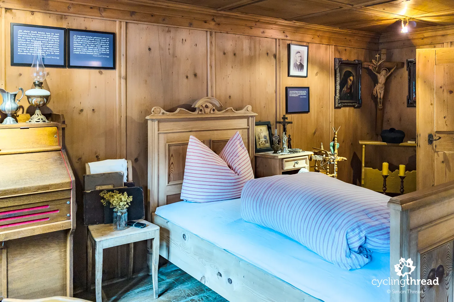
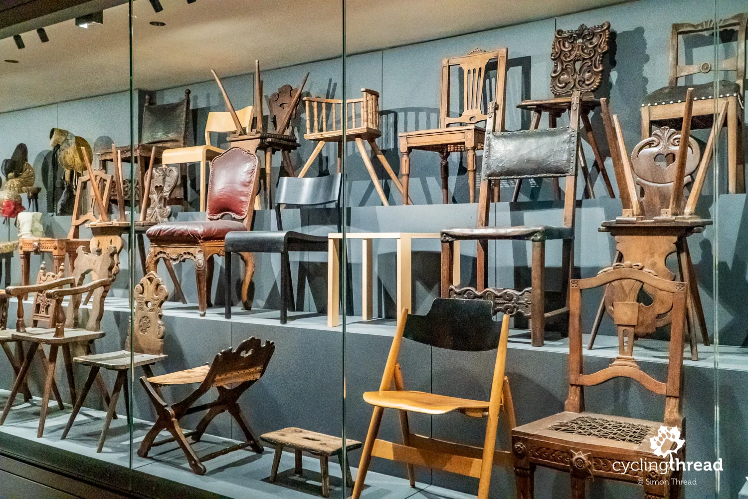
Just beyond Silvretta begins the Montafon valley, dotted with charming villages connected by an excellent bike route. We passed through places like Partenen, Gaschurn, St. Gallenkirch and Schruns. In Gaschurn we visited the small Montafon Mountain and Tourism Museum (Alpin- und Tourismusmuseum) and learned more about the region’s history - from traditional alpine farming to modern mountain sports. The museum has a great collection of early skis, climbing equipment and photos that show how tourism took root in the Alps. In St. Gallenkirch, we admired the Church of St. Gallus, which dates back to the 13th century, and in Schruns, we stopped by the Montafon Homeland Museum (Montafoner Heimatmuseum) to dive deeper into the region’s rural life, including displays on alpine traditions, farming and old mining practices.
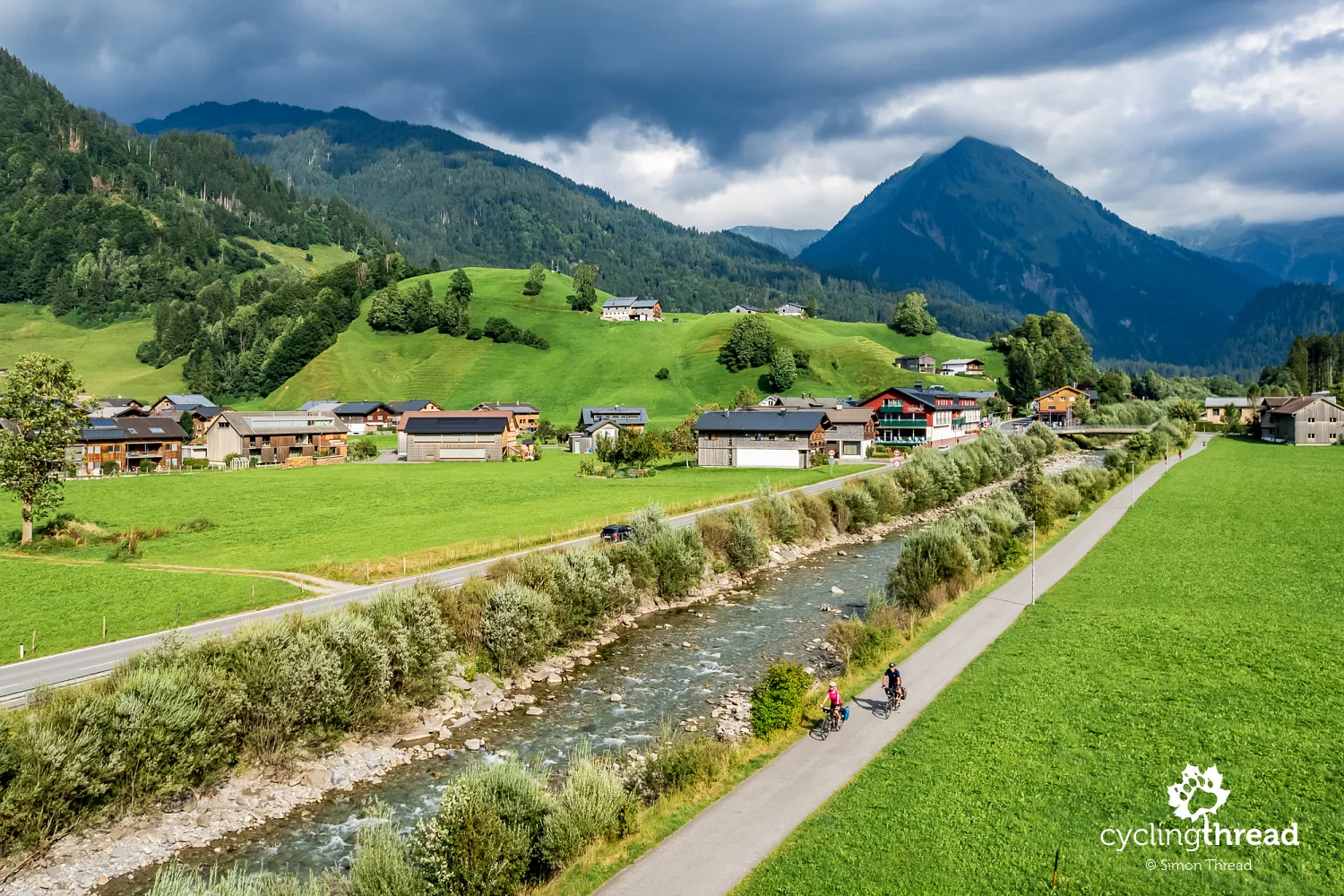
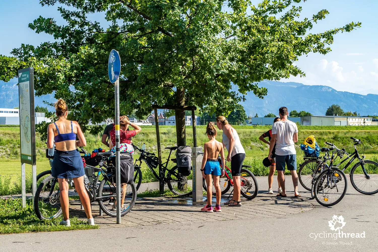
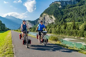
We rode through the entire Montafon valley on a bike path that was almost entirely separated from car traffic. This is part of Route No. 1 - the Ill-Rhein Route - one of several routes that showed us the best of Vorarlberg. The cycling path runs far from busy roads, which made our ride much more pleasant and allowed us to really take in the views. In some places near towns, limited car access is allowed, but usually on streets designated as bicycle priority roads, where cyclists have the right of way. This kind of setup is part of a regional strategy to build a well-connected, comfortable cycling network. The ability to ride safely and peacefully on clearly marked routes is one of the key strengths of cycling in this region - and one of the main reasons we chose Vorarlberg as a summer destination.
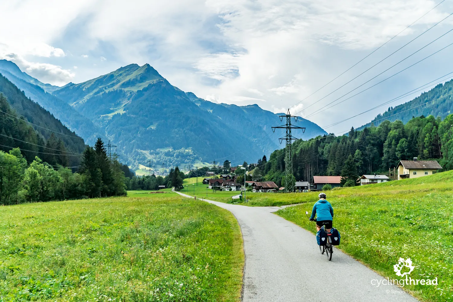
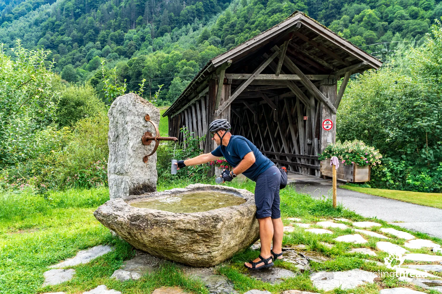
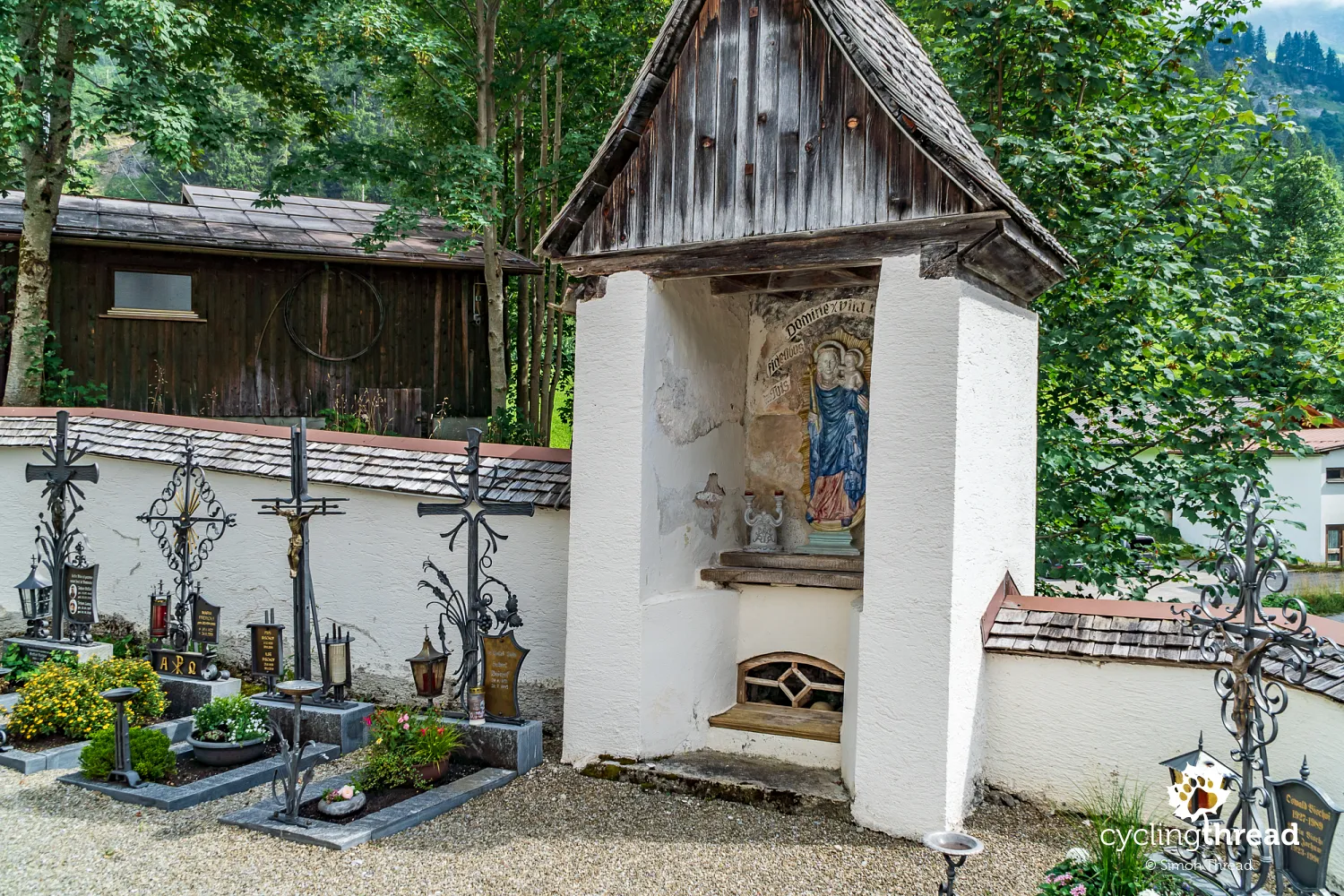
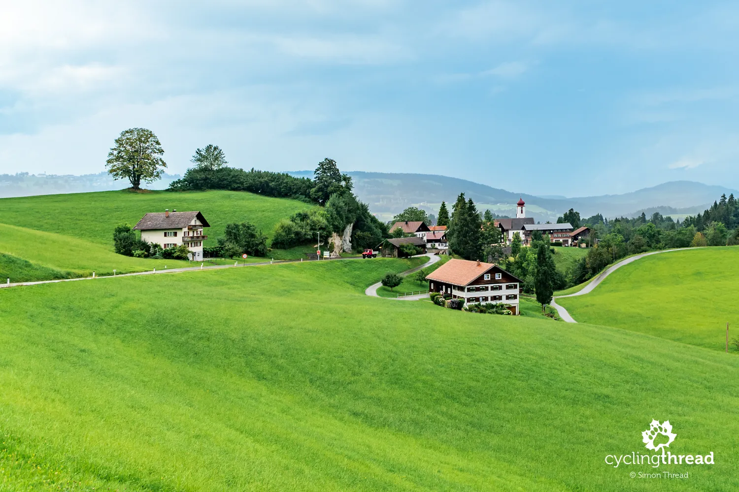
From Montafon - and from other valleys across Vorarlberg - we came away with a deep sense of authenticity and historical richness. Time and again, we passed old farmhouses and wooden barns, paused by timber bridges and filled our bottles at wells standing next to traditional architecture. Around every corner were details that spoke of care for heritage: carved beams, restored signs, flower-filled windows. It made cycling here feel like more than just active travel - it became a journey through time, where everyday life and the past coexist naturally. This preservation of traditional architecture and the harmony of the rural landscape is actively supported by local cultural heritage programs. Rather than sterile museum halls, Vorarlberg offers a living landscape where history is part of the scenery, not just an accessory to modern life.
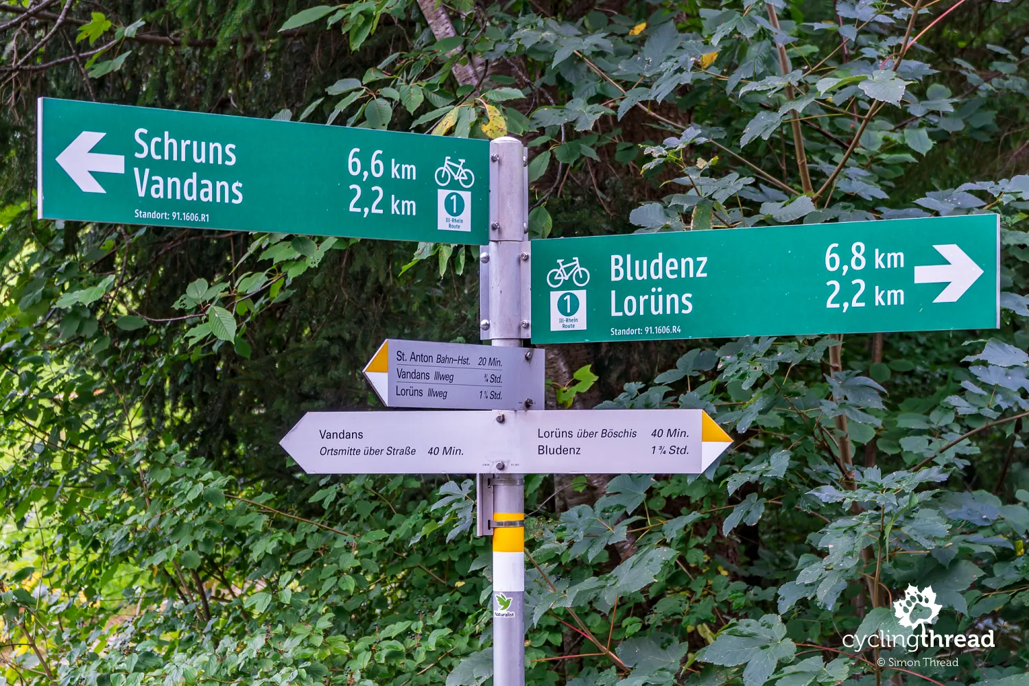
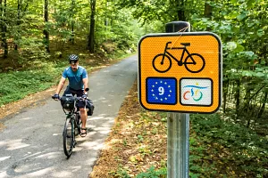
The official cycling signs of Vorarlberg
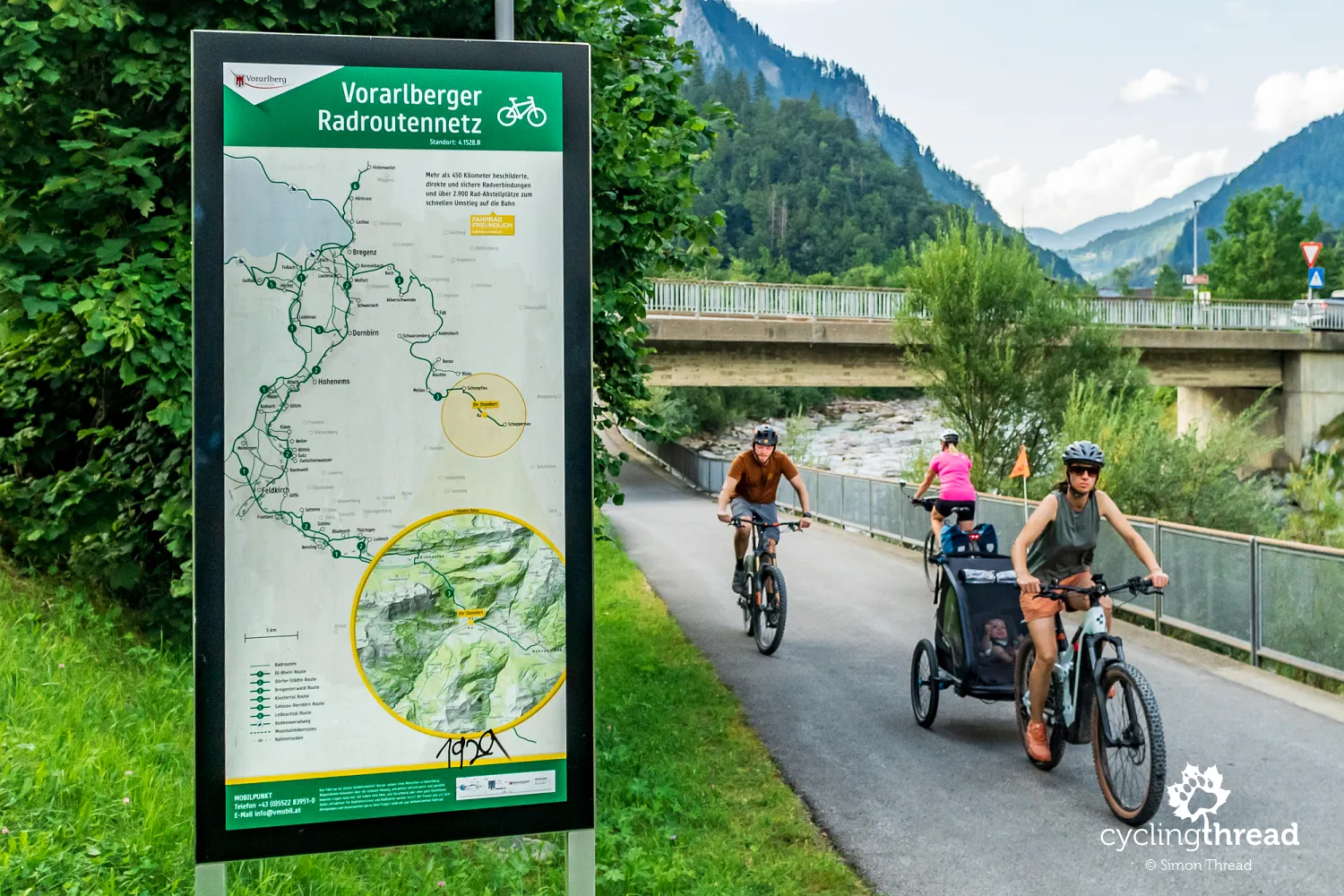
In the Montafon valley, we spotted the official Vorarlberg cycling signs - clear green boards showing the route name on top and the distance to the next town below. Their style is similar to those found in Germany and the font is large enough to read while riding. What’s surprising, though, is how hard it is to find comprehensive, easy-to-read information online about the full network of marked routes in Vorarlberg. All routes in one place, plus a schematic map, can only be found on the official Vorarlberg state website - in a modest list of PDF links at the very bottom of the page. It’s a surprisingly clunky setup for such a well-developed cycling region. There’s no route planning tool integrated with the official network, so you have to rely on commercial apps or local websites. Some sub-regional portals offer information about the routes in their area, but often without route numbers or any sense of how they fit into the larger Vorarlberg cycling system.
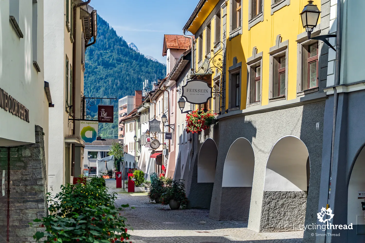
Bludenz reminds us of the Werdenbergs
That day we finished our ride in Bludenz, a small but pleasant town in western Austria. Its old town is full of charm, with narrow lanes and colorful houses. A distinctive feature is the arcaded facades along Werdenbergerstraße, which give the street a unique look. The name refers to the Werdenberg family, who founded the town in 1265 and whose ancestral seat was the Werdenberg Castle - located in the smallest town in Switzerland, which we passed earlier on our ride along the Rhine route. Overlooking the town is the baroque Gayenhofen Castle, now home to the district administration. At its center is a small square - more like a tiny marketplace - surrounded by cafés and local shops, perfect for relaxing after a long day in the saddle. Bludenz sits at the crossroads of several valleys, making it a great base for exploring different parts of Vorarlberg and even nearby Tyrol.
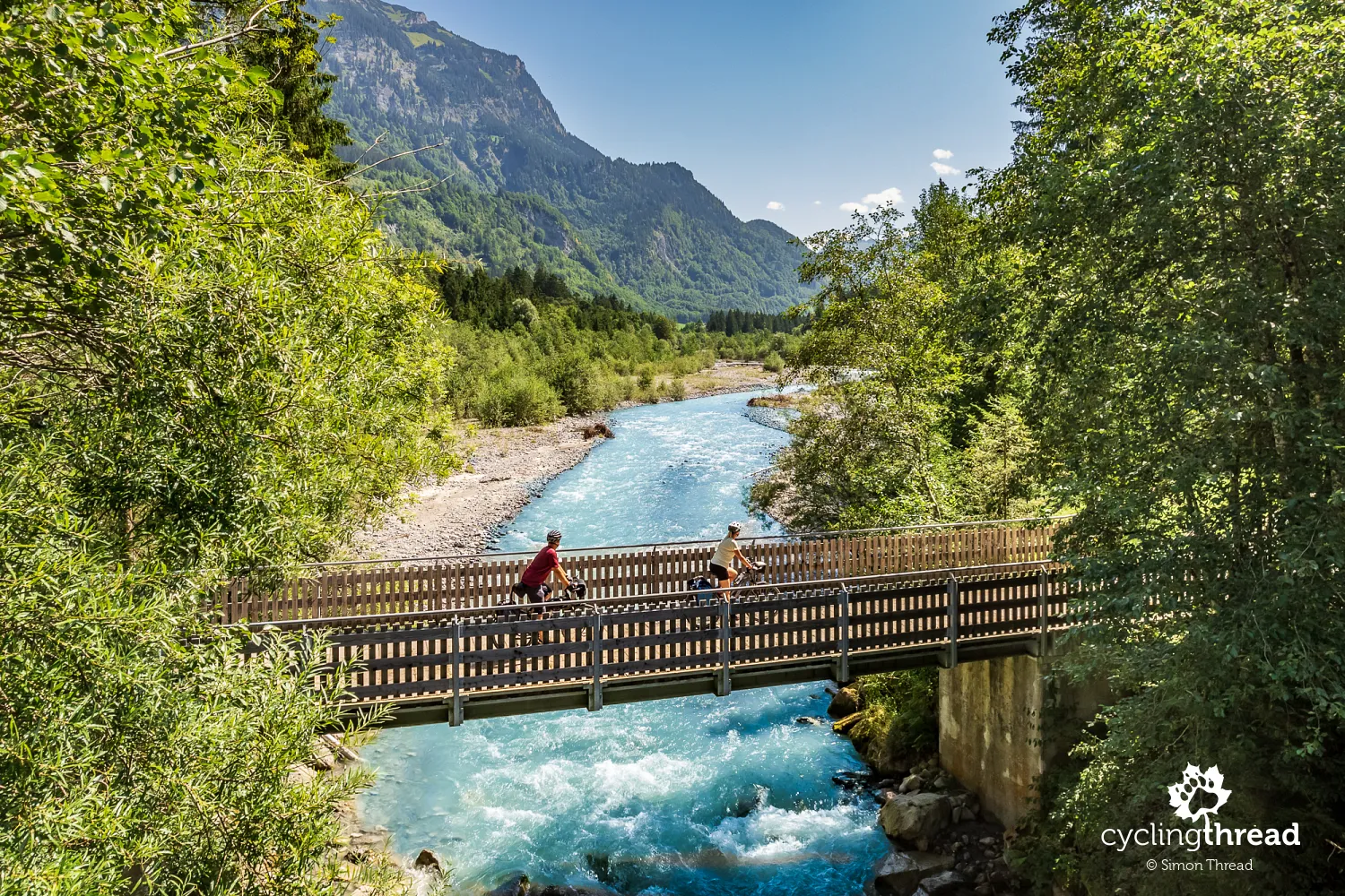
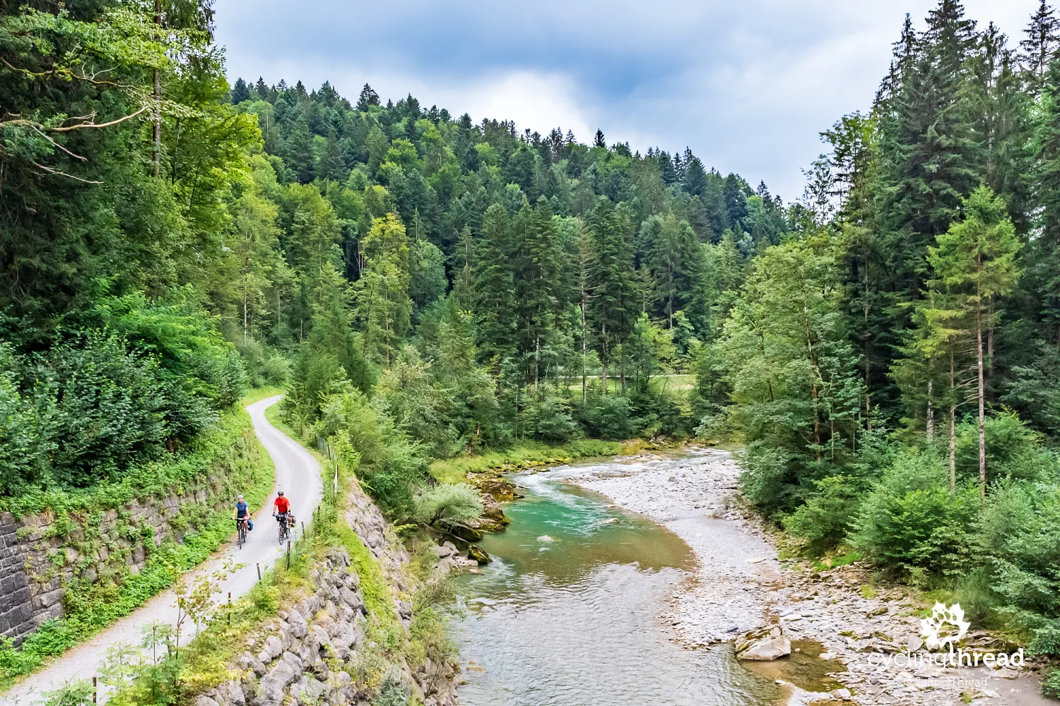
Thanks to its position at the intersection of five valleys - Montafon, Walgau, Brandnertal, Klostertal and Großes Walsertal - Bludenz is an ideal starting point for hiking and cycling adventures. Two of "our" cycling routes connect here: we arrived in Bludenz via Route No. 1 from Montafon and continued into the Klostertal valley on Route No. 4. In Klostertal, we found ourselves in a familiar setting - quiet, safe side roads, often gravel, led us gradually uphill toward Klösterle and Langen am Arlberg. The route followed the Alfenz stream, crossing it via several small bridges and offering plenty of scenic spots to pause.
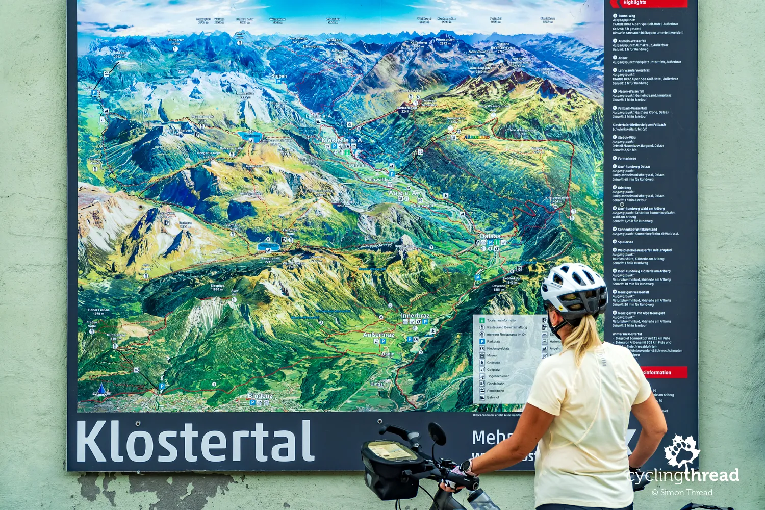
The next stage: a ride up Klostertal
Klostertal stretches from Bludenz all the way to the Arlberg Pass. For centuries, it was a key trade route linking Vorarlberg and Tyrol. Today, it attracts visitors with its mountain views, tranquility and sense of authenticity. The shape and character of the valley were beautifully illustrated on a large panoramic map we found on the wall of a local info point. It helped us trace our route for the day and spot a side valley leading from Lech am Arlberg to the alpine lake Formarinsee - our plan for a short ride the following day. Visualizations like these are especially useful in mountainous regions, where the road and route networks can be complex. We saw a similarly practical solution a few years ago along the Drau route in Carinthia, where the route was displayed on an aerial photo - an orthophoto map - which made the entire journey easy to visualize at a glance.
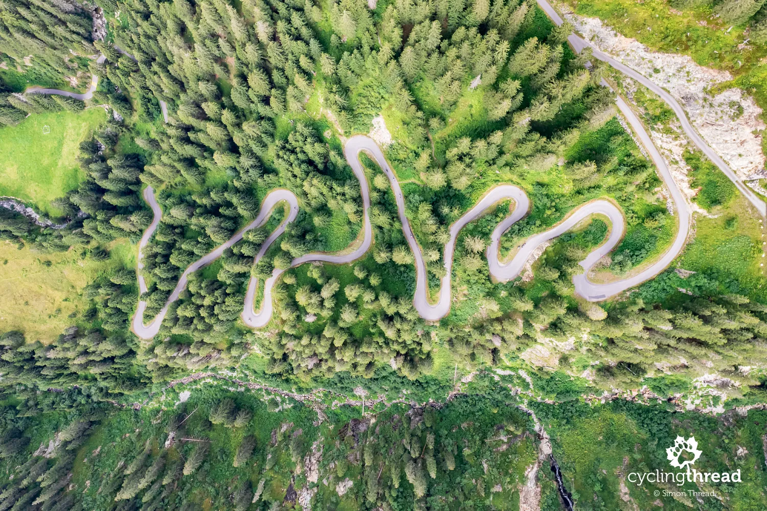
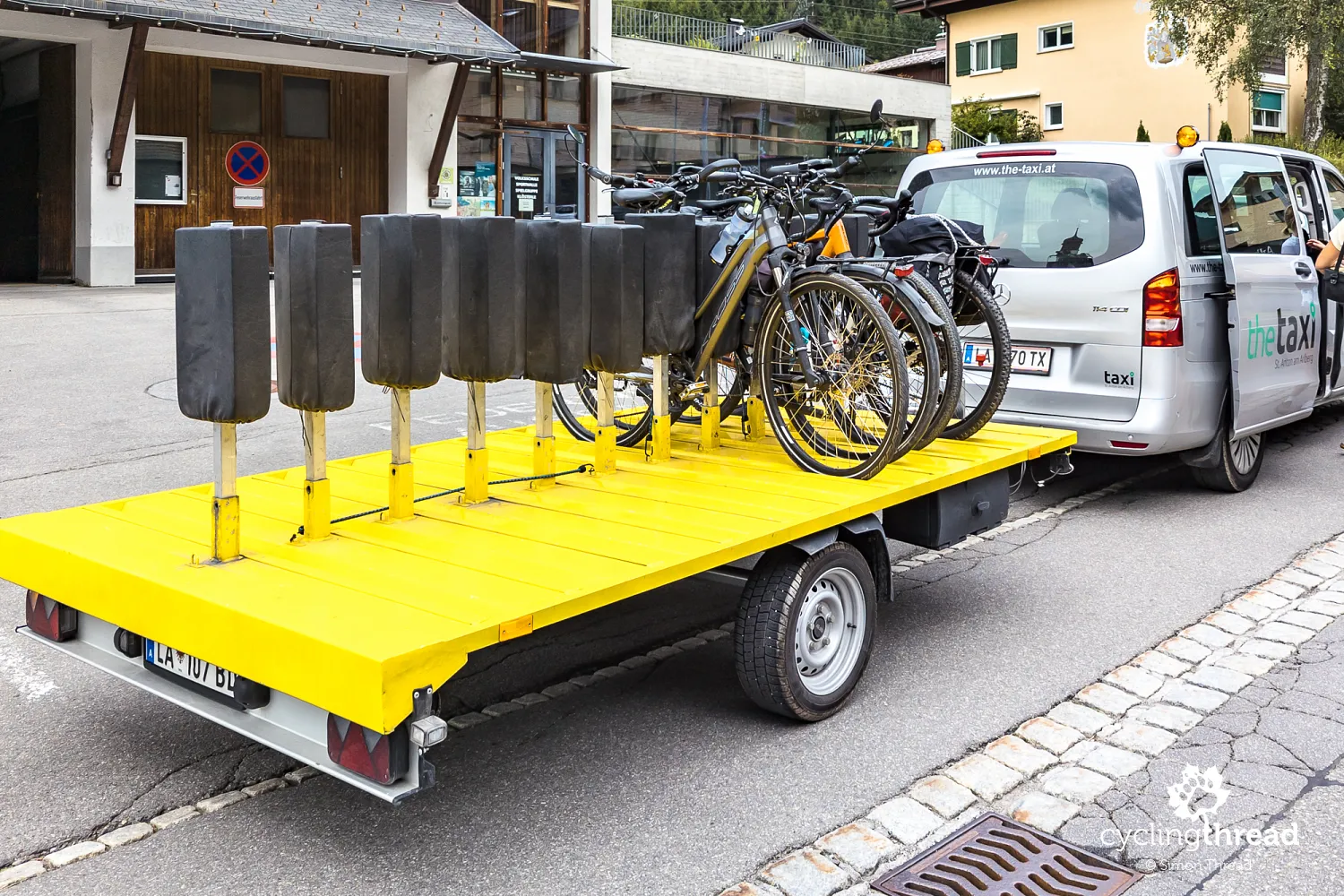
A bike taxi over the Arlberg Pass
In Klösterle, our journey took an unexpected turn - not due to any roadblocks, but because of an interesting logistical twist. All car traffic was being directed over the Arlberg Pass, a scenic but narrow alpine road, which made cycling conditions more challenging on that stretch. For safety reasons, cyclists were advised not to ride up the pass beyond the village of Stuben and instead use a dedicated bike taxi service. So, together with two fellow riders from Germany, we hopped into a minibus while our bikes followed on a special trailer. Although we briefly switched from two wheels to four, it was a great chance to experience one of the cyclist-friendly services available in Vorarlberg. And honestly, gliding up the pass with panoramic views wasn’t a bad deal at all.
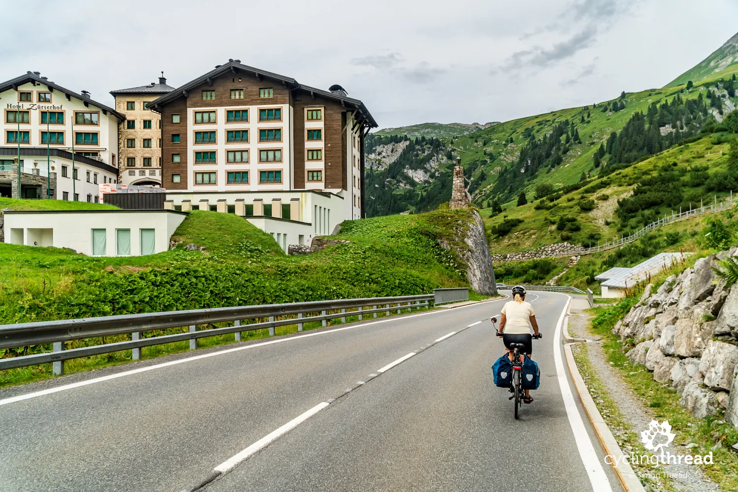
We got out of the bike taxi at the first available parking area past the pass, just beyond a series of tunnels and avalanche galleries near the Arlberg Pass. Ahead of us was Zürs - one of the most famous winter sports resorts in the Alps and a historic birthplace of alpine skiing. Ski lessons were held here as early as the beginning of the 20th century, and in 1937, Austria’s first T-bar lift opened in Zürs - a milestone in the evolution of ski infrastructure. But Zürs in summer tells a very different story. The old village charm has long vanished, replaced by large, modern hotels and guesthouses that stand mostly empty outside the ski season, giving the place a rather gloomy feel.
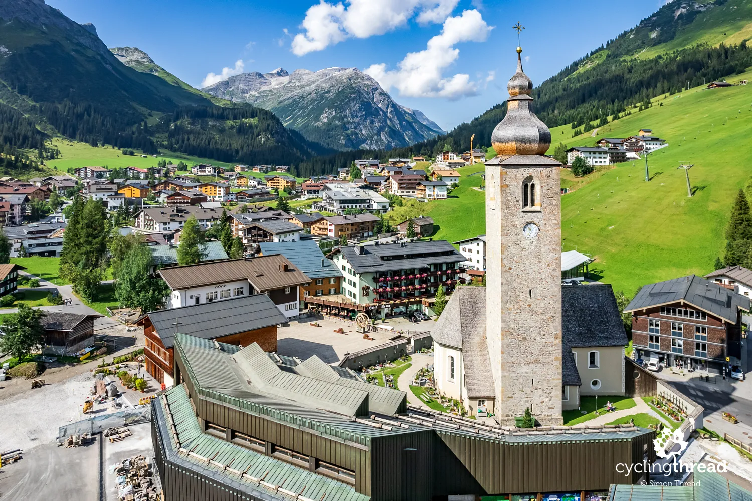
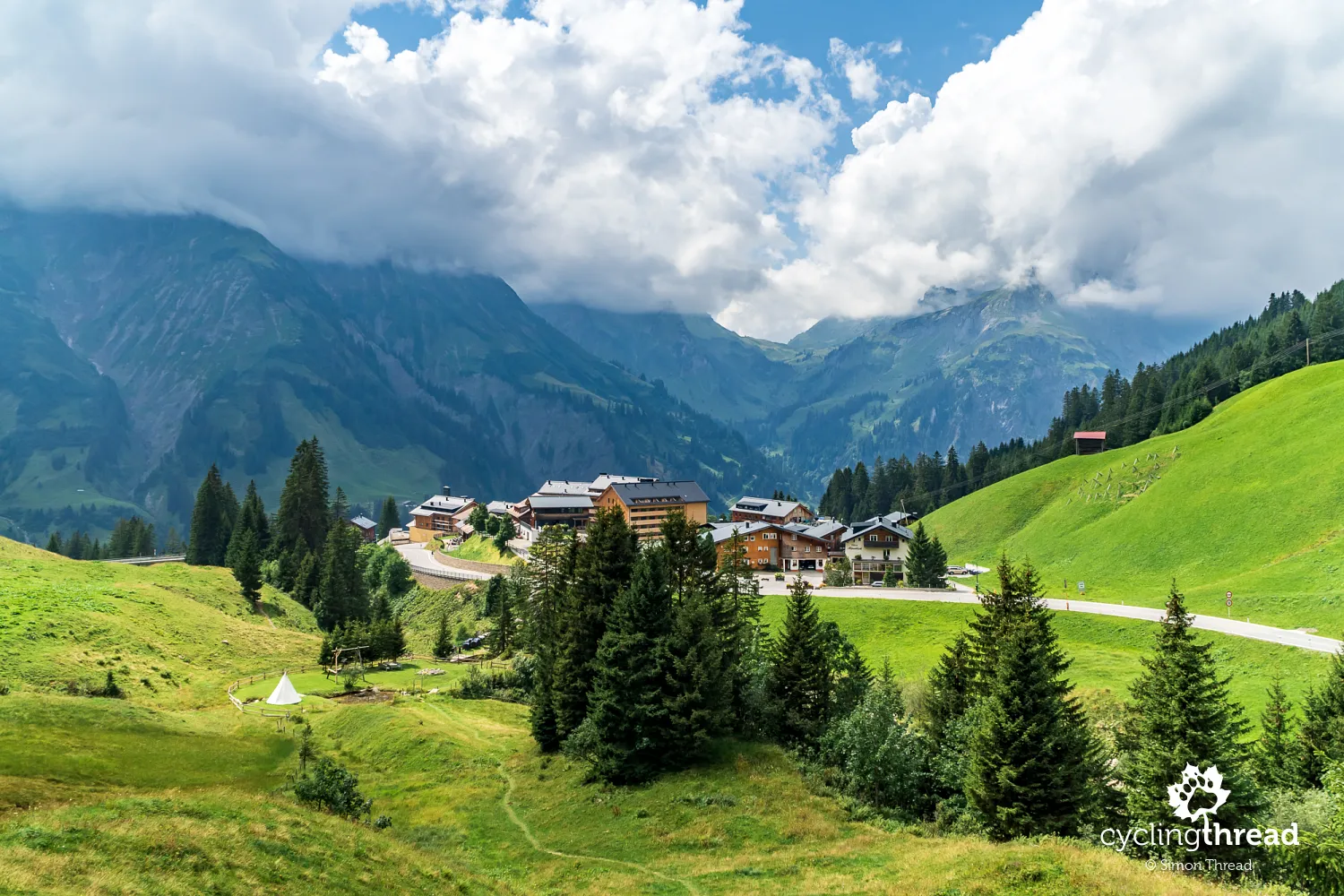
Very pleasant moments in Lech am Arlberg
Lech am Arlberg, just 4 kilometers from Zürs, is its complete opposite. Though known as one of the most exclusive alpine resorts, Lech has retained the atmosphere of a small, cozy mountain village and charms visitors with its peaceful pace. Its long history is reflected in the 14th-century Gothic Church of St. Nicholas, with its distinctive tower marking the center of town. Wooden guesthouses and traditional restaurants create a warm, welcoming backdrop, and strolling through Lech’s narrow streets is a great way to stretch your legs after a day of cycling and soak in the alpine rhythm of life. Unlike Zürs, Lech actively promotes summer tourism, with hiking paths, cycling routes and cultural events drawing visitors outside of winter. Look up and you’ll spot the distinctive peak of Omeshorn (2,557 m) rising above the village, while the Lech and Zürsbach streams define its layout.
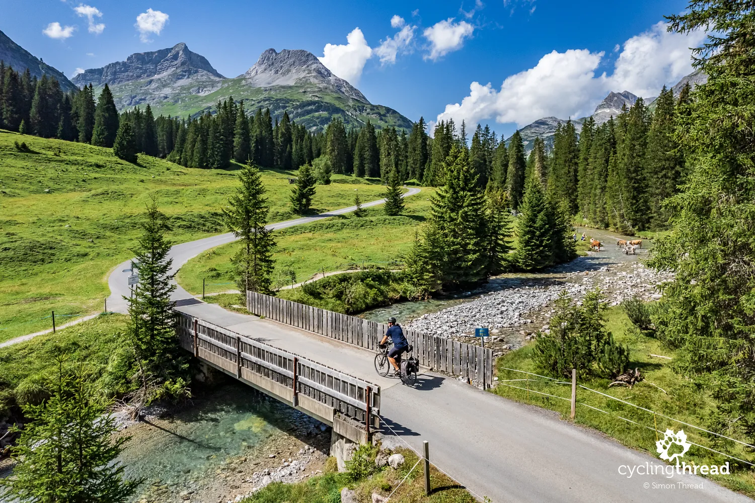
The area around Lech is also worth exploring. For cyclists, one of the most scenic rides is up the Zugertal valley to the alpine lake Formarinsee, about 14 kilometers away. It’s a perfect escape into quiet, high-mountain landscapes, ideal for fresh air and picnic breaks among green pastures. The route, while not overly difficult, climbs steadily along a narrow alpine road through forests, meadows and small hamlets, ending at the turquoise waters of the lake - perfect for dipping tired feet. Along the way, a few rustic inns invite you to stop and enjoy local specialties. And here’s a fun fact: the route passes Austria’s highest-elevation golf course, sitting at over 1,500 meters above sea level. The ride to Formarinsee is part of the Lechweg - a popular long-distance hiking and cycling route that follows the Lech River from the Alps to the Allgäu region. Between the ride and the atmosphere of Lech itself, we found more than enough reason to stay an extra night in this part of Vorarlberg.
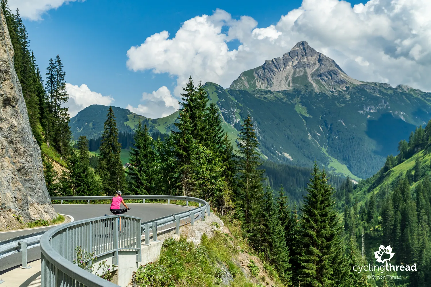
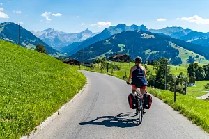
From Lech, we continued our journey on open roads - this is one of the highest areas in Vorarlberg, and the terrain doesn’t allow for separate cycling paths. We expected heavier traffic, but the road to Warth turned out to be surprisingly calm. On the long climb, we could even ride side by side at times. Our direction was set by the pointed summit of Biberkopf (2,599 m), which remained in view ahead as we followed the road along the steep, narrow valley carved by the Lech River. This stretch, while technically simple, offered some of the best scenery - steep alpine slopes, bright green meadows and rugged peaks rising close by.
Where the most snow falls in Austria
Warth sits at around 1,500 meters above sea level, making it one of the highest villages in all of Austria and the highest municipality in Vorarlberg. The town is famous for its massive snowfall - up to 11 meters per year - which makes the Warth-Schröcken area one of the most snow-reliable ski regions in the Alps. At the village center stands the charming St. Sebastian Chapel from the late 17th century, one of the few historical landmarks in this landscape that’s largely shaped by nature. Unlike many alpine resorts, Warth has retained a peaceful, small-town feel - there are still no large hotels or sprawling tourist complexes here.
Mountain panoramas in the Bregenzerwald
From Warth, we entered the Bregenzerwald (the Bregenz Forest) - another scenic region along our Vorarlberg route. This area is a patchwork of rolling hills, dense spruce forests and wide alpine meadows where dairy cows graze in the summer - the source of the region’s famous cheese. The landscape ranges from gentle valleys to steep, rocky peaks, making Bregenzerwald a favorite for both hikers and winter sports fans. Contrasts define the view: quiet green hills alternate with rugged ridges and deep gorges. The region is also known for its scattered settlements perched on mountain terraces, offering sweeping views of the surrounding ranges.
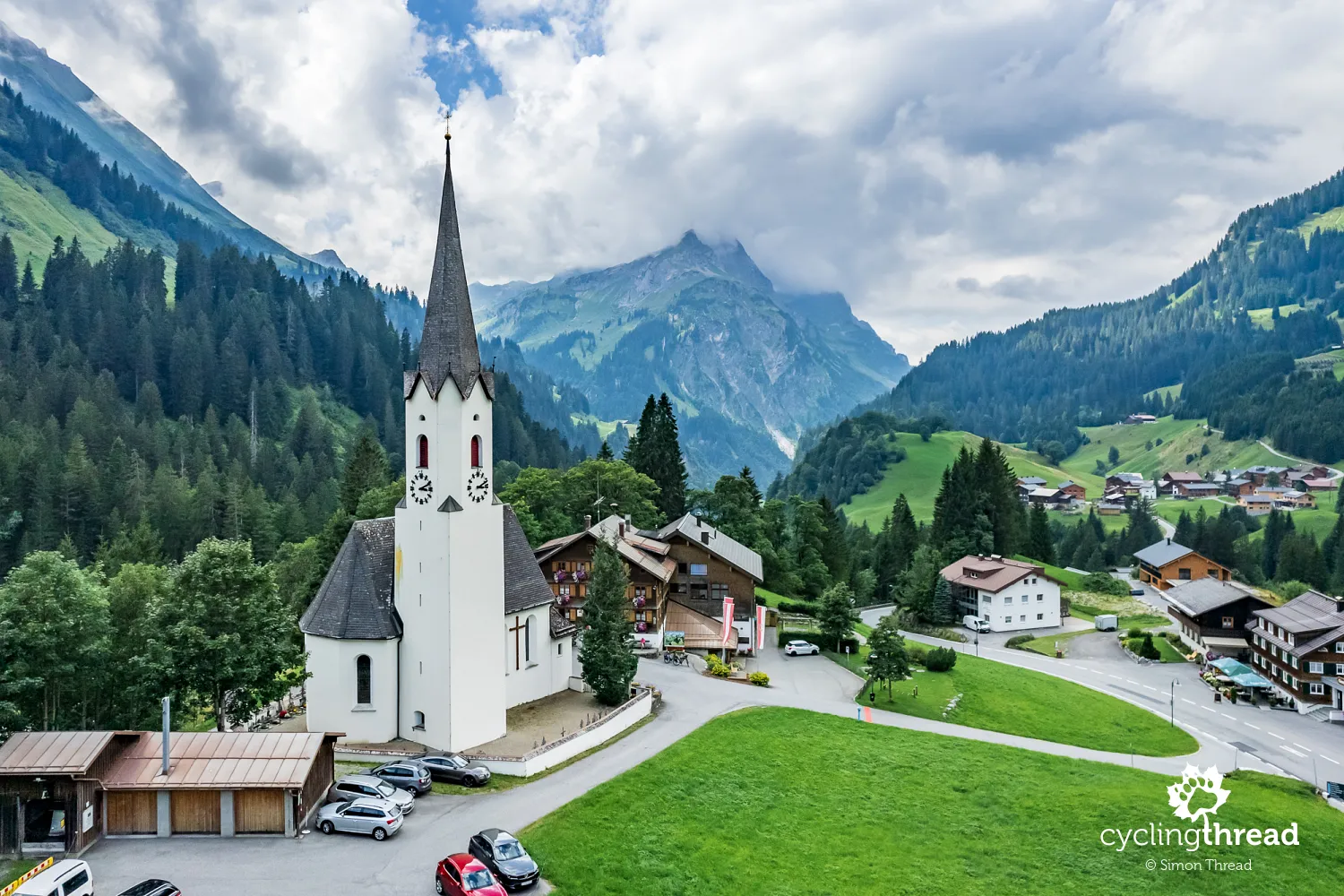
After Warth, our climb continued - through a long avalanche gallery that protects the road in winter, we reached the Hochtannberg Pass (1,660 m), the highest point of our Vorarlberg ride (aside from the starting point). After a short break and the obligatory selfie at the summit sign, we began our descent toward Schröcken. You’ll want to stay alert on this downhill - after four tight switchbacks, at the far end of the village of Nesslegg, you need to leave the main road and join the old, narrow road that runs parallel to the modern mountain highway. It’s a great way to avoid car traffic and roll straight into Schröcken next to the historic Church of the Assumption of Mary from 1600. The cemetery around the church holds a rare find in alpine landscapes - a well-preserved ossuary, a small building once used to store the bones of the deceased when burial space ran short. It's a unique reminder of how long people have lived in this remote mountain region.
Schröcken sits high in the Bregenzer Ach valley, and from this point, the river would accompany us for many kilometers through the Bregenzerwald. Like Warth, Schröcken lies in a zone of extreme snowfall - up to 10 meters annually! For us, it was a quiet and friendly village nestled among steep alpine slopes. It’s also the start of a 10-kilometer descent along a fast road with tunnels and avalanche galleries, ending in the peaceful town of Schoppernau, where the third of our Vorarlberg cycling routes begins. A helpful info board by the roadside shows the clear layout of the local route network - although we did notice the lack of elevation profiles, something especially useful when cycling in the mountains. The winding path ahead, leading toward Lake Constance, followed the meandering course of the Bregenzer Ach through the Bregenzerwald.
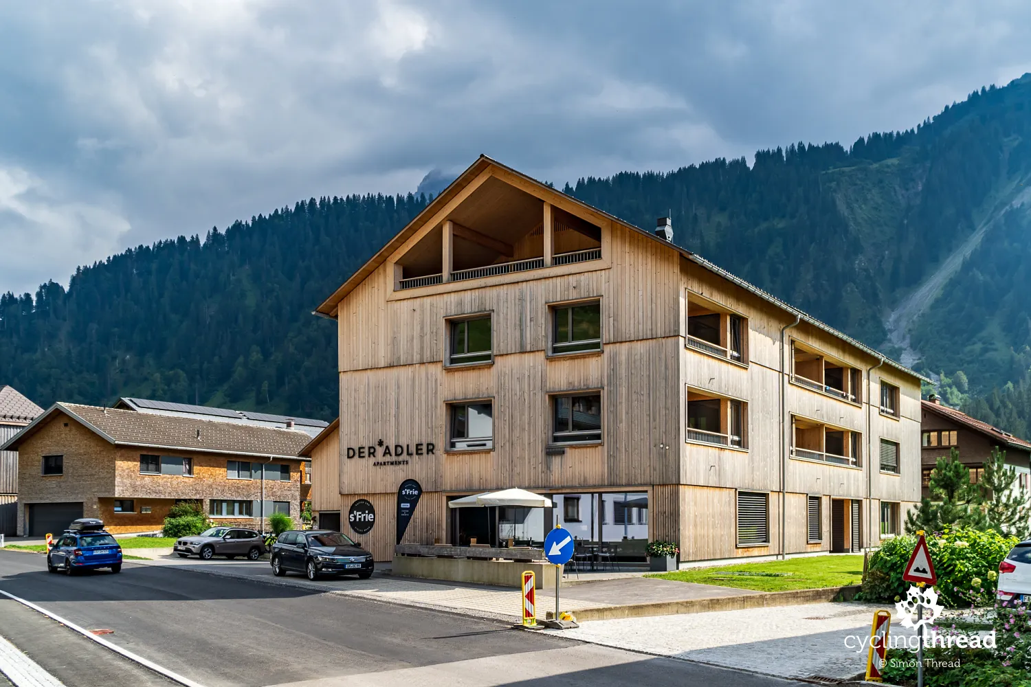
Home of good coffee and modern architecture
In Schoppernau, we stopped for coffee and cake at a modern yet cozy café located in the Adler Apartments building. It was the perfect moment to admire what Vorarlberg is known for - the seamless blend of traditional wooden architecture with contemporary design. Many buildings here, whether private homes or public spaces, are built from local spruce and larch, harvested in the surrounding forests. Architects favor clean lines and large windows that bring in natural light and connect the interiors with the alpine scenery. At the same time, they stay rooted in local heritage, echoing the traditional Bregenzerwald style - especially the iconic shingled facades. The result is architecture that’s modest yet thoughtfully designed, practical yet full of character - perfectly in tune with the mountainous surroundings.
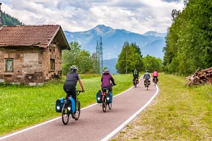
The next stretch of our ride through Vorarlberg turned out to be one of the most enjoyable parts of the entire journey. Route No. 3 follows the Bregenzer Ach river for many kilometers, leading us through a variety of scenic landscapes. One moment, we’re surrounded by towering alpine peaks and dramatic vistas; the next, gentle hills and idyllic valleys take their place. Sometimes we wind through narrow river gorges shaded by dense forests, with mossy retaining walls hugging the slopes, only to emerge into wide, sunlit meadows. Vorarlberg from a bike saddle is wonderfully photogenic and carefully preserved - almost entirely free of industrial intrusions, or at least skilled at hiding them from view. The landscapes here seem to invite you to slow down, take it all in, and really look around.
The Vorarlberg Münster scheme was born in Au
The next village on our route was Au - a place of special importance in Vorarlberg’s architectural history. It was here, in the 17th century, that the renowned Auer Zunft (Guild of Au) was founded - a community of builders, carpenters and sculptors who played a key role in shaping Baroque architecture across southern Germany, Switzerland and French Alsace. From this small town emerged the so-called Vorarlberger Münsterschema, a distinctive design of monastic churches with twin western towers and a dome at the crossing of the nave and transept. Developed in an alpine context, this style spread far and wide thanks to the mobility and networks of craftsmen during the time of Catholic Counter-Reformation. Among the most remarkable buildings designed by the guild’s masters are two monasteries we had admired earlier on our Rhine route - in Disentis and Rheinau.
Au stands out from other villages in the area because it lacks a traditional central square or core. It’s a classic example of a "scattered village" (Streudorf) - a settlement made up of separate districts, each serving different purposes. The town hall is located in Argenau, while the parish church of St. Leonard stands in Jaghausen. The Bregenzer Ach river divides Au into two sides: Schattseite - the shaded side, and Sonnseite - the sunny side. This division not only describes the sun exposure of the slopes, but also reflects the rhythms of daily life for the residents living on both sides of the valley. Cycling through Au, it’s easy to see how the local architecture blends naturally into the landscape, with a clear respect for tradition. A great example is the village’s new primary school, designed in the spirit of local wooden construction. Visible from the bike route across the river, the school has been praised as a model of sustainable design and often features in publications about contemporary architecture in Vorarlberg.
Beautiful houses in the Bregenzerwald
After this peaceful riverside section, the route leads us to Hirschau, part of the village of Schnepfau. The village has preserved its traditional feel and its buildings are a textbook example of classic alpine architecture from the Bregenzerwald region. Most of the houses here are of the Bregenzerwälderhaus type - wooden structures that have stood the test of time, combining living quarters, barns and storage under one roof. This compact form was ideal for conserving heat and optimizing space in a harsh mountain environment. Typical features include vertical shingle facades at the front, horizontal planking at the back and wide roof overhangs to protect against snow and rain. These buildings remain relevant today, thanks to thoughtful renovations and smart adaptations to modern needs that preserve the original style. Riding through Hirschau, among homes that feel perfectly at home in the landscape, we were reminded once again of the strength and vitality of local building traditions - practical, functional and beautiful all at once.
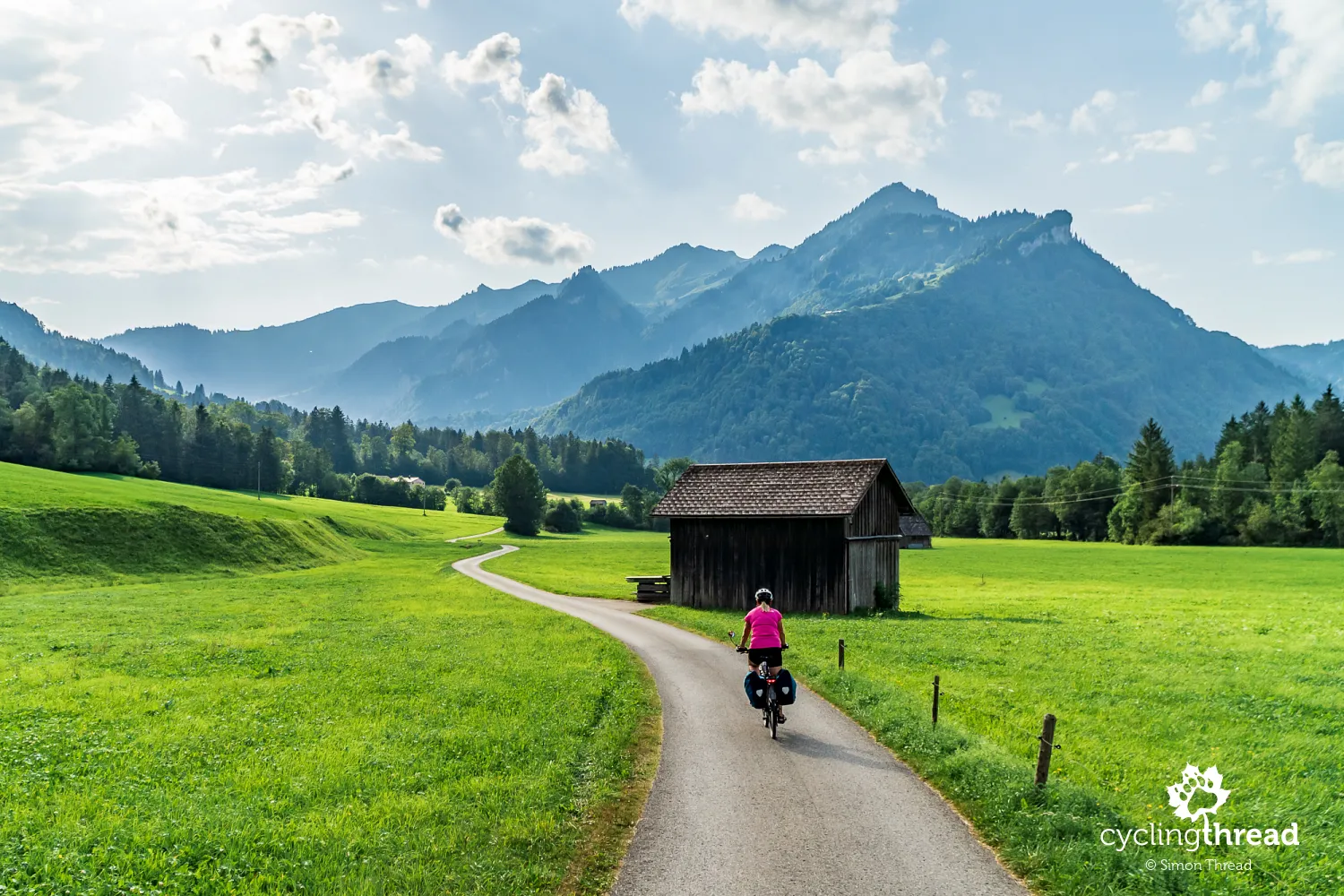
From Hirschau to the center of Mellau is just 4 kilometers, but this short stretch was one of those rides you wish would go on forever. We found ourselves on a narrow paved road used mainly by locals and cyclists. All around us stretched a peaceful, natural landscape, and our route gently wound between fields, green meadows and rustic wooden huts. This was exactly the kind of joy we seek in bicycle touring - a treat for the senses paired with the satisfaction of being active. The day was drawing to a close and the sun was sinking low, and we couldn't help but feel a little sorry that it was already time to start looking for our overnight stop in Mellau.
The flavors of Vorarlberg reflect the tradition
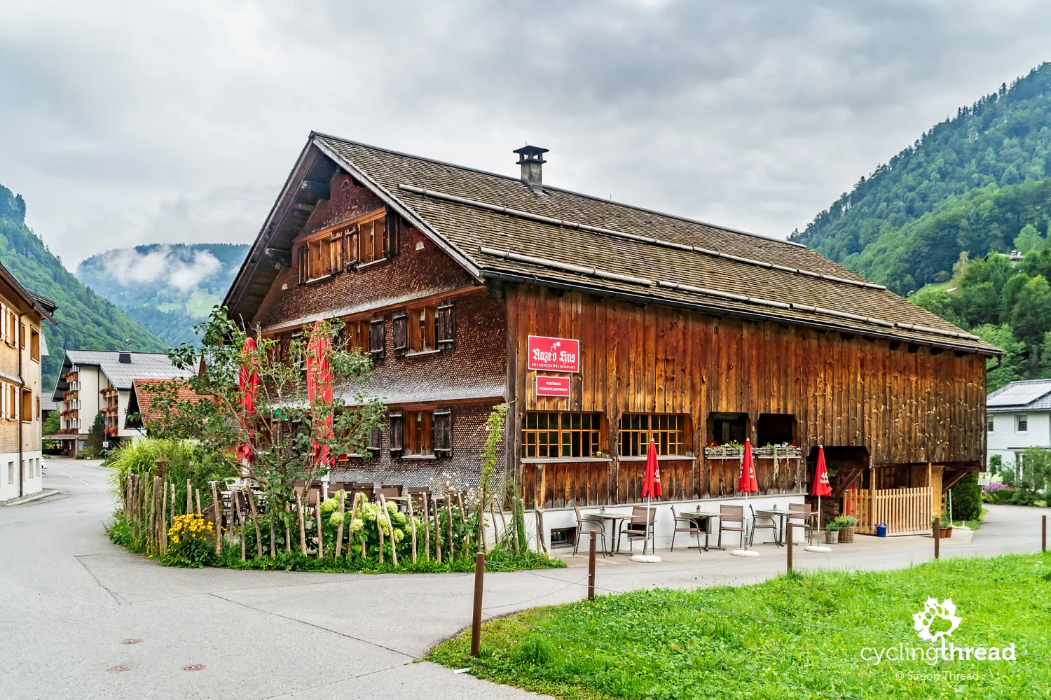
But before collapsing into bed, there was still dinner. We ended up at Naze's Hus in Mellau - one of those traditional wooden houses converted into a cozy restaurant, where history and hearty food come together around the table. It was another place that captured the spirit of Vorarlberg: modest and rooted in local architecture on the outside, warm and welcoming on the inside. The menu was full of regional flavors - cheeses from Bregenzerwald, fresh homemade bread, seasonal vegetables. We especially remembered the thick, creamy Käsknöpfle - a simple local cheese pasta served with crispy onions. The flavors of Vorarlberg tend to be humble but bold, each ingredient evoking alpine meadows, mountain farms, and a way of life that refuses to be rushed.
Bicycle-friendly hotels in Vorarlberg
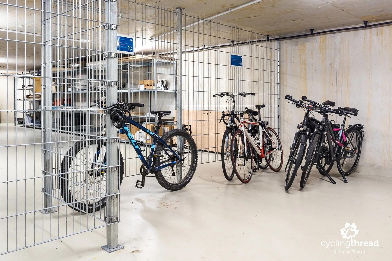
This seems like the right moment to mention the bicycle-friendly hotels we stayed at along the way. While cycling tourism doesn’t seem to be the top outdoor activity in Vorarlberg - hiking and mountain biking are clearly more popular - every place we stayed at was well-prepared to welcome guests traveling with panniers. In the hotel in Bludenz, our bikes were stored in the ski room. The hotel in Mellau had space in an underground garage. And at the hotel near Bregenz, we were given access to a dedicated bicycle storage room. This kind of welcome and attention to cyclists' needs goes a long way - it’s what lets you rest easy at night, both literally and figuratively.
Cycling route along a former railway line
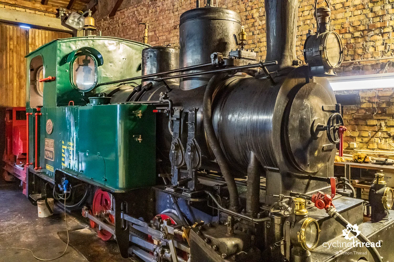
In this area, Route No. 3 - the Bregenzerwald Radweg - follows the path of an old railway line. The narrow-gauge Bregenzerwaldbahn was launched in 1902 and connected Bregenz on Lake Constance with Bezau in the Bregenzerwald, covering a distance of 35 kilometers. Today, a preserved section between Bezau and Schwarzenberg is run as a heritage railway, offering nostalgic rides on historic steam and diesel locomotives. The route winds through picturesque valleys, forests and across scenic bridges, including a striking truss bridge over the Bregenzer Ach. These rides operate regularly from May through October and attract railway enthusiasts as well as families with kids. One of the restored stations on this line is the Schwarzenberg depot in the village of Bersbuch - right next to our cycling route.
Andelsbuch - artistry, modern architecture...
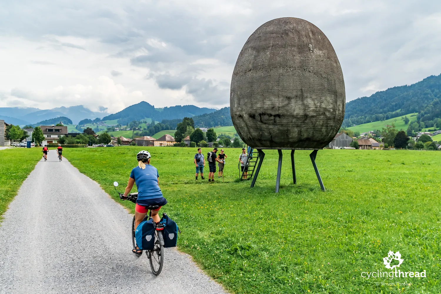
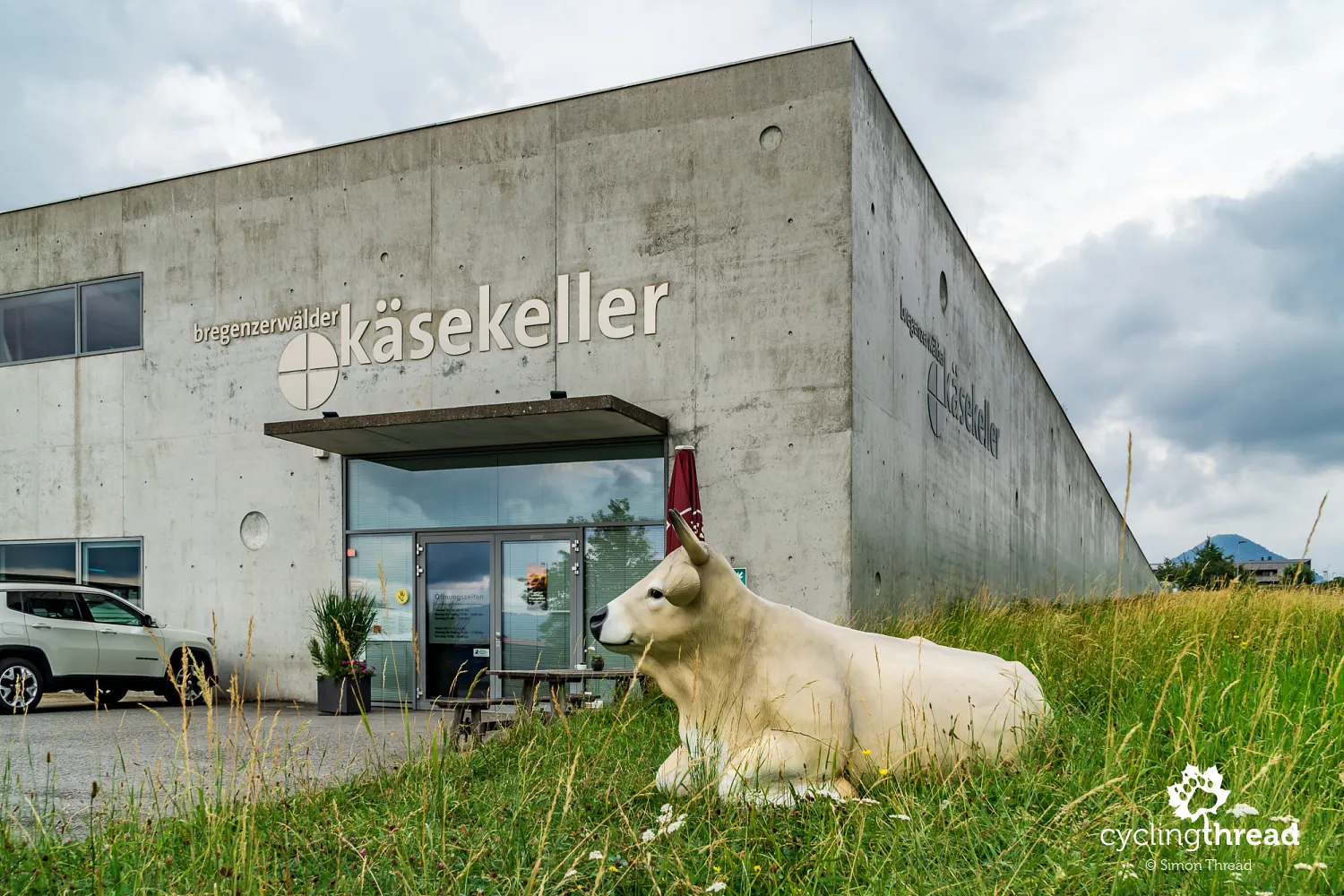
Next on the route was Andelsbuch, a peaceful yet distinctive village in the heart of the Bregenzerwald, known not only for its landscape but also for its creativity. At the entrance to the town, a large concrete sculpture shaped like an egg immediately grabs attention - a modern art installation that’s become a local landmark and a favorite photo stop for visitors. Andelsbuch is also deeply rooted in cheese-making traditions - it’s worth stopping by the Käsehaus Bregenzerwald, the local cheese house, where you can buy products from nearby dairies and learn more about how they’re made. Käsehaus regularly hosts tastings and demonstrations, giving guests insight into how aging time and conditions influence cheese flavor. It’s a place that blends education with enjoyment and offers a deeper understanding of how important dairy farming is to the region’s economy and identity.
... and the Bregenzerwald Cheese Route
Käsehaus is part of a larger initiative called Käsestraße Bregenzerwald - the Bregenzerwald Cheese Route - which brings together farmers, dairies, restaurants and shops that support local, sustainable agriculture. It’s a network of regional cooperation that has not only preserved traditional cheese-making but allowed it to thrive. Cycling along the Käsestraße, you can visit alpine pastures, join tastings, learn about time-honored techniques passed down through generations and drop by family-run businesses involved in cheese production and processing. The initiative also promotes short supply chains and transparent sourcing, which helps build consumer trust and supports the local economy. Here, cheese is not just a delicious specialty - it’s a symbol of care for the land, for community and for the living heritage of the Bregenzerwald.
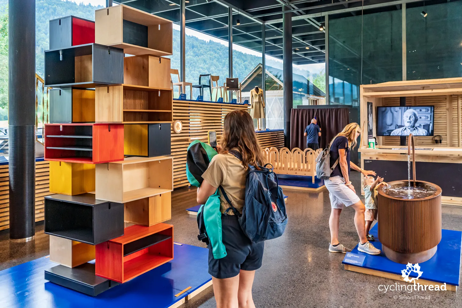
Andelsbuch is also a place where tradition meets contemporary design - and nowhere is this more evident than at Werkraumhaus, a craft and design center created by renowned Swiss architect Peter Zumthor. The building, minimalist and built with local materials, is itself a testament to masterful craftsmanship and thoughtful architecture. Inside its airy, glass-walled spaces, you'll find exhibitions, workshops and showcases focused on woodworking, furniture-making, metalwork and other regional trades. Werkraumhaus is not a museum, but a living space for dialogue - between artisans and contemporary designers, between the past and the future. The institution is a joint initiative of local workshops and family businesses organized under Werkraum Bregenzerwald, a cooperative aiming to promote quality craftsmanship and vocational education. Visitors can not only admire the skill of local makers but also gain a deeper appreciation for the role that handcrafts still play in the culture and economy of this alpine region.
Cycling beautiful rail-to-trail in Vorarlberg
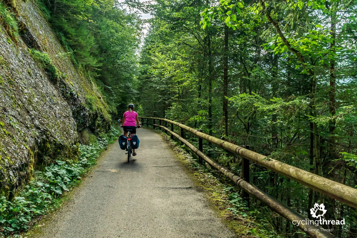
The route to the town of Egg follows the former Bregenzerwaldbahn railway line. As a result, the bike path avoids main roads and winds through the landscape in gentle curves, far from motor traffic. Once again, we’re reminded how the modest gradients of old railway lines make these kinds of routes especially comfortable and accessible for cyclists of all levels. Along the way, we meet not only seasoned bike travelers, but also families with young children - some riding their own bikes, others tucked into trailers. Repurposing old railway lines into cycle routes isn’t just practical; it’s also a way to preserve a piece of local infrastructure history. You can find more examples of such cycling rail-to-trails in Europe in one of our travel guides.
A bit further along this railway-based path - known in this section as the Achtalweg - you can admire restored railway bridges, including the impressive viaduct at Egg-Tuppen and other structures spanning the Subersach and Weißach rivers, showcasing the engineering skill of the late 19th and early 20th centuries. Unfortunately, the weather in Vorarlberg begins to play tricks on us - a light rain sets in, and when the sun does appear, it shines from the worst possible angle. The result? A lack of good photos to do justice to this beautiful stretch of the Achtalweg. And it truly is a scenic ride - the narrow, mostly gravel road hugs the water’s edge, winding through the forest in a way that feels natural and discreetly integrated into the landscape.
An extra section of the route in Vorarlberg
If you're up for it, near the end of this riverside section you can leave the valley via a short but at times steep road leading to nearby mountain villages. From there, you can ride a 10-15 km stretch - unfortunately on paved roads only - through some of Vorarlberg’s more hidden and authentic corners. Be aware, though, that the elevation changes can be significant, and the roads are shared with cars, making them less suitable if you're cycling with kids. But for more experienced riders, it's a rewarding detour, offering a glimpse of the region’s raw, mountainous side. If you've still got the legs - and the curiosity - it's well worth the extra effort for the kind of views that simply don’t appear on the main route.
Austria’s first and only women's museum
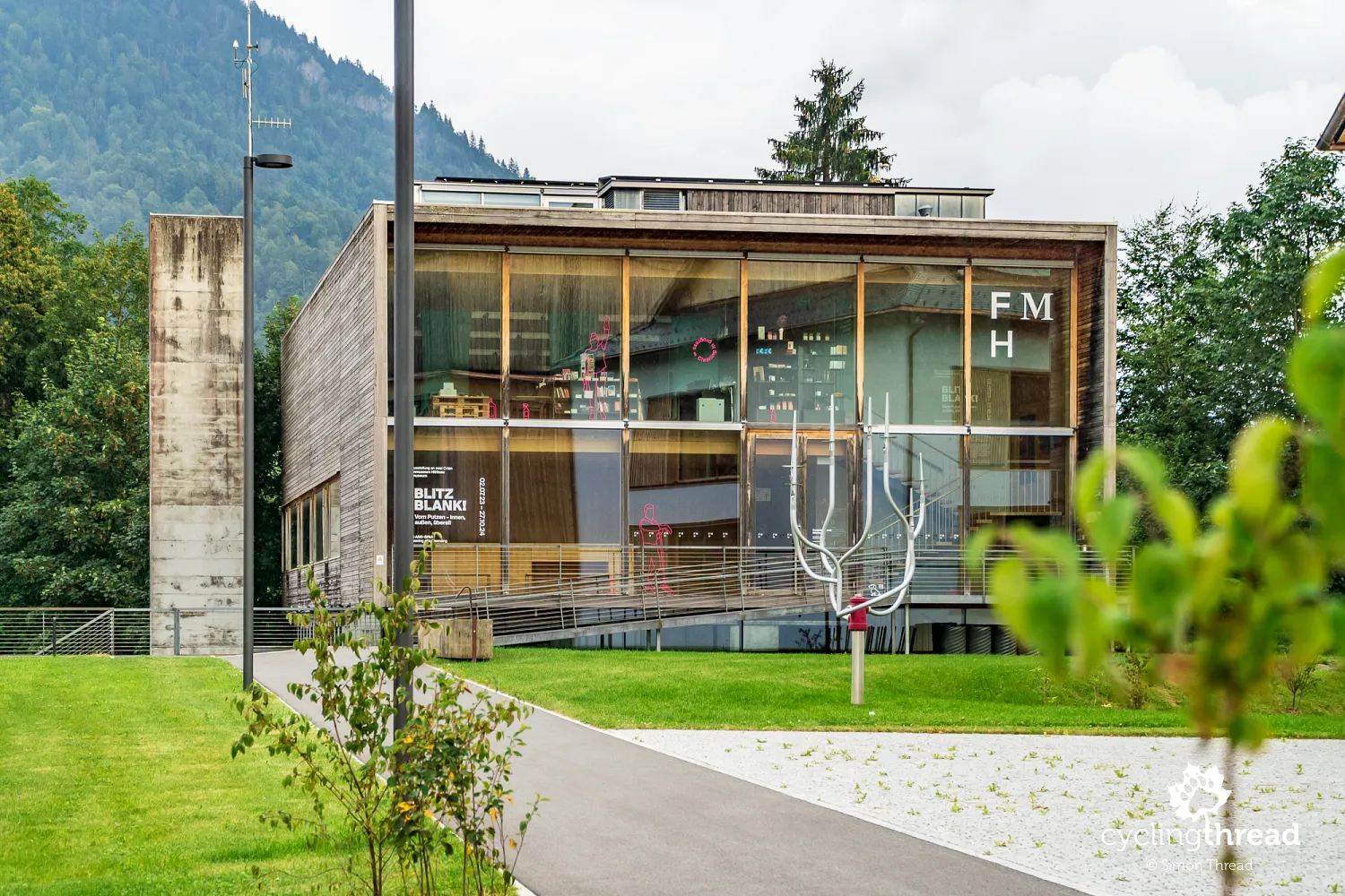
One of the most remarkable places in this part of Vorarlberg is the charming town of Hittisau, which offers not only stunning alpine scenery but also a unique cultural experience. Here you’ll find the Frauenmuseum Hittisau - Austria’s first and only museum entirely dedicated to women's history and contributions. Founded in 2000 by Elisabeth Stöckler, the museum focuses on documenting and showcasing women's cultural achievements and roles in society. Its exhibitions explore various aspects of women’s lives - from art and culture to everyday life, architecture and social change. The museum also hosts workshops, lectures and events for both adults and children throughout the year. It’s housed in a striking contemporary wooden building designed by architects Andreas Cukrowicz and Anton Nachbaur-Sturm - yet another example of Vorarlberg’s signature modern timber architecture. The design earned the Austrian State Prize for Architecture in 2000, further cementing Hittisau’s place on the cultural map of the region.
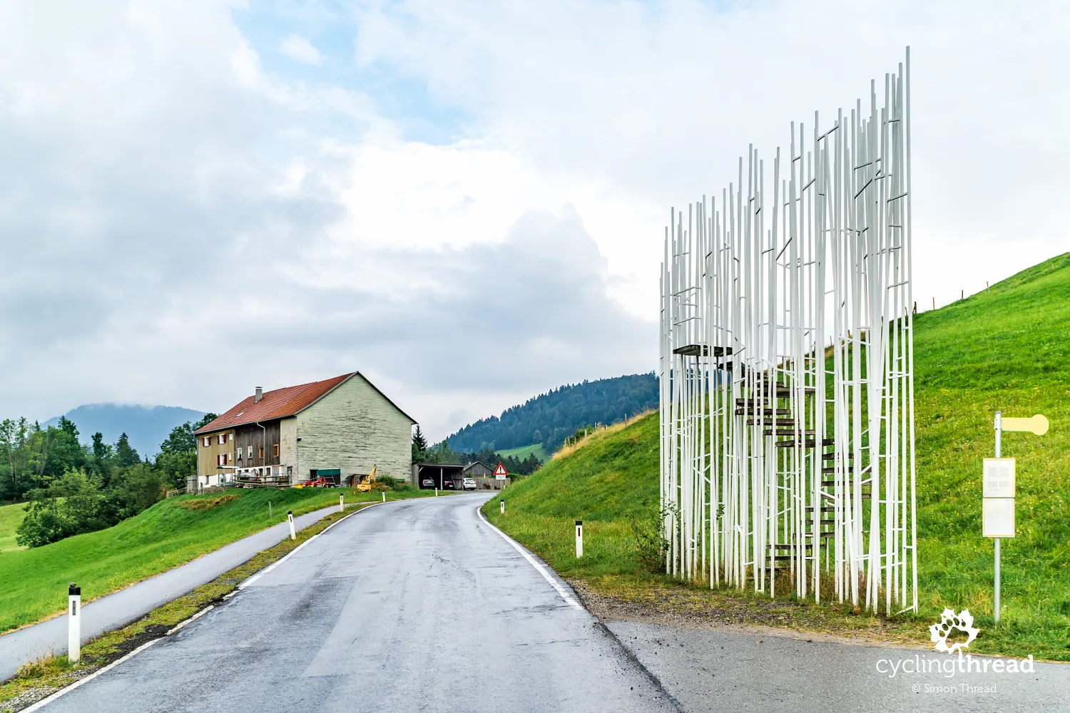
Bus stops combine design with craftsmanship
This area is also known for another unique project - a series of bus stops that have become a symbol of the village of Krumbach. As part of the innovative “BUS:STOP Krumbach” initiative, seven renowned architects from different countries were invited to design unique bus shelters that combine modern design with traditional craftsmanship. Each shelter is a one-of-a-kind creation, reflecting both the architect’s individual style and the regional identity of Bregenzerwald. They were all built in collaboration with local carpenters, blacksmiths and artisans, highlighting the value of local skills and traditions. The project has gained international recognition as an inspiring example of how everyday infrastructure can become a cultural landmark, bridging global creativity with local community.
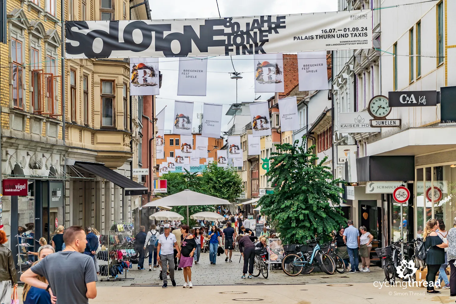
Bregenz - the vibrant capital of Vorarlberg
Soon after, we reached Bregenz, the capital of Vorarlberg. This city has a rich history dating back to Roman times, when it was known as Brigantium. Nestled between the shores of Lake Constance and the slopes of Mount Pfänder, Bregenz blends heritage with the lively energy of a regional cultural hub. One of its highlights is the Vorarlberg Museum - a striking museum that showcases the history, art and culture of the region in a bold mix of old and new architecture. Its permanent and temporary exhibitions explore everyday life, artistic expression and social topics, offering both insight and inspiration. The museum stands right on Kornmarktplatz, the city’s main square, next to the neoclassical theater and a historic grain storage building.
While strolling through the pleasant, lively pedestrian streets of Bregenz, it’s worth keeping an eye out for quirky details. Tucked away in a side alley, you’ll find a surprising sculpture of a… peeing man - an unexpected but well-known curiosity often snapped by visitors. On Kornmarktstraße, another small gem awaits: the city’s narrowest building façade, barely wider than a door, yet fully integrated into the urban fabric. Bregenz also offers a well-designed lakeside promenade, perfect for a coffee break with a view of passing boats. Year-round, the city buzzes with cultural events, but it's in summer that Bregenz truly shines, thanks to its world-famous floating opera stage.
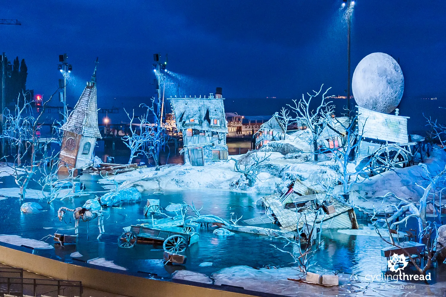
One of the most beautiful attractions in Europe
This stage on Lake Constance is arguably most iconic attraction of Bregenz and one of the most spectacular sights in all of Europe. Every July and August, the Bregenz Festival takes over the floating stage and nearby Festspielhaus with some of Europe’s most spectacular opera performances. Every two years, the festival unveils a new production and an entirely new set design - often massive, imaginative and perfectly tailored to the lakefront setting. Over the years, audiences have marveled at a giant head of Don Giovanni, a surreal maze made of playing cards and a massive hand with a revolver floating above the water. Just imagine the performers singing and acting against the backdrop of a glowing lake and a slowly setting sun…
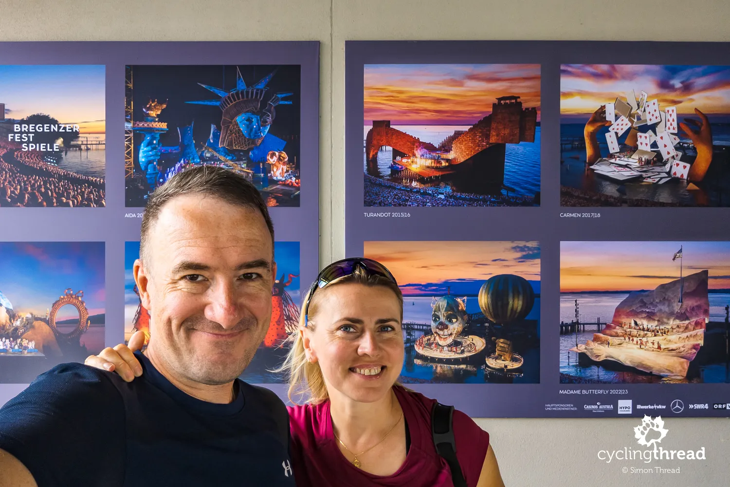
Sadly, we had to settle for imagining it too. We had timed our Vorarlberg trip to attend the final performance of the 2024 season - a new production of Der Freischütz - but the weather had other plans. A torrential downpour forced the organizers to cancel the show, prompting a collective groan from 7,000 ticket-holders huddled under umbrellas and ponchos. The storm swept over the lake just as hopes were high for a break in the clouds. It was our second encounter with the famous stage - we had seen it for the first time during an Alpine trip in 2012 - and now we’re holding out for a third try.
One short ride along the Rhine
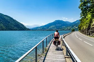
Bregenz is located not far from where the Rhine flows into Lake Constance, so shortly after leaving the city, we found ourselves riding along the river dikes and briefly joined the famous Rhine Cycle Route - one of Europe’s most scenic long-distance routes. But the atmosphere here was completely different from the quiet, intimate vibe we’d enjoyed across Vorarlberg. While we enjoy riding among fellow cycle tourists, this stretch of the Rhine had the feel of a summer “cycling highway”: a wide path, steady pace and a stream of riders of all ages, towing trailers or riding e-bikes. Scenes like this are heartening - they show how popular and well-developed cycling tourism has become - but in that moment, we couldn’t help but feel a little nostalgic for “our” Vorarlberg, which had been whispering rather than shouting, gently inviting rather than overwhelming. The Rhine tells a different story.
A short detour brought us to the Rhein-Schauen Museum und Rheinbähnle in Lustenau - a museum dedicated to the regulation of the Rhine River and the industrial railway that supported those massive projects. The exhibits include engineering plans, models, historic photos and documents that explain how the river was shaped into today’s orderly course, especially along the Austrian-Swiss border. In the old engine shed, you can see lovingly restored steam locomotives from the narrow-gauge Rheinbähnle railway, once used to transport construction materials. During the summer, the museum runs nostalgic train rides along the dike all the way to where the Rhine meets the lake - with vintage steam and electric engines dating back to the early 20th century. It’s a treat for train buffs and a fascinating way to discover how human ingenuity has shaped this powerful river.
An unexpected Jewish quarter in Hohenems
Our journey ended in two charming towns of Vorarlberg, located well off the main tourist route - and all the more worth a visit because of that. First came Hohenems, a small town known for its historic Jewish quarter. Wandering its narrow lanes, we came across preserved homes, a former synagogue, a cemetery and the Jewish Museum, which offers deep insights into the region’s Jewish heritage - from daily life to religion to trade and community history. The town also features a baroque palace once owned by the Waldburg-Zeil family, set within an elegant garden and a cozy old town filled with cafés, boutiques and bakeries. Modest in size but rich in character, Hohenems let us experience Vorarlberg’s quiet rhythm one last time - and discover another meaningful piece of its layered past.
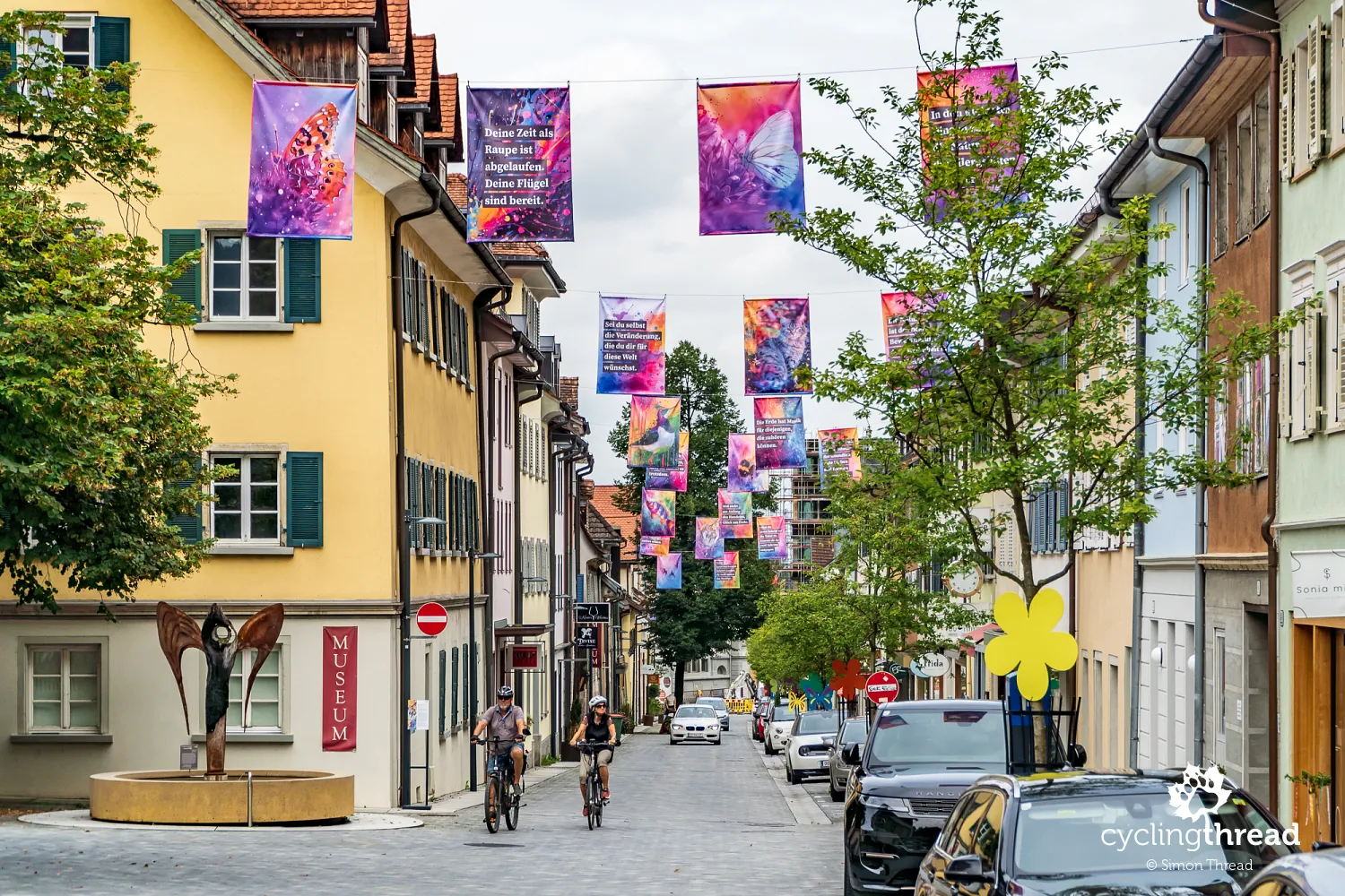
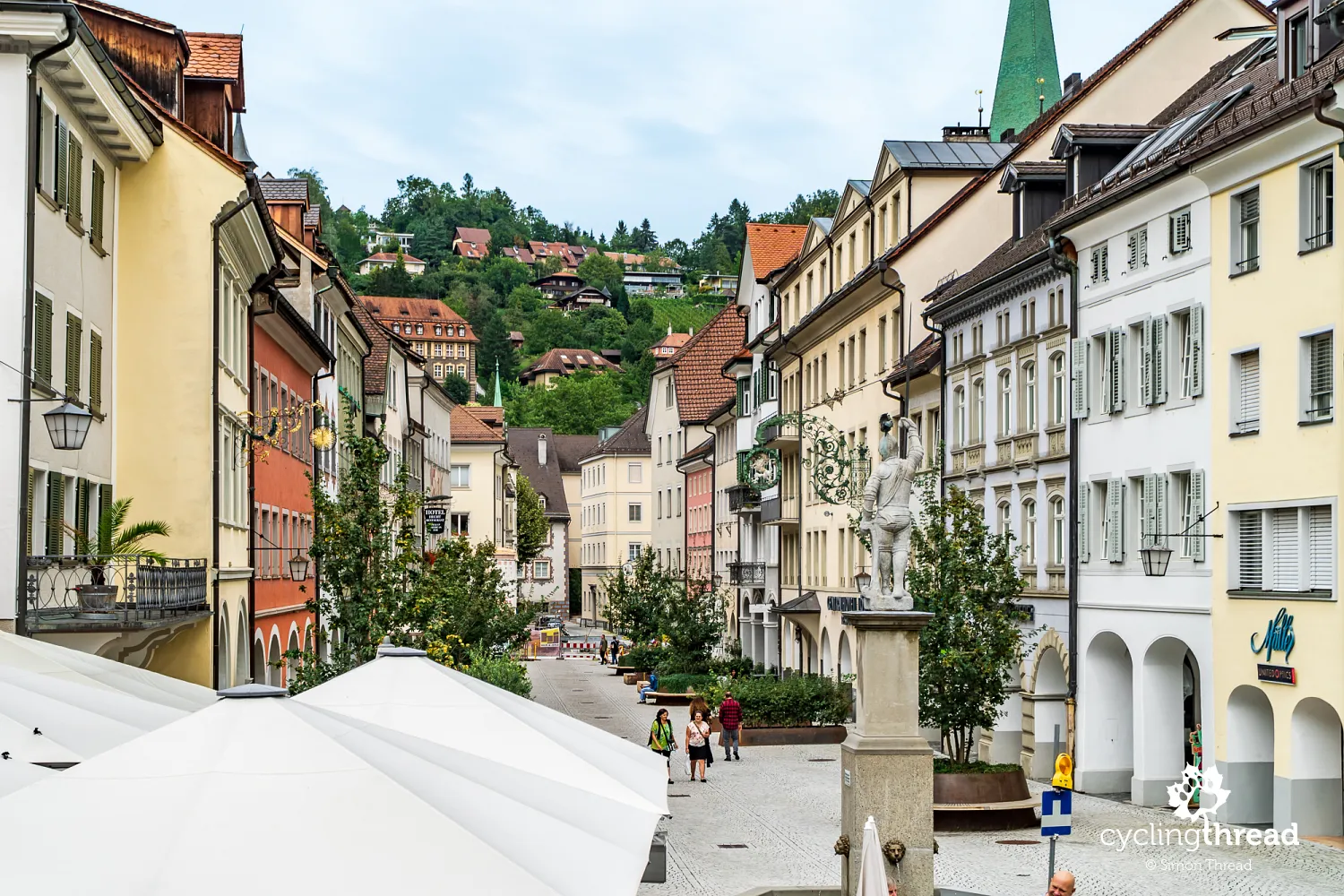
The final stop of our journey through Vorarlberg was Feldkirch, located right by the border with Switzerland and Liechtenstein. This lovely little town boasts one of the best-preserved medieval old towns in the region, with arcaded walkways, pastel facades and a calm, almost dreamy atmosphere. In the main square, we found a small fountain surrounded by café tables - a local gathering spot for morning coffee and conversation. Looming over the town is Schattenburg Castle, which is well worth the uphill walk for its panoramic views and the tiny vineyard at its base - a nod to the region’s once-thriving winemaking tradition. You’ll also find a historic wine press nearby. Feldkirch blends the elegance of a heritage town with the warmth of a slow-paced lifestyle - a place where taking your time feels entirely natural.
The easiest ways to reach Vorarlberg
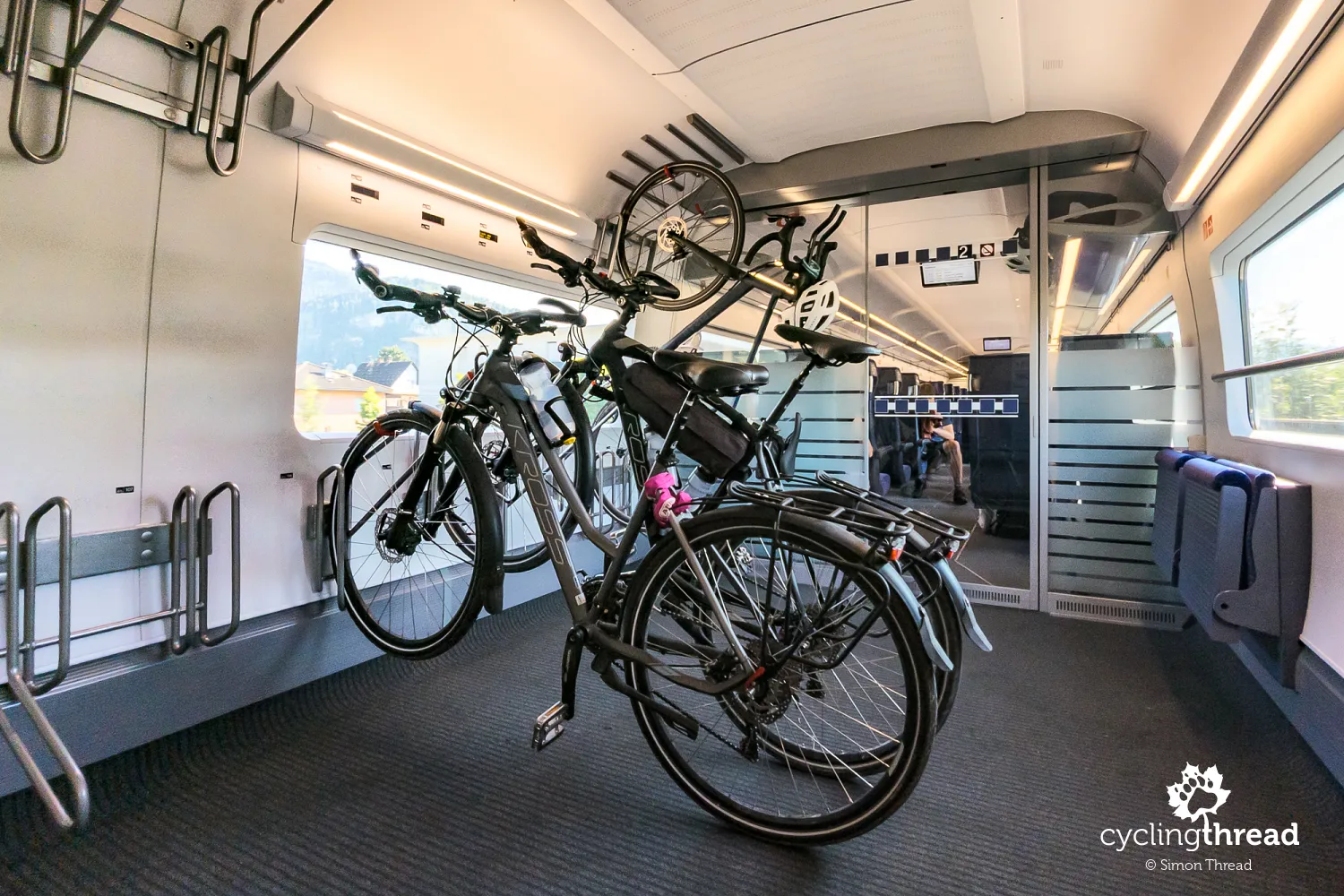
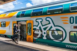
Vorarlberg, although located in the westernmost corner of Austria, is quite easy to reach. Thanks to the well-developed railway networks in Austria and Germany, it's easy to get to Vorarlberg from other major cities in the Alpine region. The region has direct train connections with Vienna, Munich, Zurich and even Cologne. For those traveling with bicycles, a big advantage is that most trains allow bicycle transport. We arrived in Landeck on a German ICE train - in excellent conditions, well worth mentioning in our article about traveling with bicycles by train, but another great starting point for a route like ours could be Bludenz. The nearest major airport is in Zurich in Switzerland, from where you can reach Bregenz - the regional capital - by train in about two hours.
Vorarlberg - mountains at every turn
In Feldkirch, we saw another map of Vorarlberg’s cycling network. If we had chosen to ride a bit farther along the well-marked routes, we could have returned to Bludenz - the town we’d visited four days earlier - and closed the loop. Even without doing that, we already felt the route had come full circle. The bike paths in Vorarlberg are impressive: smooth, easy to follow and forming an almost complete loop. Many of them run on separate lanes or quiet side roads, which makes cycling feel safe even during busier hours. Riding here is both simple and enjoyable, whether you're crossing valleys, following rivers, or passing through peaceful towns.
We had come to know Vorarlberg well. The green meadows, the mountains at every turn, the neat villages - it all felt familiar. We started to recognize not just the scenery, but also the rhythm of local life - quiet, steady and connected to nature. People waved as we passed and the rivers whispered in the valleys - this had become our new, few-days-long daily routine. The region’s wooden houses, built in a modern but natural style, fit perfectly into the landscape. Culture and tradition aren’t just for show here - they’re part of everyday life. Vorarlberg felt not only bike-friendly, but also calm, real and welcoming. The kind of place that stays with you - and makes you want to come back.
Back to top
Your Comments
Add new comment